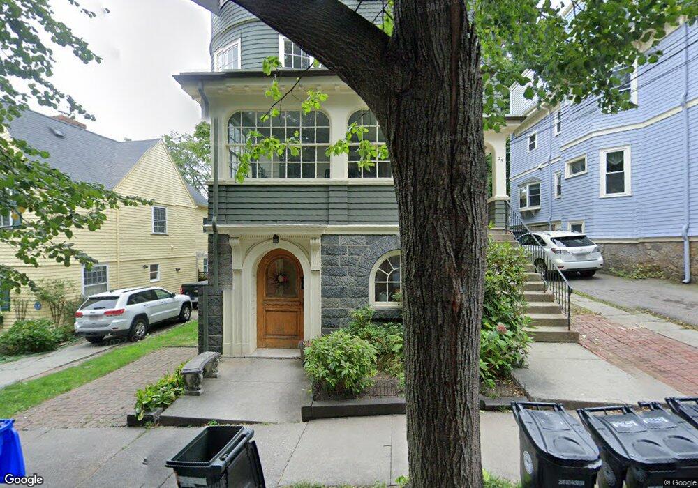
25 Littell Rd Unit 27 Brookline, MA 02446
Coolidge Corner NeighborhoodEstimated Value: $2,499,000 - $2,814,000
8
Beds
4
Baths
4,350
Sq Ft
$623/Sq Ft
Est. Value
About This Home
This home is located at 25 Littell Rd Unit 27, Brookline, MA 02446 and is currently estimated at $2,708,667, approximately $622 per square foot. 25 Littell Rd Unit 27 is a home located in Norfolk County with nearby schools including Amos A. Lawrence School, Brookline High School, and St. Mary of the Assumption Elementary School.
Ownership History
Date
Name
Owned For
Owner Type
Purchase Details
Closed on
Jul 5, 1995
Sold by
Morrison Ruben and Morrison Helen F
Bought by
Urbano Roseanne
Current Estimated Value
Home Financials for this Owner
Home Financials are based on the most recent Mortgage that was taken out on this home.
Original Mortgage
$275,000
Interest Rate
7.84%
Mortgage Type
Purchase Money Mortgage
Create a Home Valuation Report for This Property
The Home Valuation Report is an in-depth analysis detailing your home's value as well as a comparison with similar homes in the area
Home Values in the Area
Average Home Value in this Area
Purchase History
| Date | Buyer | Sale Price | Title Company |
|---|---|---|---|
| Urbano Roseanne | $378,000 | -- |
Source: Public Records
Mortgage History
| Date | Status | Borrower | Loan Amount |
|---|---|---|---|
| Open | Urbano Roseanne | $310,000 | |
| Closed | Urbano Roseanne | $30,000 | |
| Closed | Urbano Roseanne | $315,000 | |
| Closed | Urbano Roseanne | $275,000 |
Source: Public Records
Tax History
| Year | Tax Paid | Tax Assessment Tax Assessment Total Assessment is a certain percentage of the fair market value that is determined by local assessors to be the total taxable value of land and additions on the property. | Land | Improvement |
|---|---|---|---|---|
| 2025 | $27,148 | $2,750,600 | $1,180,400 | $1,570,200 |
| 2024 | $27,229 | $2,787,000 | $1,135,000 | $1,652,000 |
| 2023 | $24,871 | $2,494,600 | $938,200 | $1,556,400 |
| 2022 | $24,209 | $2,375,800 | $893,500 | $1,482,300 |
| 2021 | $22,387 | $2,284,400 | $859,100 | $1,425,300 |
| 2020 | $21,139 | $2,236,900 | $781,000 | $1,455,900 |
| 2019 | $19,962 | $2,130,400 | $743,800 | $1,386,600 |
| 2018 | $18,617 | $1,968,000 | $594,300 | $1,373,700 |
| 2017 | $17,350 | $1,756,100 | $560,700 | $1,195,400 |
| 2016 | $16,634 | $1,596,400 | $524,000 | $1,072,400 |
| 2015 | $15,025 | $1,406,800 | $445,200 | $961,600 |
| 2014 | $15,494 | $1,360,300 | $404,700 | $955,600 |
Source: Public Records
Map
Nearby Homes
- 45 Longwood Ave Unit 712
- 45 Longwood Ave Unit 812
- 60 Longwood Ave Unit 802
- 60 Longwood Ave Unit 307
- 50 Longwood Ave Unit 518
- 50 Longwood Ave Unit 611
- 20 Webster St Unit 307
- 37 Saint Paul St Unit 3
- 65 Francis St Unit A
- 1243 Beacon St Unit 5A
- 100 Sewall Ave Unit 5
- 21 Green St Unit 3
- 26 John St Unit 3
- 14 Green St Unit PHA
- 61 Toxteth St
- 106 Brook St
- 80 Vernon St Unit 1-A
- 80 Vernon St Unit 2B
- 80 Vernon St Unit PHA
- 80 Vernon St Unit 3A
- 21 Littell Rd Unit 23
- 29 Littell Rd
- 29 Littell Rd Unit 15-4
- 29 Littell Rd Unit 72-6
- 29 Littell Rd Unit 80-3
- 29 Littell Rd Unit 86-3
- 29 Littell Rd Unit 76-3
- 29 Littell Rd Unit 1
- 29 Littell Rd Unit 3
- 22 Littell Rd Unit 3
- 22 Littell Rd Unit 1
- 78 Saint Paul St Unit 78-1
- 76 St Paul St Unit 9
- 76 St Paul St Unit 3
- 76 St Paul St Unit 4
- 76 St Paul St
- 76 Saint Paul St Unit 76-6
- 20 Littell Rd Unit 22
- 20 Littell Rd
- 43 Stearns Rd
Your Personal Tour Guide
Ask me questions while you tour the home.