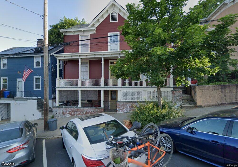
25 Main St Irvington, NY 10533
Estimated Value: $1,004,000 - $1,292,000
3
Beds
2
Baths
1,800
Sq Ft
$612/Sq Ft
Est. Value
About This Home
This home is located at 25 Main St, Irvington, NY 10533 and is currently estimated at $1,102,279, approximately $612 per square foot. 25 Main St is a home located in Westchester County with nearby schools including Main Street School, Dows Lane Elementary School, and Irvington Middle School.
Ownership History
Date
Name
Owned For
Owner Type
Purchase Details
Closed on
Jan 20, 2011
Sold by
Mack John H
Bought by
Fio Rito William M and Fio Rito Rebekah
Current Estimated Value
Home Financials for this Owner
Home Financials are based on the most recent Mortgage that was taken out on this home.
Original Mortgage
$405,000
Interest Rate
4.88%
Mortgage Type
New Conventional
Create a Home Valuation Report for This Property
The Home Valuation Report is an in-depth analysis detailing your home's value as well as a comparison with similar homes in the area
Home Values in the Area
Average Home Value in this Area
Purchase History
| Date | Buyer | Sale Price | Title Company |
|---|---|---|---|
| Fio Rito William M | $450,000 | Ceo Title Agency Inc |
Source: Public Records
Mortgage History
| Date | Status | Borrower | Loan Amount |
|---|---|---|---|
| Closed | Fio Rito William M | $405,000 |
Source: Public Records
Tax History
| Year | Tax Paid | Tax Assessment Tax Assessment Total Assessment is a certain percentage of the fair market value that is determined by local assessors to be the total taxable value of land and additions on the property. | Land | Improvement |
|---|---|---|---|---|
| 2024 | $29,757 | $999,000 | $521,400 | $477,600 |
| 2023 | $27,788 | $940,500 | $449,500 | $491,000 |
| 2022 | $27,058 | $866,300 | $449,500 | $416,800 |
| 2021 | $23,792 | $825,000 | $449,500 | $375,500 |
| 2020 | $23,217 | $719,900 | $510,700 | $209,200 |
| 2019 | $22,822 | $719,900 | $510,700 | $209,200 |
| 2018 | $21,992 | $719,900 | $510,700 | $209,200 |
| 2017 | $12,756 | $693,200 | $510,700 | $182,500 |
| 2016 | $471,186 | $666,600 | $510,700 | $155,900 |
| 2015 | -- | $11,900 | $1,800 | $10,100 |
| 2014 | -- | $11,900 | $1,800 | $10,100 |
| 2013 | -- | $11,900 | $1,800 | $10,100 |
Source: Public Records
Map
Nearby Homes
- 8 Barney Park
- 18 Barney Park
- 14 S Broadway Unit 12-1A
- 14 S Broadway Unit 7-3A
- 41 N Broadway
- 16 Marker Ridge Unit 8
- 4 Marker Ridge Unit 2
- 22 Marker Ridge Unit 11
- 6 Marker Ridge Unit 3
- 15 Marker Ridge Unit 16
- 24 Marker Ridge Unit 12
- 17 Marker Ridge
- 26 Marker Ridge Unit 13
- 30 Marker Ridge Unit 15
- 32 Westwood Close
- 20 Riverview Rd
- 81 N Broadway
- 6 W Sunnyside Ln
- 95 N Broadway
- 235 S Buckhout St Unit 235
- 23 Main St
- 3 N Cottenet St
- 7 N Cottenet St
- 21 Main St Unit 2
- 21 Main St Unit 1E
- 21 Main St
- 8 N Buckhout St
- 9 N Cottenet St
- 28 Main St
- 26 Main St
- 10 N Buckhout St
- 30 Main St
- 12 N Buckhout St
- 35 Main St
- 35 Main St Unit 1
- 35 Main St Unit Flr 2
- 35 Main St Unit 2
- 35 Main St Unit 5
- 35 Main St Unit 3
- 35 Main St Unit 4
Your Personal Tour Guide
Ask me questions while you tour the home.