C
Seller's Agent in 2025
Chuha & Scouten Team
Leading Edge Real Estate
30 in this area
126 Total Sales
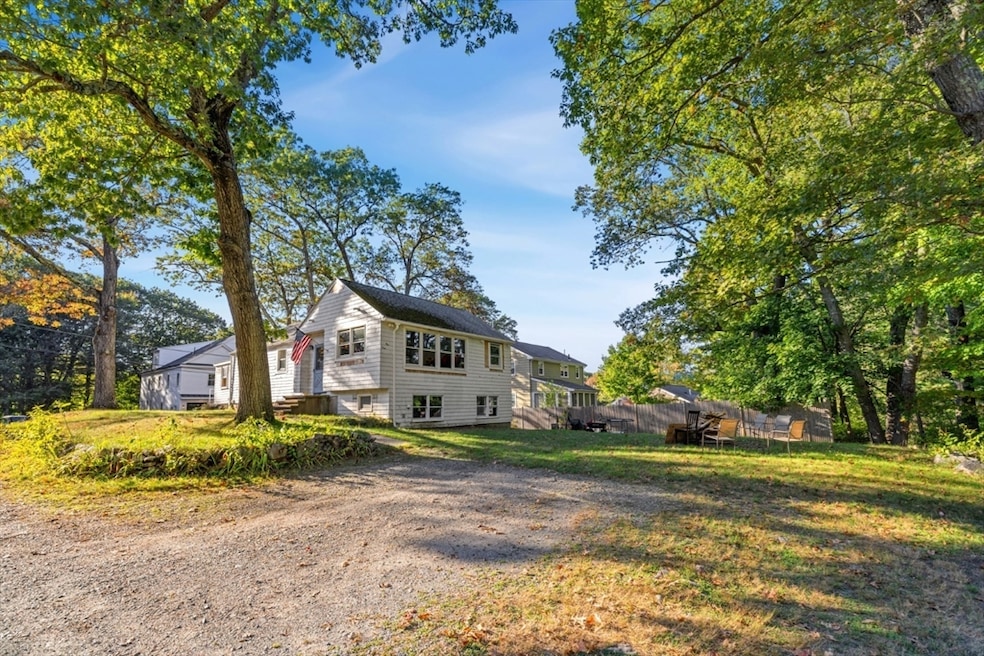
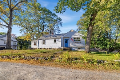
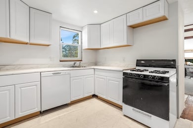
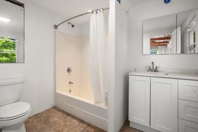
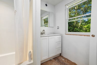
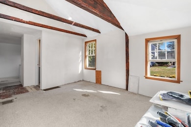
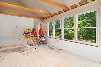
Lowest Price, Highest Potential. This diamond-in-the-rough sits in one of Reading's most coveted neighborhoods where finished homes command premium prices. This home needs work but much of he heavy lifting is behind you. Now comes the fun part: making it YOURS.: Instant equity opportunity in a location that rarely sees prices this attractive. The compact back yard is easy to maintain, yet large enough to host a game of corn hole, horseshoes or volley ball. No need to pay the high prices of oil with a home that is heated by the very popular natural gas. Consider expanding your future living space by possibly adding a second floor with town approval. Please take a look at the attached floor plans that have been added to show possible living space design. Come and enjoy Reading with all of it's offerings. This home is located in a commuter's dream area and the YMCA and Birch Meadow area with schools and parks nearby. ALL APPTS. NEED TO BE CONFIRMED.
| Date | Type | Sale Price | Title Company |
|---|---|---|---|
| Quit Claim Deed | $560,500 | -- | |
| Quit Claim Deed | -- | -- | |
| Quit Claim Deed | -- | -- | |
| Deed | -- | -- |
| Date | Status | Loan Amount | Loan Type |
|---|---|---|---|
| Open | $940,000 | Purchase Money Mortgage | |
| Previous Owner | $62,000 | No Value Available |
| Date | Event | Price | List to Sale | Price per Sq Ft |
|---|---|---|---|---|
| 12/09/2025 12/09/25 | Sold | $560,500 | +1.9% | $388 / Sq Ft |
| 11/11/2025 11/11/25 | Pending | -- | -- | -- |
| 11/07/2025 11/07/25 | For Sale | $549,900 | 0.0% | $381 / Sq Ft |
| 10/18/2025 10/18/25 | Pending | -- | -- | -- |
| 10/09/2025 10/09/25 | For Sale | $549,900 | -- | $381 / Sq Ft |
| Year | Tax Paid | Tax Assessment Tax Assessment Total Assessment is a certain percentage of the fair market value that is determined by local assessors to be the total taxable value of land and additions on the property. | Land | Improvement |
|---|---|---|---|---|
| 2025 | $7,582 | $665,700 | $467,800 | $197,900 |
| 2024 | $7,495 | $639,500 | $449,400 | $190,100 |
| 2023 | $7,259 | $576,600 | $405,200 | $171,400 |
| 2022 | $6,986 | $524,100 | $368,300 | $155,800 |
| 2021 | $7,062 | $511,400 | $352,900 | $158,500 |
| 2020 | $6,791 | $486,800 | $335,900 | $150,900 |
| 2019 | $6,597 | $463,600 | $319,900 | $143,700 |
| 2018 | $6,064 | $437,200 | $301,700 | $135,500 |
| 2017 | $5,787 | $412,500 | $284,600 | $127,900 |
| 2016 | $5,525 | $381,000 | $255,000 | $126,000 |
| 2015 | $5,177 | $352,200 | $235,700 | $116,500 |
| 2014 | $5,015 | $340,200 | $227,700 | $112,500 |
C
Seller's Agent in 2025
Chuha & Scouten Team
Leading Edge Real Estate
30 in this area
126 Total Sales
S
Seller Co-Listing Agent in 2025
Steve Chuha
Leading Edge Real Estate
7 in this area
9 Total Sales
Source: MLS Property Information Network (MLS PIN)
MLS Number: 73441970
APN: READ-000038-000000-000076
Disclaimer: Certain information contained herein is derived from information provided by parties other than Homes.com. All information provided is deemed reliable, but is not guaranteed to be accurate and should be independently verified.
![]() The property listing data and information, or the Images, set forth herein were provided to MLS Property Information Network, Inc. from third party sources, including sellers, lessors and public records, and were compiled by MLS Property Information Network, Inc. The property listing data and information, and the Images, are for the personal, non-commercial use of consumers having a good faith interest in purchasing or leasing listed properties of the type displayed to them and may not be used for any purpose other than to identify prospective properties which such consumers may have a good faith interest in purchasing or leasing. MLS Property Information Network, Inc. and its subscribers disclaim any and all representations and warranties as to the accuracy of the property listing data and information, or as to the accuracy of any of the Images, set forth herein.
The property listing data and information, or the Images, set forth herein were provided to MLS Property Information Network, Inc. from third party sources, including sellers, lessors and public records, and were compiled by MLS Property Information Network, Inc. The property listing data and information, and the Images, are for the personal, non-commercial use of consumers having a good faith interest in purchasing or leasing listed properties of the type displayed to them and may not be used for any purpose other than to identify prospective properties which such consumers may have a good faith interest in purchasing or leasing. MLS Property Information Network, Inc. and its subscribers disclaim any and all representations and warranties as to the accuracy of the property listing data and information, or as to the accuracy of any of the Images, set forth herein.
Ask me questions while you tour the home.
