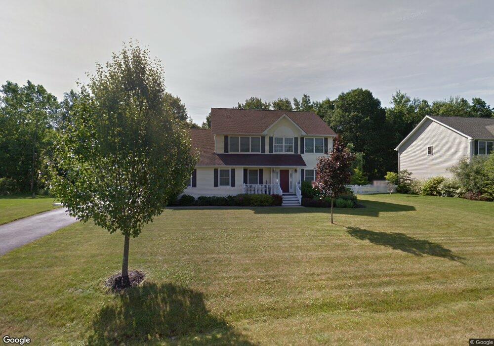
25 Mayer Dr Highland, NY 12528
Highland NeighborhoodEstimated Value: $586,333 - $702,000
4
Beds
3
Baths
2,680
Sq Ft
$238/Sq Ft
Est. Value
About This Home
This home is located at 25 Mayer Dr, Highland, NY 12528 and is currently estimated at $636,833, approximately $237 per square foot. 25 Mayer Dr is a home located in Ulster County with nearby schools including Highland Elementary School, Highland Middle School, and Highland High School.
Ownership History
Date
Name
Owned For
Owner Type
Purchase Details
Closed on
Mar 22, 2007
Sold by
Hudson Summit Llc
Bought by
Urtula Michael and Soto Gonzalez Carol L
Current Estimated Value
Purchase Details
Closed on
Feb 11, 2005
Sold by
Hudson Summit Llc
Bought by
Fiorese Peter and Fiorese Rebecca
Home Financials for this Owner
Home Financials are based on the most recent Mortgage that was taken out on this home.
Original Mortgage
$323,992
Interest Rate
5%
Mortgage Type
Fannie Mae Freddie Mac
Purchase Details
Closed on
Dec 23, 2003
Sold by
Hudson Summit 2002 Llc
Bought by
Hudson Summit Llc
Home Financials for this Owner
Home Financials are based on the most recent Mortgage that was taken out on this home.
Original Mortgage
$3,867,000
Interest Rate
5.82%
Mortgage Type
Purchase Money Mortgage
Create a Home Valuation Report for This Property
The Home Valuation Report is an in-depth analysis detailing your home's value as well as a comparison with similar homes in the area
Home Values in the Area
Average Home Value in this Area
Purchase History
| Date | Buyer | Sale Price | Title Company |
|---|---|---|---|
| Urtula Michael | $412,000 | None Available | |
| Fiorese Peter | $408,967 | National Granite Title | |
| Hudson Summit Llc | $5,200,000 | National Granite Title |
Source: Public Records
Mortgage History
| Date | Status | Borrower | Loan Amount |
|---|---|---|---|
| Previous Owner | Fiorese Peter | $323,992 | |
| Previous Owner | Hudson Summit Llc | $3,867,000 |
Source: Public Records
Tax History
| Year | Tax Paid | Tax Assessment Tax Assessment Total Assessment is a certain percentage of the fair market value that is determined by local assessors to be the total taxable value of land and additions on the property. | Land | Improvement |
|---|---|---|---|---|
| 2024 | $12,840 | $334,000 | $82,400 | $251,600 |
| 2023 | $12,577 | $334,000 | $82,400 | $251,600 |
| 2022 | $12,399 | $334,000 | $82,400 | $251,600 |
| 2021 | $12,399 | $334,000 | $82,400 | $251,600 |
| 2020 | $11,600 | $334,000 | $82,400 | $251,600 |
| 2019 | $10,935 | $334,000 | $82,400 | $251,600 |
| 2018 | $11,788 | $334,000 | $82,400 | $251,600 |
| 2017 | $11,591 | $334,000 | $82,400 | $251,600 |
| 2016 | $10,954 | $322,800 | $82,400 | $240,400 |
| 2015 | -- | $322,800 | $82,400 | $240,400 |
| 2014 | -- | $322,800 | $82,400 | $240,400 |
Source: Public Records
Map
Nearby Homes
- 38 Mayer Dr
- 57 Mayer Dr
- 10-32 S Roberts Rd
- 224 Vineyard Ave
- 243 Vineyard Ave Unit 251
- 15 Troy Ln
- 00 Vineyard Ave
- 0 Vineyard Ave Unit 20256184
- 791 Gregory Ct Unit 706
- 787 Gregory Ct
- 340 Vineyard Ave
- Tbd Smith Terrace
- 25 Mile Hill Rd
- 0 Haviland Rd Unit KEY899872
- 13 Sharon Dr
- 128 Vineyard Ave Unit 207
- 128 Vineyard Ave Unit 206
- 128 Vineyard Ave Unit 104
- 128 Vineyard Ave Unit 210
- 128 Vineyard Ave Unit 205
Your Personal Tour Guide
Ask me questions while you tour the home.