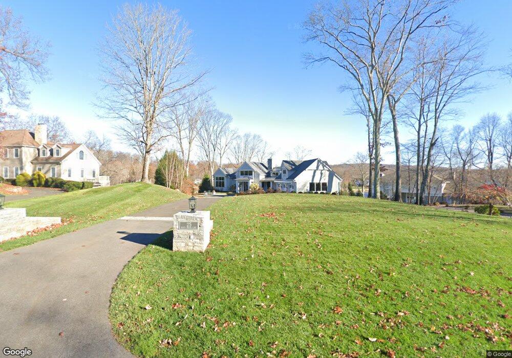
25 Misty Brook Ln New Fairfield, CT 06812
Estimated Value: $1,478,000 - $4,446,000
5
Beds
7
Baths
4,859
Sq Ft
$626/Sq Ft
Est. Value
About This Home
This home is located at 25 Misty Brook Ln, New Fairfield, CT 06812 and is currently estimated at $3,040,583, approximately $625 per square foot. 25 Misty Brook Ln is a home located in Fairfield County with nearby schools including Meeting House Hill School, New Fairfield Middle School, and New Fairfield High School.
Ownership History
Date
Name
Owned For
Owner Type
Purchase Details
Closed on
Oct 2, 2023
Sold by
Blair Meredith B
Bought by
Meredith B Blair Ret and Blair
Current Estimated Value
Purchase Details
Closed on
Mar 20, 2018
Sold by
Gottlieb Jay
Bought by
Blair Meredith B
Purchase Details
Closed on
Jan 11, 2011
Sold by
Gottlieb Stanley
Bought by
Gottlieb Jay
Purchase Details
Closed on
Jan 4, 1996
Sold by
Hart Guyellen P and Novelle Patricia
Bought by
Laurick Trust
Create a Home Valuation Report for This Property
The Home Valuation Report is an in-depth analysis detailing your home's value as well as a comparison with similar homes in the area
Home Values in the Area
Average Home Value in this Area
Purchase History
| Date | Buyer | Sale Price | Title Company |
|---|---|---|---|
| Meredith B Blair Ret | -- | None Available | |
| Blair Meredith B | $790,000 | -- | |
| Gottlieb Jay | -- | -- | |
| Laurick Trust | $230,000 | -- |
Source: Public Records
Mortgage History
| Date | Status | Borrower | Loan Amount |
|---|---|---|---|
| Previous Owner | Laurick Trust | $500,000 |
Source: Public Records
Tax History Compared to Growth
Tax History
| Year | Tax Paid | Tax Assessment Tax Assessment Total Assessment is a certain percentage of the fair market value that is determined by local assessors to be the total taxable value of land and additions on the property. | Land | Improvement |
|---|---|---|---|---|
| 2025 | $56,080 | $2,129,900 | $846,600 | $1,283,300 |
| 2024 | $50,646 | $1,386,800 | $605,000 | $781,800 |
| 2023 | $48,399 | $1,386,800 | $605,000 | $781,800 |
| 2022 | $45,029 | $1,386,800 | $605,000 | $781,800 |
| 2021 | $43,670 | $1,386,800 | $605,000 | $781,800 |
| 2020 | $42,408 | $1,386,800 | $605,000 | $781,800 |
| 2019 | $19,655 | $636,100 | $636,100 | $0 |
| 2018 | $19,452 | $636,100 | $636,100 | $0 |
| 2017 | $18,969 | $636,100 | $636,100 | $0 |
| 2016 | $18,148 | $636,100 | $636,100 | $0 |
| 2015 | $18,148 | $636,100 | $636,100 | $0 |
| 2014 | $16,782 | $643,500 | $643,500 | $0 |
Source: Public Records
Map
Nearby Homes
- 4 Harbour View Dr
- 15 Misty Brook Ln
- 32 Sail Harbour Dr
- 8 Heritage Island Rd
- 14 Cherry Dr
- 35 Candle Hill Rd
- 15 Flak Ln
- 7 Candle Hill Rd
- 5 Sail Harbour Dr
- 256 State Route 39
- 2 Pleasant View Rd
- 54 Lavelle Ave
- 35 Skyline Dr
- 155 Shortwoods Rd
- 0 Rte 39 South State Route
- 0 Wagon Wheel Rd Unit 24065102
- 11 Knollcrest Rd
- 153 Shortwoods Rd
- 7 Eagle Dr
- 34 Sherry Ln
- 25 Misty Brook Ln
- 25 Misty Brook Ln
- 27 Misty Brook Ln
- 23 Misty Brook Ln
- 31-33 Misty Brook Ln
- 29-33 Misty Brook Ln
- 21 Misty Brook Ln
- 20 Misty Brook Ln
- 29 Misty Brook Ln
- 19 Misty Brook Ln
- 18 Misty Brook Ln
- 17 Misty Brook Ln
- 6 Harbour View Dr
- 36 Sail Harbour Dr
- 16 Misty Brook Ln
- 38 Sail Harbour Dr
- 31 Misty Brook Ln
- 4 Heritage Island Rd
- 14 Misty Brook Ln