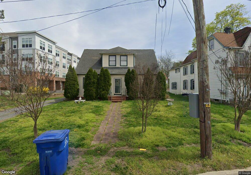
25 N Locust Ave Marlton, NJ 08053
Estimated Value: $320,000 - $482,934
--
Bed
--
Bath
2,846
Sq Ft
$144/Sq Ft
Est. Value
About This Home
This home is located at 25 N Locust Ave, Marlton, NJ 08053 and is currently estimated at $409,984, approximately $144 per square foot. 25 N Locust Ave is a home located in Burlington County with nearby schools including H.L. Beeler Elementary School, Marlton Middle School, and Cherokee High School.
Ownership History
Date
Name
Owned For
Owner Type
Purchase Details
Closed on
Oct 15, 2003
Sold by
Darpino Grace
Bought by
Curci Edward and Curci Anita
Current Estimated Value
Home Financials for this Owner
Home Financials are based on the most recent Mortgage that was taken out on this home.
Original Mortgage
$160,000
Interest Rate
6.01%
Mortgage Type
Purchase Money Mortgage
Purchase Details
Closed on
Apr 15, 2003
Sold by
Darpino Grace
Bought by
Darpino Grace
Create a Home Valuation Report for This Property
The Home Valuation Report is an in-depth analysis detailing your home's value as well as a comparison with similar homes in the area
Home Values in the Area
Average Home Value in this Area
Purchase History
| Date | Buyer | Sale Price | Title Company |
|---|---|---|---|
| Curci Edward | $20,000 | Independence Abstract & Titl | |
| Darpino Grace | -- | -- |
Source: Public Records
Mortgage History
| Date | Status | Borrower | Loan Amount |
|---|---|---|---|
| Closed | Curci Edward | $60,000 | |
| Previous Owner | Curci Edward | $160,000 |
Source: Public Records
Tax History Compared to Growth
Tax History
| Year | Tax Paid | Tax Assessment Tax Assessment Total Assessment is a certain percentage of the fair market value that is determined by local assessors to be the total taxable value of land and additions on the property. | Land | Improvement |
|---|---|---|---|---|
| 2025 | $8,879 | $260,000 | $83,000 | $177,000 |
| 2024 | $8,354 | $260,000 | $83,000 | $177,000 |
| 2023 | $8,354 | $260,000 | $83,000 | $177,000 |
| 2022 | $7,979 | $260,000 | $83,000 | $177,000 |
| 2021 | $7,792 | $260,000 | $83,000 | $177,000 |
| 2020 | $7,691 | $260,000 | $83,000 | $177,000 |
| 2019 | $7,628 | $260,000 | $83,000 | $177,000 |
| 2018 | $7,522 | $260,000 | $83,000 | $177,000 |
| 2017 | $7,183 | $260,000 | $83,000 | $177,000 |
| 2016 | $7,001 | $260,000 | $83,000 | $177,000 |
| 2015 | $6,874 | $260,000 | $83,000 | $177,000 |
| 2014 | $6,671 | $260,000 | $83,000 | $177,000 |
Source: Public Records
Map
Nearby Homes
- 30 Cooper Ave
- 42 S Locust Ave
- 5 Marlborough Ave
- 15 W Main St
- 100 Cambridge Ave
- 61 S Maple Ave
- 29 Marlborough Ave
- 22 Bettlewood Rd
- 118 Cambridge Ave
- 78 Kent Ave
- 128 Cambridge Ave
- 63 Baker Blvd
- 161 Carlton Ave
- 39 Duchess Ave
- 47 Bon Air Dr
- 31 Ashley Ct
- 38 Ashley Ct Unit 38
- 63 Banner Ct Unit 63
- 21 Olympia Dr
- 7 Quaker St
- 23 N Locust Ave
- 23 N Locust Ave Unit B
- 27 N Locust Ave
- 21 N Locust Ave
- 19 N Locust Ave
- 17 N Locust Ave
- 15 N Locust Ave
- 104 Kains Ct Unit 104
- 103 Kains Ct Unit 103
- 102 Kains Ct Unit 102
- 101 Kains Ct
- 201 Kains Ct Unit 201
- 202 Kains Ct Unit 202
- 203 Kains Ct Unit 203
- 7 N Locust Ave
- 701 Stillhouse Ln Unit 701
- 204 Kains Ct Unit 204
- 702 Stillhouse Ln Unit 702
- 703 Stillhouse Ln Unit 703
- 6 N Locust Ave Unit 68