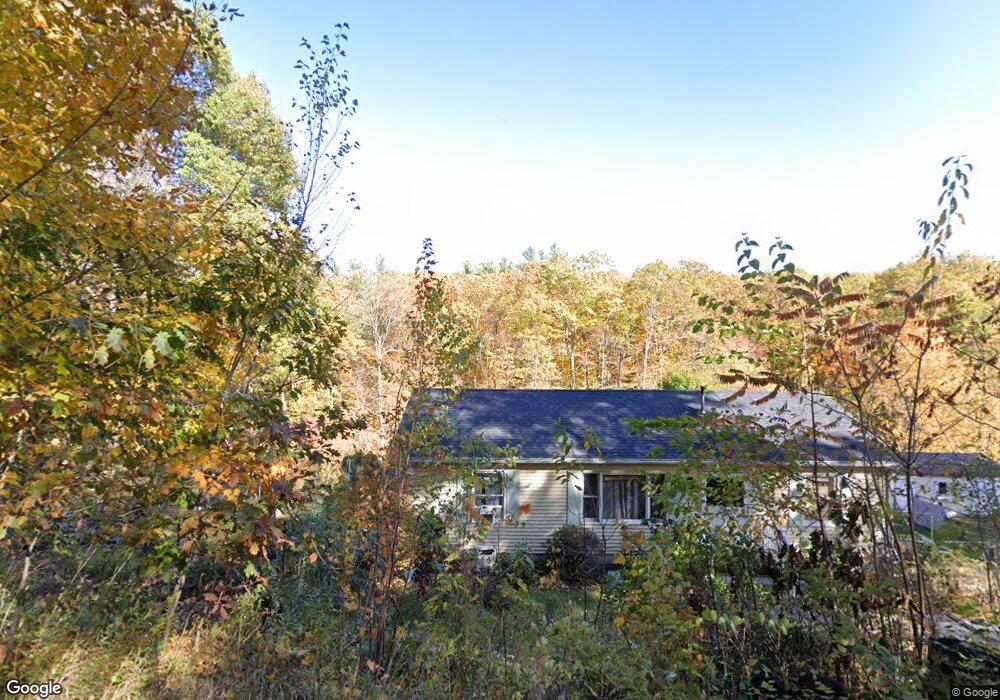
25 Overlook Rd Westminster, MA 01473
Estimated Value: $745,000 - $854,000
4
Beds
4
Baths
3,495
Sq Ft
$222/Sq Ft
Est. Value
About This Home
This home is located at 25 Overlook Rd, Westminster, MA 01473 and is currently estimated at $775,182, approximately $221 per square foot. 25 Overlook Rd is a home located in Worcester County with nearby schools including Oakmont Regional High School and Wachusett Hills Christian School.
Ownership History
Date
Name
Owned For
Owner Type
Purchase Details
Closed on
May 31, 2011
Sold by
Xarras Stephen and Xarras Sharon
Bought by
Gronowicz Matthew S and Dawson Caroline A
Current Estimated Value
Home Financials for this Owner
Home Financials are based on the most recent Mortgage that was taken out on this home.
Original Mortgage
$236,800
Outstanding Balance
$162,672
Interest Rate
4.94%
Mortgage Type
Purchase Money Mortgage
Estimated Equity
$612,510
Purchase Details
Closed on
Jun 14, 1999
Sold by
Xarras Sharon and Xarras Stephen
Bought by
Bankboston Na
Create a Home Valuation Report for This Property
The Home Valuation Report is an in-depth analysis detailing your home's value as well as a comparison with similar homes in the area
Home Values in the Area
Average Home Value in this Area
Purchase History
| Date | Buyer | Sale Price | Title Company |
|---|---|---|---|
| Gronowicz Matthew S | $296,000 | -- | |
| Bankboston Na | $42,000 | -- |
Source: Public Records
Mortgage History
| Date | Status | Borrower | Loan Amount |
|---|---|---|---|
| Open | Bankboston Na | $236,800 | |
| Previous Owner | Bankboston Na | $42,900 |
Source: Public Records
Tax History
| Year | Tax Paid | Tax Assessment Tax Assessment Total Assessment is a certain percentage of the fair market value that is determined by local assessors to be the total taxable value of land and additions on the property. | Land | Improvement |
|---|---|---|---|---|
| 2025 | $8,187 | $665,600 | $151,600 | $514,000 |
| 2024 | $7,781 | $634,700 | $151,600 | $483,100 |
| 2023 | $7,803 | $597,500 | $141,700 | $455,800 |
| 2022 | $8,006 | $506,700 | $125,400 | $381,300 |
| 2021 | $8,016 | $478,300 | $111,600 | $366,700 |
| 2020 | $7,985 | $455,000 | $103,000 | $352,000 |
| 2019 | $8,037 | $440,400 | $88,400 | $352,000 |
| 2018 | $7,741 | $417,300 | $88,400 | $328,900 |
| 2017 | $7,452 | $409,700 | $88,400 | $321,300 |
| 2016 | $7,319 | $389,700 | $76,300 | $313,400 |
| 2015 | $7,165 | $378,100 | $76,300 | $301,800 |
| 2014 | $7,091 | $373,600 | $76,300 | $297,300 |
Source: Public Records
Map
Nearby Homes
- 0 Syd Smith Rd Unit 73395578
- 0 Syd Smith Rd (Rear)
- 0 Syd Smith Rd Map 71 Lot 4-2
- 0
- 2 Roberts Way
- 100A W Main St
- 2 Seaver St
- 17 Leominster St
- 170 N Common Rd
- 0 Worcester Rd Unit 73326124
- 9 Knower Rd
- 29 Dawley Rd
- 38 Knower Rd
- 6 Shady Ave
- 29 Sunset Rd
- Lot 3 Sunset Rd
- Lot 5 Sunset Rd
- 25 Sunset Rd
- Lot 6 Shady Ave
- 23 Olde Colonial Dr Unit 6
- 31 Overlook Rd
- 23 Overlook Rd
- 23 Overlook Rd Unit 2
- 23 Overlook Rd
- 21 Overlook Rd
- 27 Overlook Rd
- 19 Overlook Rd
- L1-6 Pierce Rd and Bragg Hill Rd
- Lot28 Old Mill Cir Unit Townsend
- 0 Livermore Hill Unit 70689771
- Lot 19A Tommy Francis
- 34 Overlook Rd
- 54 Overlook Rd
- 54 Overlook Rd Unit Lot 1
- 54 Overlook Rd Unit Lot 1+2
- 34 N Common Rd
- 17 Overlook Rd
- 38 N Common Rd
- 42 N Common Rd
- 32 N Common Rd
Your Personal Tour Guide
Ask me questions while you tour the home.