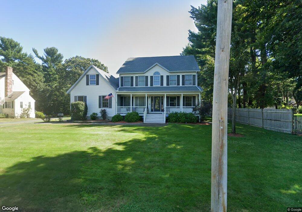
25 Parsons Ln Reading, MA 01867
Estimated Value: $1,393,570 - $1,888,000
5
Beds
4
Baths
3,149
Sq Ft
$496/Sq Ft
Est. Value
About This Home
This home is located at 25 Parsons Ln, Reading, MA 01867 and is currently estimated at $1,563,143, approximately $496 per square foot. 25 Parsons Ln is a home located in Middlesex County with nearby schools including Wood End Elementary School, Arthur W. Coolidge Middle School, and Reading Memorial High School.
Ownership History
Date
Name
Owned For
Owner Type
Purchase Details
Closed on
Aug 25, 2003
Sold by
Meyer Danielle and Meyer Gary
Bought by
Rogers Kathleen A and Coppins Robert T
Current Estimated Value
Home Financials for this Owner
Home Financials are based on the most recent Mortgage that was taken out on this home.
Original Mortgage
$600,000
Interest Rate
5.52%
Mortgage Type
Purchase Money Mortgage
Purchase Details
Closed on
Sep 26, 2000
Sold by
Borak Gary P and Borak Judith A
Bought by
Meyer Gary and Meyer Danielle
Home Financials for this Owner
Home Financials are based on the most recent Mortgage that was taken out on this home.
Original Mortgage
$509,324
Interest Rate
8%
Mortgage Type
Purchase Money Mortgage
Create a Home Valuation Report for This Property
The Home Valuation Report is an in-depth analysis detailing your home's value as well as a comparison with similar homes in the area
Home Values in the Area
Average Home Value in this Area
Purchase History
| Date | Buyer | Sale Price | Title Company |
|---|---|---|---|
| Rogers Kathleen A | $765,000 | -- | |
| Meyer Gary | $305,000 | -- |
Source: Public Records
Mortgage History
| Date | Status | Borrower | Loan Amount |
|---|---|---|---|
| Open | Meyer Gary | $505,000 | |
| Closed | Rogers Kathleen A | $600,000 | |
| Previous Owner | Meyer Gary | $72,000 | |
| Previous Owner | Meyer Gary | $580,000 | |
| Previous Owner | Meyer Gary | $509,324 |
Source: Public Records
Tax History Compared to Growth
Tax History
| Year | Tax Paid | Tax Assessment Tax Assessment Total Assessment is a certain percentage of the fair market value that is determined by local assessors to be the total taxable value of land and additions on the property. | Land | Improvement |
|---|---|---|---|---|
| 2025 | $14,119 | $1,239,600 | $569,700 | $669,900 |
| 2024 | $14,073 | $1,200,800 | $551,900 | $648,900 |
| 2023 | $13,168 | $1,045,900 | $480,700 | $565,200 |
| 2022 | $12,909 | $968,400 | $445,100 | $523,300 |
| 2021 | $12,230 | $885,600 | $420,500 | $465,100 |
| 2020 | $12,021 | $861,700 | $409,100 | $452,600 |
| 2019 | $12,034 | $845,700 | $401,500 | $444,200 |
| 2018 | $11,619 | $837,700 | $397,700 | $440,000 |
| 2017 | $11,193 | $797,800 | $378,800 | $419,000 |
| 2016 | $12,054 | $831,300 | $322,400 | $508,900 |
| 2015 | $11,293 | $768,200 | $298,000 | $470,200 |
| 2014 | $10,940 | $742,200 | $287,900 | $454,300 |
Source: Public Records
Map
Nearby Homes
- 684 Haverhill St
- 8 Partridge Rd
- 725 Haverhill St
- 11 Clover Cir Unit A
- 409 Haverhill St
- 31 Cedar St
- 0 Charles St Unit 72374573
- 9 Mill St
- 18 Symonds Way
- 98 Lilah Ln
- 25 Marshall St
- 20 Marshall St
- 37 Eames St
- 483 Franklin St
- 25 Martin Rd
- 217 Park St
- 28 Martin Rd
- 7 Hickory Ln
- 114 Haverhill St
- 56 Mount Vernon St
- 25 Parsons Lane (Lot)
- 642 Haverhill St
- 31 Parsons Ln
- 654 Haverhill St
- 20 Parsons Ln
- 30 Parsons Ln
- 35 Parsons Ln
- 656 Haverhill St
- 636 Haverhill St
- 12 Batchelder Rd
- 17 Franklin St
- 21 Franklin St
- 29 Franklin St
- 11 Franklin St
- 643 Haverhill St
- 637 Haverhill St
- 668 Haverhill St
- 7 Franklin St
- 626 Haverhill St
- 629 Haverhill St