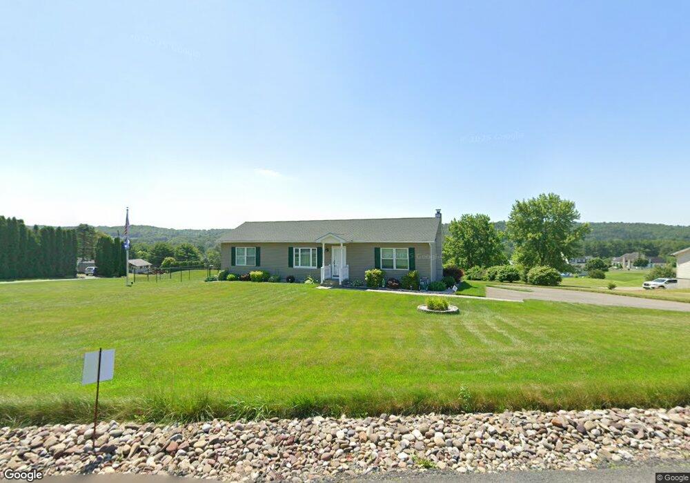
25 Pheasant Hill Dr Kunkletown, PA 18058
Estimated Value: $298,765 - $399,000
3
Beds
3
Baths
1,930
Sq Ft
$181/Sq Ft
Est. Value
About This Home
This home is located at 25 Pheasant Hill Dr, Kunkletown, PA 18058 and is currently estimated at $349,691, approximately $181 per square foot. 25 Pheasant Hill Dr is a home located in Carbon County with nearby schools including Palmerton Area High School.
Ownership History
Date
Name
Owned For
Owner Type
Purchase Details
Closed on
Jan 21, 2010
Sold by
Baddorf Dale R
Bought by
Hartnett Margaret Mary and Borowski Bernice M
Current Estimated Value
Home Financials for this Owner
Home Financials are based on the most recent Mortgage that was taken out on this home.
Original Mortgage
$97,000
Interest Rate
4.79%
Mortgage Type
New Conventional
Purchase Details
Closed on
Jan 28, 2008
Sold by
Kauffman Kimberly
Bought by
Baddorf Dale R
Home Financials for this Owner
Home Financials are based on the most recent Mortgage that was taken out on this home.
Original Mortgage
$184,300
Interest Rate
6.14%
Mortgage Type
New Conventional
Purchase Details
Closed on
Nov 15, 2006
Sold by
Holley Brian J and Holley Kimberly S
Bought by
Kauffman Kimberly S and Holley Kimberly S
Create a Home Valuation Report for This Property
The Home Valuation Report is an in-depth analysis detailing your home's value as well as a comparison with similar homes in the area
Home Values in the Area
Average Home Value in this Area
Purchase History
| Date | Buyer | Sale Price | Title Company |
|---|---|---|---|
| Hartnett Margaret Mary | $170,000 | None Available | |
| Baddorf Dale R | $194,670 | None Available | |
| Kauffman Kimberly S | $19,000 | None Available |
Source: Public Records
Mortgage History
| Date | Status | Borrower | Loan Amount |
|---|---|---|---|
| Closed | Hartnett Margaret Mary | $97,000 | |
| Previous Owner | Baddorf Dale R | $184,300 |
Source: Public Records
Tax History Compared to Growth
Tax History
| Year | Tax Paid | Tax Assessment Tax Assessment Total Assessment is a certain percentage of the fair market value that is determined by local assessors to be the total taxable value of land and additions on the property. | Land | Improvement |
|---|---|---|---|---|
| 2025 | $4,762 | $56,750 | $12,600 | $44,150 |
| 2024 | $4,535 | $56,750 | $12,600 | $44,150 |
| 2023 | $4,379 | $56,750 | $12,600 | $44,150 |
| 2022 | $4,222 | $56,750 | $12,600 | $44,150 |
| 2021 | $4,088 | $56,750 | $12,600 | $44,150 |
| 2020 | $4,031 | $56,750 | $12,600 | $44,150 |
| 2019 | $3,917 | $56,750 | $12,600 | $44,150 |
| 2018 | $3,917 | $56,750 | $12,600 | $44,150 |
| 2017 | $3,846 | $56,750 | $12,600 | $44,150 |
| 2016 | -- | $56,750 | $12,600 | $44,150 |
| 2015 | -- | $56,750 | $12,600 | $44,150 |
| 2014 | -- | $56,750 | $12,600 | $44,150 |
Source: Public Records
Map
Nearby Homes
- 85 Panorama Cir
- 125 Hillview Rd
- 90 Halina Way
- 2 T425
- 157 Viewtop Rd
- 1101 Red Fox Ct Unit Ct 9
- 229 Deer Path
- 0 T425
- 969 Hideaway Hill Rd
- 207 Scenic Dr
- 150 Red Oak Dr
- 209 Floyd Dr
- Lot 32 Greenview Ct
- 1160 Dayne Dr
- 424 Mark Ln
- 0 Preacher's Camp Dr Unit PM-137021
- 0 Victoria Arms Cir Unit PM-133039
- Lot T 444 Lower Middle Creek Rd
- 0 Sr 209 Unit PM-130225
- 101 Sterner Run Rd
- 0 Koch Unit 5843079
- 13 Koch Rd
- Lot D1 Koch Rd
- 0 Koch Rd
- 207 Panorama Cir
- 45 Pheasant Hill Dr
- 1112 Panorama Cir
- 320 Panorama Cir
- 20 Pheasant Hill Dr
- 1010 Koch Rd
- 40 Pheasant Hill Dr
- 75 Pheasant Hill Dr
- 300 Panorama Cir
- 60 Pheasant Hill Dr
- 20 Hillview Rd
- 990 Koch Rd
- 40 Hillview Rd
- 970 Koch Rd
- 0 Koch Rd Unit 5842334
- 0 Koch Rd Unit 5842333