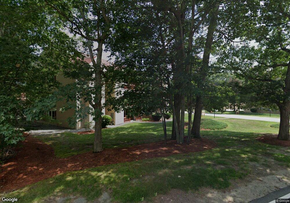
25 Randolph Dr Tewksbury, MA 01876
Estimated Value: $438,000 - $465,236
2
Beds
1
Bath
1,009
Sq Ft
$446/Sq Ft
Est. Value
About This Home
This home is located at 25 Randolph Dr, Tewksbury, MA 01876 and is currently estimated at $449,809, approximately $445 per square foot. 25 Randolph Dr is a home located in Middlesex County.
Ownership History
Date
Name
Owned For
Owner Type
Purchase Details
Closed on
Oct 29, 2007
Sold by
Sovie Christopher and Sovie Jennifer
Bought by
Hurton Anne M
Current Estimated Value
Home Financials for this Owner
Home Financials are based on the most recent Mortgage that was taken out on this home.
Original Mortgage
$163,960
Interest Rate
6.39%
Mortgage Type
Purchase Money Mortgage
Purchase Details
Closed on
Mar 26, 2004
Sold by
Truong Cuom V and Truong Elizabeth R
Bought by
Sovie Christopher and Sovie Jennifer
Home Financials for this Owner
Home Financials are based on the most recent Mortgage that was taken out on this home.
Original Mortgage
$206,600
Interest Rate
5.65%
Mortgage Type
Purchase Money Mortgage
Purchase Details
Closed on
May 29, 2002
Sold by
Luciano Patricia
Bought by
Truong Cuom and Truong Elizabeth R
Home Financials for this Owner
Home Financials are based on the most recent Mortgage that was taken out on this home.
Original Mortgage
$179,350
Interest Rate
7%
Mortgage Type
Purchase Money Mortgage
Purchase Details
Closed on
Jul 27, 1990
Sold by
Chinchillo Gary J
Bought by
Cerullo Charles J
Create a Home Valuation Report for This Property
The Home Valuation Report is an in-depth analysis detailing your home's value as well as a comparison with similar homes in the area
Home Values in the Area
Average Home Value in this Area
Purchase History
| Date | Buyer | Sale Price | Title Company |
|---|---|---|---|
| Hurton Anne M | $204,950 | -- | |
| Sovie Christopher | $217,500 | -- | |
| Truong Cuom | $184,900 | -- | |
| Cerullo Charles J | $104,000 | -- |
Source: Public Records
Mortgage History
| Date | Status | Borrower | Loan Amount |
|---|---|---|---|
| Open | Cerullo Charles J | $159,000 | |
| Closed | Hurton Anne M | $163,960 | |
| Previous Owner | Sovie Christopher | $206,600 | |
| Previous Owner | Cerullo Charles J | $179,350 | |
| Previous Owner | Cerullo Charles J | $8,000 | |
| Previous Owner | Cerullo Charles J | $46,000 |
Source: Public Records
Tax History Compared to Growth
Tax History
| Year | Tax Paid | Tax Assessment Tax Assessment Total Assessment is a certain percentage of the fair market value that is determined by local assessors to be the total taxable value of land and additions on the property. | Land | Improvement |
|---|---|---|---|---|
| 2025 | $5,879 | $444,700 | $0 | $444,700 |
| 2024 | $51 | $3,800 | $0 | $3,800 |
| 2023 | $54 | $3,800 | $0 | $3,800 |
| 2022 | $4,004 | $263,400 | $0 | $263,400 |
| 2021 | $4,056 | $258,000 | $0 | $258,000 |
| 2020 | $4,029 | $252,300 | $0 | $252,300 |
| 2019 | $3,664 | $231,300 | $0 | $231,300 |
| 2018 | $3,291 | $204,000 | $0 | $204,000 |
| 2017 | $2,964 | $181,700 | $0 | $181,700 |
| 2016 | $2,817 | $172,300 | $0 | $172,300 |
| 2015 | $2,647 | $161,700 | $0 | $161,700 |
| 2014 | $2,473 | $153,500 | $0 | $153,500 |
Source: Public Records
Map
Nearby Homes
- 97 Kendall Rd
- 399 North St
- 910 Livingston St
- 1170 Livingston St
- 1117 Emerald Ct
- 1224 Emerald Ct
- 900 Livingston St
- 13 Berkeley
- 20 Sophie Ruth Way
- 20 Meredith Rd
- 18 Newton Ave
- 11 Orchard St
- 12 Hillcrest Rd
- 1325 Main
- 43 Patrick Rd
- 61 Patrick Rd
- 101 Squire Ln
- 1418 Main St Unit 201
- 1455 Main St Unit 8
- 172 Patrick Rd
- 36 Randolph Dr
- 34 Randolph Dr
- 33 Randolph Dr
- 32 Randolph Dr
- 30 Randolph Dr
- 29 Randolph Dr
- 28 Randolph Dr
- 27 Randolph Dr
- 26 Randolph Dr
- 26 Randolph Dr Unit 26
- 32 Randolph Dr Unit 32
- 35 Randolph Dr
- 48 Randolph Dr
- 47 Randolph Dr
- 46 Randolph Dr
- 45 Randolph Dr
- 44 Randolph Dr
- 43 Randolph Dr
- 42 Randolph Dr
- 41 Randolph Dr