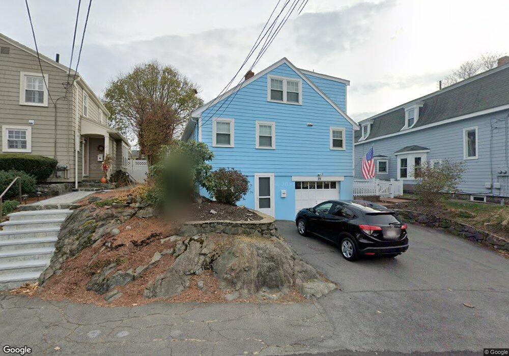
25 Rock Ave Swampscott, MA 01907
Estimated Value: $764,097 - $909,000
3
Beds
2
Baths
2,172
Sq Ft
$388/Sq Ft
Est. Value
About This Home
This home is located at 25 Rock Ave, Swampscott, MA 01907 and is currently estimated at $842,774, approximately $388 per square foot. 25 Rock Ave is a home located in Essex County with nearby schools including Swampscott Middle School and Swampscott High School.
Ownership History
Date
Name
Owned For
Owner Type
Purchase Details
Closed on
Apr 18, 2013
Sold by
Medwedeff Natasha N
Bought by
Cardon John and Mazzaferro Melissa
Current Estimated Value
Home Financials for this Owner
Home Financials are based on the most recent Mortgage that was taken out on this home.
Original Mortgage
$403,750
Outstanding Balance
$283,675
Interest Rate
3.52%
Mortgage Type
New Conventional
Estimated Equity
$559,099
Purchase Details
Closed on
Jun 30, 1999
Sold by
Walsh Michael K and Walsh Kerin T
Bought by
Hiliard Judith L and Medwedeff Natasha N
Home Financials for this Owner
Home Financials are based on the most recent Mortgage that was taken out on this home.
Original Mortgage
$183,900
Interest Rate
7.19%
Mortgage Type
Purchase Money Mortgage
Purchase Details
Closed on
Jul 1, 1991
Sold by
Ken Cyrus Newhall Est
Bought by
Walsh Walsh Michael K Michael K and Kerin T Walsh
Create a Home Valuation Report for This Property
The Home Valuation Report is an in-depth analysis detailing your home's value as well as a comparison with similar homes in the area
Home Values in the Area
Average Home Value in this Area
Purchase History
| Date | Buyer | Sale Price | Title Company |
|---|---|---|---|
| Cardon John | $425,000 | -- | |
| Cardon John | $425,000 | -- | |
| Hiliard Judith L | $229,900 | -- | |
| Hiliard Judith L | $229,900 | -- | |
| Walsh Walsh Michael K Michael K | $155,000 | -- | |
| Walsh Michael K | $155,000 | -- |
Source: Public Records
Mortgage History
| Date | Status | Borrower | Loan Amount |
|---|---|---|---|
| Open | Cardon John | $403,750 | |
| Closed | Walsh Michael K | $403,750 | |
| Previous Owner | Walsh Michael K | $167,530 | |
| Previous Owner | Walsh Michael K | $183,900 |
Source: Public Records
Tax History Compared to Growth
Tax History
| Year | Tax Paid | Tax Assessment Tax Assessment Total Assessment is a certain percentage of the fair market value that is determined by local assessors to be the total taxable value of land and additions on the property. | Land | Improvement |
|---|---|---|---|---|
| 2025 | $7,555 | $658,700 | $233,900 | $424,800 |
| 2024 | $7,370 | $641,400 | $222,800 | $418,600 |
| 2023 | $6,886 | $586,500 | $206,300 | $380,200 |
| 2022 | $6,693 | $521,700 | $181,500 | $340,200 |
| 2021 | $6,479 | $469,500 | $156,800 | $312,700 |
| 2020 | $6,595 | $461,200 | $148,500 | $312,700 |
| 2019 | $6,759 | $444,700 | $132,000 | $312,700 |
| 2018 | $6,896 | $431,000 | $132,000 | $299,000 |
| 2017 | $6,739 | $386,200 | $107,300 | $278,900 |
| 2016 | $6,549 | $377,900 | $99,000 | $278,900 |
| 2015 | $6,481 | $377,900 | $99,000 | $278,900 |
| 2014 | $5,232 | $279,800 | $82,500 | $197,300 |
Source: Public Records
Map
Nearby Homes
- 7-9 Rock Ave
- 28 Claremont Terrace Unit 4
- 28 Claremont Terrace Unit 6
- 108-110 Burrill St Unit 1
- 30 Paradise Rd
- 133 Eastern Ave Unit 8
- 46 Wardwell Ave
- 2 Peirce Rd
- 189 Burrill St Unit 2
- 35 Columbia Ave
- 29-31 Essex Ave Unit 2
- 140 Elmwood Rd
- 98 Paradise Rd
- 80 Norfolk Ave Unit 1
- 11 Seymour Ave Unit 3
- 42 Basset St
- 26 Groveland St
- 106 Norfolk Ave
- 59 Essex St Unit 59B
- 38 Cherry St Unit 1
- 25 Rock Ave
- 29 Rock Ave Unit 29
- 27 Rock Ave Unit 29
- 21 Rock Ave
- 31 Rock Ave
- 16 Nirvana Dr
- 14 Nirvana Dr
- 14 Nirvana Dr Unit 14
- 14 Nirvana Dr Unit 8A
- 12 Nirvana Dr
- 10 Nirvana Dr
- 26 Rock Ave Unit 2
- 26 Rock Ave Unit 1
- 20 Rock Ave
- 11 Rock Ave
- 54 Rock Ave Unit 1
- 54 Rock Ave
- 62 Claremont Terrace
- 31 Claremont Terrace
- 33 Rock Ave Unit 35