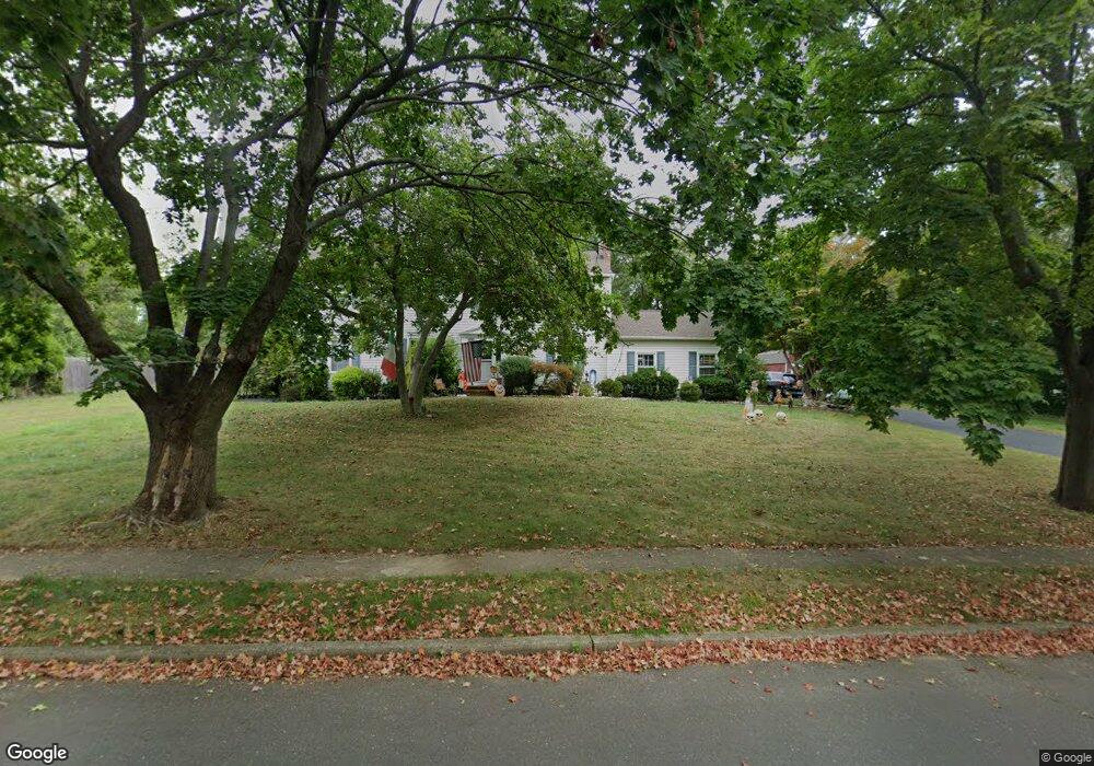
25 Rolling Knolls Dr Middletown, NJ 07748
New Monmouth NeighborhoodEstimated Value: $932,000 - $1,077,000
5
Beds
3
Baths
2,976
Sq Ft
$345/Sq Ft
Est. Value
About This Home
This home is located at 25 Rolling Knolls Dr, Middletown, NJ 07748 and is currently estimated at $1,027,261, approximately $345 per square foot. 25 Rolling Knolls Dr is a home located in Monmouth County with nearby schools including Middletown Village Elementary School, Thompson Middle School, and Middletown High School North.
Ownership History
Date
Name
Owned For
Owner Type
Purchase Details
Closed on
Feb 2, 2020
Sold by
Riso John L
Bought by
Riso Ronald
Current Estimated Value
Purchase Details
Closed on
Jul 6, 2012
Sold by
Riso Ronald
Bought by
Riso Ronald and Riso John L
Purchase Details
Closed on
Jul 5, 2012
Sold by
Riso John L
Bought by
Riso Ronald
Purchase Details
Closed on
Nov 15, 2011
Sold by
Riso John and Riso Virginia
Bought by
Riso Gerald and Riso Ronald
Create a Home Valuation Report for This Property
The Home Valuation Report is an in-depth analysis detailing your home's value as well as a comparison with similar homes in the area
Home Values in the Area
Average Home Value in this Area
Purchase History
| Date | Buyer | Sale Price | Title Company |
|---|---|---|---|
| Riso Ronald | -- | None Available | |
| Riso Ronald | -- | None Available | |
| Riso Ronald | -- | None Available | |
| Riso Gerald | -- | None Available |
Source: Public Records
Tax History Compared to Growth
Tax History
| Year | Tax Paid | Tax Assessment Tax Assessment Total Assessment is a certain percentage of the fair market value that is determined by local assessors to be the total taxable value of land and additions on the property. | Land | Improvement |
|---|---|---|---|---|
| 2025 | $13,173 | $922,600 | $477,500 | $445,100 |
| 2024 | $12,397 | $800,800 | $336,000 | $464,800 |
| 2023 | $12,397 | $713,300 | $281,300 | $432,000 |
| 2022 | $11,997 | $671,700 | $255,000 | $416,700 |
| 2021 | $11,997 | $623,100 | $252,500 | $370,600 |
| 2020 | $13,243 | $619,400 | $252,500 | $366,900 |
| 2019 | $13,037 | $617,300 | $252,500 | $364,800 |
| 2018 | $12,601 | $581,500 | $230,000 | $351,500 |
| 2017 | $12,124 | $570,800 | $230,000 | $340,800 |
| 2016 | $12,012 | $563,700 | $265,000 | $298,700 |
| 2015 | $12,432 | $582,000 | $285,000 | $297,000 |
| 2014 | $12,149 | $566,400 | $275,000 | $291,400 |
Source: Public Records
Map
Nearby Homes
- 164 Heights Terrace
- 93 Twin Brooks Ave
- 20 Devon Rd
- 35 Woodland Dr
- 0 Hamiltonian Dr Unit 22514980
- 93 Wallace Rd
- 74 Fish Hawk Dr
- 11 Mayflower Dr
- 8 Church St
- 7 Meehan Ct
- 6 Waller Dr
- 17 Winding Brook Way
- 10 Waller Dr
- 16 Waller Dr
- 22 Waller Dr
- 58 Edmund Way
- 211 April Way Unit 211
- 304 April Way Unit 304
- 7 Rosewood Terrace
- 22 Edmund Way
- 27 Rolling Knolls Dr
- 23 Rolling Knolls Dr
- 24 Rolling Knolls Dr
- 13 Kamar Ct
- 22 Rolling Knolls Dr
- 26 Rolling Knolls Dr
- 21 Rolling Knolls Dr
- 19 Kamar Ct
- 29 Rolling Knolls Dr
- 7 Kamar Ct
- 20 Rolling Knolls Dr
- 28 Rolling Knolls Dr
- 25 Kamar Ct
- 4 Bellerive Ct
- 6 Bellerive Ct
- 19 Rolling Knolls Dr
- 31 Rolling Knolls Dr
- 140 Heights Terrace
- 30 Rolling Knolls Dr
- 134 Heights Terrace