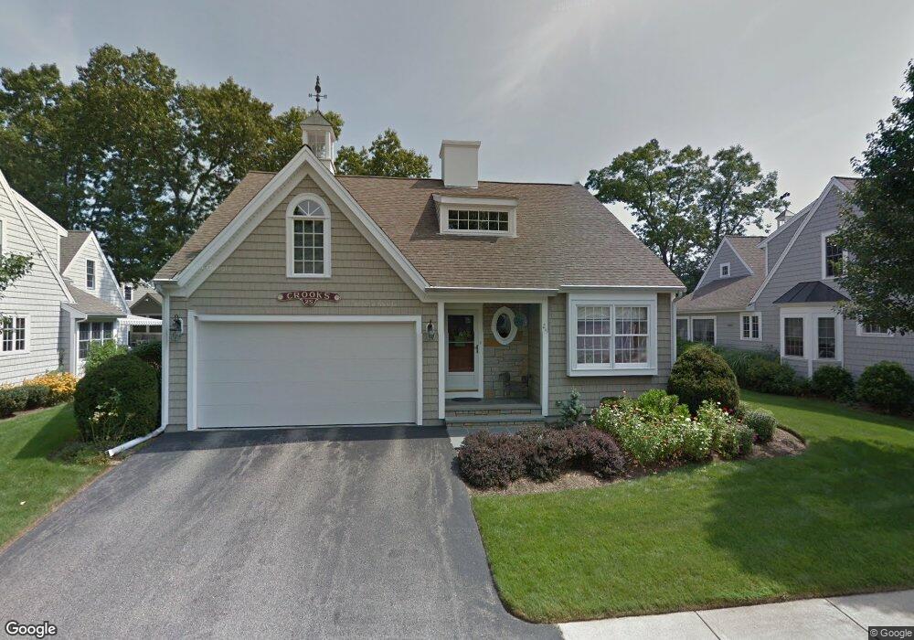
25 Sandtrap Cir South Weymouth, MA 02190
South Weymouth NeighborhoodEstimated Value: $860,000 - $934,000
2
Beds
3
Baths
1,800
Sq Ft
$498/Sq Ft
Est. Value
About This Home
This home is located at 25 Sandtrap Cir, South Weymouth, MA 02190 and is currently estimated at $896,847, approximately $498 per square foot. 25 Sandtrap Cir is a home located in Norfolk County with nearby schools including Thomas W. Hamilton Primary School, Abigail Adams Middle School, and Weymouth Middle School Chapman.
Ownership History
Date
Name
Owned For
Owner Type
Purchase Details
Closed on
Dec 17, 2024
Sold by
Crooks William J
Bought by
Crooks Ft and Morley
Current Estimated Value
Purchase Details
Closed on
Aug 6, 2003
Sold by
Weathervane Dev Corp
Bought by
Jacobson Donald G and Jacobson Sue A
Home Financials for this Owner
Home Financials are based on the most recent Mortgage that was taken out on this home.
Original Mortgage
$322,700
Interest Rate
5.28%
Mortgage Type
Purchase Money Mortgage
Purchase Details
Closed on
Dec 20, 2002
Sold by
Weathervane Dev Corp
Bought by
Crooks Marianne and Crooks William J
Create a Home Valuation Report for This Property
The Home Valuation Report is an in-depth analysis detailing your home's value as well as a comparison with similar homes in the area
Home Values in the Area
Average Home Value in this Area
Purchase History
| Date | Buyer | Sale Price | Title Company |
|---|---|---|---|
| Crooks Ft | -- | None Available | |
| Crooks Ft | -- | None Available | |
| Jacobson Donald G | $480,690 | -- | |
| Jacobson Donald G | $480,690 | -- | |
| Crooks Marianne | $429,640 | -- | |
| Crooks Marianne | $429,640 | -- |
Source: Public Records
Mortgage History
| Date | Status | Borrower | Loan Amount |
|---|---|---|---|
| Previous Owner | Crooks Marianne | $128,000 | |
| Previous Owner | Crooks Marianne | $100,000 | |
| Previous Owner | Crooks Marianne | $322,700 |
Source: Public Records
Tax History Compared to Growth
Tax History
| Year | Tax Paid | Tax Assessment Tax Assessment Total Assessment is a certain percentage of the fair market value that is determined by local assessors to be the total taxable value of land and additions on the property. | Land | Improvement |
|---|---|---|---|---|
| 2025 | $7,856 | $777,800 | $0 | $777,800 |
| 2024 | $7,637 | $743,600 | $0 | $743,600 |
| 2023 | $6,715 | $642,600 | $0 | $642,600 |
| 2022 | $6,727 | $587,000 | $0 | $587,000 |
| 2021 | $6,596 | $561,800 | $0 | $561,800 |
| 2020 | $6,437 | $540,000 | $0 | $540,000 |
| 2019 | $6,167 | $508,800 | $0 | $508,800 |
| 2018 | $5,968 | $477,400 | $0 | $477,400 |
| 2017 | $6,001 | $468,500 | $0 | $468,500 |
| 2016 | $5,878 | $459,200 | $0 | $459,200 |
| 2015 | $5,661 | $438,800 | $0 | $438,800 |
| 2014 | $5,739 | $431,500 | $0 | $431,500 |
Source: Public Records
Map
Nearby Homes
- 227 Sandtrap Cir
- 8 Mulligan Dr
- 10 Mulligan Dr
- 221 Sandtrap Cir
- 33 Sandtrap Cir
- 26 Sandtrap Cir
- 16 Mulligan Dr
- 6 Par Place
- 39 Sandtrap Cir
- 226 Sandtrap Cir Unit 118
- 226 Sandtrap Cir
- 14 Sandtrap Cir
- 7 Mulligan Dr
- 218 Sandtrap Cir
- 7 Sandtrap Cir
- 20 Mulligan Dr
- 17 Mulligan Dr
- 17 Mulligan Dr Unit 17
- 43 Sandtrap Cir
- 5 Par Place