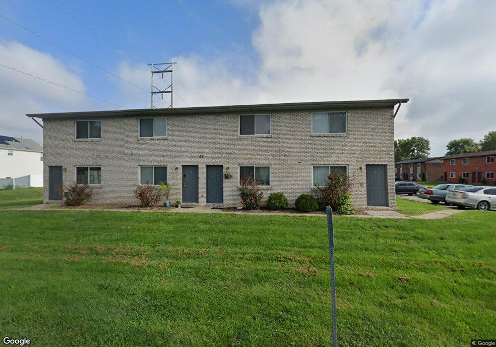
25 Sarpy Rd Belleville, IL 62221
Estimated Value: $173,348 - $205,000
Studio
--
Bath
1,885
Sq Ft
$99/Sq Ft
Est. Value
About This Home
This home is located at 25 Sarpy Rd, Belleville, IL 62221 and is currently estimated at $187,337, approximately $99 per square foot. 25 Sarpy Rd is a home with nearby schools including Whiteside Elementary School, Whiteside Middle School, and St Teresa Catholic School.
Ownership History
Date
Name
Owned For
Owner Type
Purchase Details
Closed on
Feb 10, 2026
Sold by
Turner Sean R and Turner Heidi M
Bought by
Mbjp Enterprises Llc
Current Estimated Value
Home Financials for this Owner
Home Financials are based on the most recent Mortgage that was taken out on this home.
Original Mortgage
$3,337,500
Outstanding Balance
$3,337,500
Interest Rate
6.16%
Mortgage Type
Commercial
Estimated Equity
-$3,150,163
Purchase Details
Closed on
Mar 30, 2016
Sold by
First County Bank
Bought by
Turner Sean R and Turner Heidi M
Home Financials for this Owner
Home Financials are based on the most recent Mortgage that was taken out on this home.
Original Mortgage
$2,293,000
Interest Rate
4.35%
Mortgage Type
Construction
Purchase Details
Closed on
Dec 2, 2015
Sold by
Abrahim Hassan and Abrahim Hassan A
Bought by
First County Bank
Purchase Details
Closed on
Dec 31, 1998
Bought by
Abrahim Hassan A
Create a Home Valuation Report for This Property
The Home Valuation Report is an in-depth analysis detailing your home's value as well as a comparison with similar homes in the area
Home Values in the Area
Average Home Value in this Area
Purchase History
| Date | Buyer | Sale Price | Title Company |
|---|---|---|---|
| Mbjp Enterprises Llc | $4,450,000 | Abstracts & Titles | |
| Turner Sean R | $805,500 | Abstracts & Titles Inc | |
| First County Bank | -- | Attorney | |
| Abrahim Hassan A | $72,000 | -- |
Source: Public Records
Mortgage History
| Date | Status | Borrower | Loan Amount |
|---|---|---|---|
| Open | Mbjp Enterprises Llc | $3,337,500 | |
| Previous Owner | Turner Sean R | $2,293,000 |
Source: Public Records
Tax History
| Year | Tax Paid | Tax Assessment Tax Assessment Total Assessment is a certain percentage of the fair market value that is determined by local assessors to be the total taxable value of land and additions on the property. | Land | Improvement |
|---|---|---|---|---|
| 2024 | $2,935 | $43,052 | $8,481 | $34,571 |
| 2023 | $2,697 | $38,525 | $8,365 | $30,160 |
| 2022 | $2,347 | $35,086 | $7,618 | $27,468 |
| 2021 | $2,302 | $33,646 | $7,305 | $26,341 |
| 2020 | $2,231 | $31,334 | $6,803 | $24,531 |
| 2019 | $2,190 | $31,769 | $7,429 | $24,340 |
| 2018 | $2,146 | $30,958 | $7,239 | $23,719 |
| 2017 | $2,167 | $30,134 | $7,046 | $23,088 |
| 2016 | $2,157 | $29,095 | $6,803 | $22,292 |
| 2014 | $1,974 | $28,915 | $6,162 | $22,753 |
| 2013 | $2,189 | $28,915 | $6,162 | $22,753 |
Source: Public Records
Map
Nearby Homes
- 106 Shiloh Ridge Dr
- 2277 Wellington Dr
- 2333 Greenfield Dr
- 330 Radcliff Rd
- 739 Oxen Dr
- 2611 Piper Hills Dr
- 1460 Hartman Ln
- 0 N Green Mount Rd
- 3458 Chippewa Dr
- 804 Bluff Ridge Ln
- 2609 Greystone Estates Pkwy
- 3416 Lebanon Ave
- 2562 Windsor Crest Ct
- 3469 Chippewa Dr
- 2605 Cheyenne Wells Dr
- 3422 Chippewa Dr
- 2609 Windsor Crest Ct
- 3241 Millbrook Dr
- 3493 Chippewa Dr
- 220 Anderson Ln
- 10 Sarpy Rd
- 6 Sarpy Rd
- 305 Biggs Dr
- 308TBB Ganim Dr
- 26 Sarpy Rd Unit E
- 7TBB *Pinehurst Model*
- 19TBB *Pinehurst Model*
- 312TBB Ganim Dr
- 312 Ganim Dr
- 17 Sarpy Rd
- 309 Biggs Dr Unit 4
- 309 Biggs Dr
- 22 Sarpy Rd
- 1TBB *Hazeltine Model*
- 15TBB *Hazeltine Model*
- 304 Biggs Dr
- 300 Ganim Dr
- 18TBB *Ellerston*
- 2TBB *Ellerston*
- 300TBB Ganim Dr
Your Personal Tour Guide
Ask me questions while you tour the home.