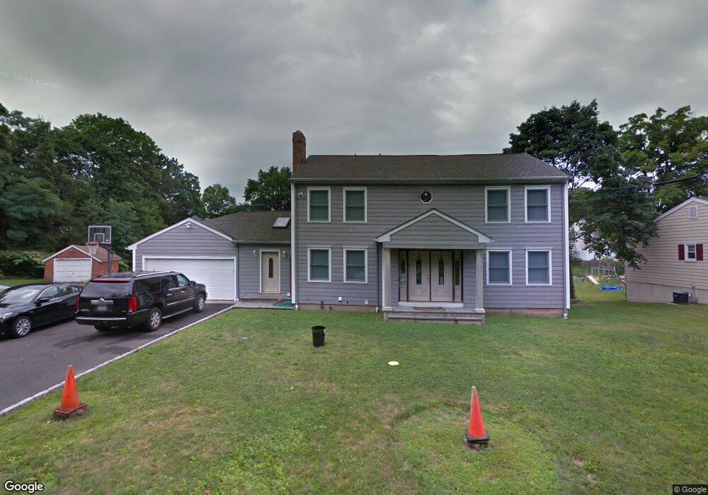
25 Scott St Norwalk, CT 06851
Woods Pond NeighborhoodEstimated Value: $940,485 - $968,000
3
Beds
3
Baths
2,926
Sq Ft
$328/Sq Ft
Est. Value
About This Home
This home is located at 25 Scott St, Norwalk, CT 06851 and is currently estimated at $959,121, approximately $327 per square foot. 25 Scott St is a home located in Fairfield County with nearby schools including Cranbury Elementary School, West Rocks Middle School, and Norwalk High School.
Ownership History
Date
Name
Owned For
Owner Type
Purchase Details
Closed on
Aug 10, 2011
Sold by
Pellegrino James J and Pellegrino Charlotte C
Bought by
Petridis Panagiotis and Petridis Chrisoula
Current Estimated Value
Home Financials for this Owner
Home Financials are based on the most recent Mortgage that was taken out on this home.
Original Mortgage
$413,000
Interest Rate
5.25%
Purchase Details
Closed on
Feb 18, 1997
Sold by
Obrien Harry
Bought by
Somma Todd A and Somma Joann
Purchase Details
Closed on
Oct 17, 1991
Sold by
Somma Lawrence
Bought by
Obrien Harry
Purchase Details
Closed on
Apr 13, 1989
Sold by
Fitzgerald Edward
Bought by
Steen Thomas
Create a Home Valuation Report for This Property
The Home Valuation Report is an in-depth analysis detailing your home's value as well as a comparison with similar homes in the area
Home Values in the Area
Average Home Value in this Area
Purchase History
| Date | Buyer | Sale Price | Title Company |
|---|---|---|---|
| Petridis Panagiotis | $487,400 | -- | |
| Petridis Panagiotis | $487,400 | -- | |
| Somma Todd A | $175,000 | -- | |
| Somma Todd A | $175,000 | -- | |
| Obrien Harry | $185,000 | -- | |
| Steen Thomas | $260,000 | -- |
Source: Public Records
Mortgage History
| Date | Status | Borrower | Loan Amount |
|---|---|---|---|
| Closed | Steen Thomas | $413,000 | |
| Previous Owner | Steen Thomas | $250,000 |
Source: Public Records
Tax History Compared to Growth
Tax History
| Year | Tax Paid | Tax Assessment Tax Assessment Total Assessment is a certain percentage of the fair market value that is determined by local assessors to be the total taxable value of land and additions on the property. | Land | Improvement |
|---|---|---|---|---|
| 2025 | $12,558 | $529,000 | $186,880 | $342,120 |
| 2024 | $12,365 | $529,000 | $186,880 | $342,120 |
| 2023 | $10,067 | $403,240 | $148,960 | $254,280 |
| 2022 | $9,909 | $403,240 | $148,960 | $254,280 |
| 2021 | $8,432 | $403,240 | $148,960 | $254,280 |
| 2020 | $9,519 | $403,240 | $148,960 | $254,280 |
| 2019 | $9,193 | $403,240 | $148,960 | $254,280 |
| 2018 | $9,241 | $356,390 | $160,740 | $195,650 |
| 2017 | $8,918 | $356,390 | $160,740 | $195,650 |
| 2016 | $9,067 | $356,390 | $160,740 | $195,650 |
| 2015 | $8,144 | $356,390 | $160,740 | $195,650 |
| 2014 | $8,924 | $356,390 | $160,740 | $195,650 |
Source: Public Records
Map
Nearby Homes