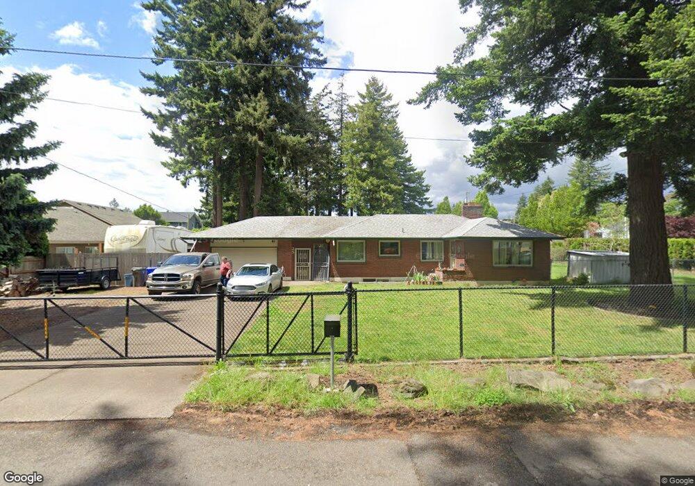
25 SE 151st Ave Portland, OR 97233
Glenfair NeighborhoodEstimated Value: $393,000 - $499,000
2
Beds
2
Baths
2,912
Sq Ft
$158/Sq Ft
Est. Value
About This Home
This home is located at 25 SE 151st Ave, Portland, OR 97233 and is currently estimated at $459,313, approximately $157 per square foot. 25 SE 151st Ave is a home located in Multnomah County with nearby schools including Glenfair Elementary School, Hauton B Lee Middle School, and Reynolds High School.
Ownership History
Date
Name
Owned For
Owner Type
Purchase Details
Closed on
Dec 10, 1997
Sold by
Sellon Richard A
Bought by
Oneale Patrick E and Oneale Susan
Current Estimated Value
Home Financials for this Owner
Home Financials are based on the most recent Mortgage that was taken out on this home.
Original Mortgage
$119,950
Outstanding Balance
$19,529
Interest Rate
7.19%
Mortgage Type
Purchase Money Mortgage
Estimated Equity
$439,784
Create a Home Valuation Report for This Property
The Home Valuation Report is an in-depth analysis detailing your home's value as well as a comparison with similar homes in the area
Home Values in the Area
Average Home Value in this Area
Purchase History
| Date | Buyer | Sale Price | Title Company |
|---|---|---|---|
| Oneale Patrick E | $149,950 | Transnation Title Insurance |
Source: Public Records
Mortgage History
| Date | Status | Borrower | Loan Amount |
|---|---|---|---|
| Open | Oneale Patrick E | $119,950 |
Source: Public Records
Tax History Compared to Growth
Tax History
| Year | Tax Paid | Tax Assessment Tax Assessment Total Assessment is a certain percentage of the fair market value that is determined by local assessors to be the total taxable value of land and additions on the property. | Land | Improvement |
|---|---|---|---|---|
| 2025 | $5,283 | $225,890 | -- | -- |
| 2024 | $5,015 | $219,320 | -- | -- |
| 2023 | $4,820 | $212,940 | $0 | $0 |
| 2022 | $4,747 | $206,740 | $0 | $0 |
| 2021 | $4,685 | $200,720 | $0 | $0 |
| 2020 | $4,229 | $194,880 | $0 | $0 |
| 2019 | $4,014 | $189,210 | $0 | $0 |
| 2018 | $3,977 | $183,700 | $0 | $0 |
| 2017 | $3,835 | $178,350 | $0 | $0 |
| 2016 | $3,656 | $173,160 | $0 | $0 |
| 2015 | $3,557 | $168,120 | $0 | $0 |
| 2014 | $3,402 | $163,230 | $0 | $0 |
Source: Public Records
Map
Nearby Homes
- 15131 E Burnside St
- 15133 E Burnside St
- 15135 E Burnside St
- 15139 E Burnside St
- 15153 E Burnside St
- 15155 E Burnside St
- 15157 E Burnside St
- 15159 E Burnside St
- 15161 E Burnside St
- 14894 NE Couch St Unit 16
- 14888 NE Couch St Unit 15
- 14876 NE Couch St Unit 13
- 14870 NE Couch St Unit 12
- 14864 NE Couch St Unit 11
- 14858 NE Couch St Unit 10
- 14852 NE Couch St Unit 9
- 14846 NE Couch St Unit 8
- 15139 SE Pine Ct
- 14840 NE Couch St Unit 7
- 14828 NE Couch St Unit 5
- 15000 E Burnside St
- 105 SE 151st Ave
- 10 SE 151st Ave
- 42 SE 151st Ave
- 119 SE 151st Ave
- 14940 E Burnside St
- 5 NE 151st Ave
- 131-149 SE 151st Ave
- 131 SE 151st Ave
- 131-149-149 Se 151st Ave Unit 149-05
- 131-149-149 Se 151st Ave Unit 145-04
- 131-149-149 Se 151st Ave Unit 145-03
- 131-149-149 Se 151st Ave Unit 145-01
- 131-149-149 Se 151st Ave Unit 137-04
- 131-149-149 Se 151st Ave Unit 141-03
- 131-149-149 Se 151st Ave
- 131-149-149 Se 151st Ave Unit 131-02
- 131-149-149 Se 151st Ave Unit 145-03
- 15005 E Burnside St
- 15105 E Burnside St