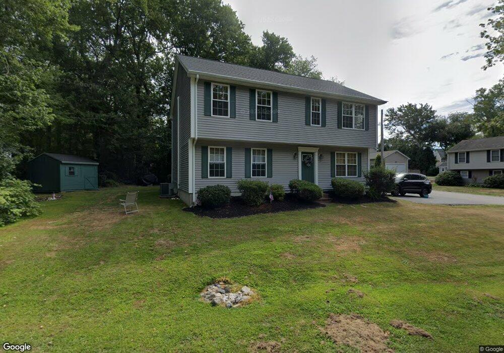
25 Spring Brook Rd Narragansett, RI 02882
Estimated Value: $994,283 - $1,280,000
4
Beds
2
Baths
1,944
Sq Ft
$589/Sq Ft
Est. Value
About This Home
This home is located at 25 Spring Brook Rd, Narragansett, RI 02882 and is currently estimated at $1,144,821, approximately $588 per square foot. 25 Spring Brook Rd is a home located in Washington County with nearby schools including Narragansett Elementary School, Narragansett Pier Middle School, and Narragansett High School.
Ownership History
Date
Name
Owned For
Owner Type
Purchase Details
Closed on
Nov 9, 2010
Sold by
Fernandes Raymond R and Fernandes Paula R
Bought by
Schooner Prop Llc
Current Estimated Value
Purchase Details
Closed on
Aug 16, 2010
Sold by
Schooner Prop Llc
Bought by
Fernandes Raymond R and Fernandes Paula R
Home Financials for this Owner
Home Financials are based on the most recent Mortgage that was taken out on this home.
Original Mortgage
$373,500
Interest Rate
4.57%
Purchase Details
Closed on
Mar 9, 2007
Sold by
Bell Paul N and Bell Ellen S
Bought by
Fernandes Raymond R and Perosino Paula R
Home Financials for this Owner
Home Financials are based on the most recent Mortgage that was taken out on this home.
Original Mortgage
$380,000
Interest Rate
6.3%
Mortgage Type
Purchase Money Mortgage
Purchase Details
Closed on
Oct 30, 2002
Sold by
Mulhearn Michael and Mulhearn Judith
Bought by
Bell Paul N and Bell Ellen S
Purchase Details
Closed on
May 12, 2000
Sold by
Conley Timothy P and Manning James P
Bought by
Mulhearn Michael and Mulhearn Judith
Create a Home Valuation Report for This Property
The Home Valuation Report is an in-depth analysis detailing your home's value as well as a comparison with similar homes in the area
Home Values in the Area
Average Home Value in this Area
Purchase History
| Date | Buyer | Sale Price | Title Company |
|---|---|---|---|
| Schooner Prop Llc | -- | -- | |
| Fernandes Raymond R | -- | -- | |
| Fernandes Raymond R | $480,000 | -- | |
| Bell Paul N | $345,000 | -- | |
| Mulhearn Michael | $176,785 | -- |
Source: Public Records
Mortgage History
| Date | Status | Borrower | Loan Amount |
|---|---|---|---|
| Previous Owner | Mulhearn Michael | $373,500 | |
| Previous Owner | Mulhearn Michael | $380,000 | |
| Previous Owner | Mulhearn Michael | $290,000 |
Source: Public Records
Tax History Compared to Growth
Tax History
| Year | Tax Paid | Tax Assessment Tax Assessment Total Assessment is a certain percentage of the fair market value that is determined by local assessors to be the total taxable value of land and additions on the property. | Land | Improvement |
|---|---|---|---|---|
| 2025 | $5,727 | $843,500 | $430,800 | $412,700 |
| 2024 | $5,525 | $843,500 | $430,800 | $412,700 |
| 2023 | $5,076 | $545,200 | $253,400 | $291,800 |
| 2022 | $4,907 | $545,200 | $253,400 | $291,800 |
| 2021 | $4,830 | $545,200 | $253,400 | $291,800 |
| 2020 | $4,569 | $436,000 | $190,800 | $245,200 |
| 2019 | $4,460 | $436,000 | $190,800 | $245,200 |
| 2018 | $4,338 | $436,000 | $190,800 | $245,200 |
| 2017 | $4,303 | $407,500 | $201,200 | $206,300 |
| 2016 | $4,108 | $407,500 | $201,200 | $206,300 |
| 2015 | $4,051 | $407,500 | $201,200 | $206,300 |
| 2014 | $4,024 | $400,800 | $201,200 | $199,600 |
Source: Public Records
Map
Nearby Homes
- 137 Bonnet Shores Rd
- 55 Bonnet Shores Rd
- 18 Anawan Ave
- 20 Anchorage Rd
- 53 Bonnet Shores Rd
- 51 Bonnet Shores Rd
- 91 Bonnet Point Rd
- 51 Osceola Ave
- 0 Betty Dr
- 64 Juniper Trail
- 74 Bayberry Rd
- 45 Leonard Bodwell Rd
- 7 Leatherleaf Rd
- 80 Old Pine Rd
- 264 Colonel John Gardner Rd
- 18 Lakeview Dr
- 12 Overlook Rd
- 121 Spice Bush Trail
- 49 Meadow Sweet Trail
- 11 Tupelo Trail
- 144 Bonnet Shores Rd
- 4 King Philip Rd
- 150 Bonnet Shores Rd
- 6 King Philip Rd
- 9 King Philip Rd
- 145 Bonnet Shores Rd
- 3 What Cheer Rd
- 151 Bonnet Shores Rd
- 11 King Philip Rd
- 10 King Philip Rd
- 1 Fairway Dr
- 158 Bonnet Shores Rd
- 9 What Cheer Rd
- 155 Bonnet Shores Rd
- 14 King Philip Rd
- 7 Spring Brook Rd
- 159 Bonnet Shores Rd
- 16 King Philip Rd
- 0 Brookside Rd Unit 314619
- 0 Brookside Rd Unit 1270338