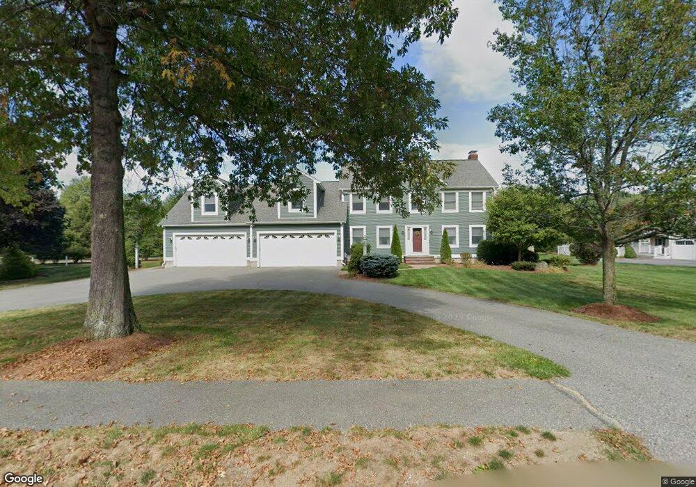
25 Stonebridge Way Groton, MA 01450
Estimated Value: $1,154,000 - $1,426,000
4
Beds
3
Baths
5,616
Sq Ft
$235/Sq Ft
Est. Value
About This Home
This home is located at 25 Stonebridge Way, Groton, MA 01450 and is currently estimated at $1,320,290, approximately $235 per square foot. 25 Stonebridge Way is a home located in Middlesex County with nearby schools including Groton Dunstable Regional High School, Groton Community School, and Lawrence Academy.
Ownership History
Date
Name
Owned For
Owner Type
Purchase Details
Closed on
Apr 19, 2005
Sold by
Snell George F and Snell Janice M
Bought by
Snell Tr George F and Snell Janice M
Current Estimated Value
Home Financials for this Owner
Home Financials are based on the most recent Mortgage that was taken out on this home.
Original Mortgage
$94,000
Outstanding Balance
$48,191
Interest Rate
5.78%
Estimated Equity
$1,272,099
Purchase Details
Closed on
Jan 21, 2005
Sold by
Snell George F and Snell Janice M
Bought by
Snell George F and Snell Janice M
Create a Home Valuation Report for This Property
The Home Valuation Report is an in-depth analysis detailing your home's value as well as a comparison with similar homes in the area
Home Values in the Area
Average Home Value in this Area
Purchase History
| Date | Buyer | Sale Price | Title Company |
|---|---|---|---|
| Snell Tr George F | -- | -- | |
| Snell George F | -- | -- | |
| Snell Tr George F | -- | -- | |
| Snell Tr George F | -- | -- | |
| Snell George F | -- | -- | |
| Snell George F | -- | -- | |
| Snell George F | -- | -- |
Source: Public Records
Mortgage History
| Date | Status | Borrower | Loan Amount |
|---|---|---|---|
| Open | Snell George F | $94,000 | |
| Closed | Snell George F | $94,000 |
Source: Public Records
Tax History Compared to Growth
Tax History
| Year | Tax Paid | Tax Assessment Tax Assessment Total Assessment is a certain percentage of the fair market value that is determined by local assessors to be the total taxable value of land and additions on the property. | Land | Improvement |
|---|---|---|---|---|
| 2025 | $18,106 | $1,187,300 | $234,200 | $953,100 |
| 2024 | $17,667 | $1,170,800 | $234,200 | $936,600 |
| 2023 | $16,275 | $1,040,600 | $234,200 | $806,400 |
| 2022 | $15,110 | $879,000 | $215,600 | $663,400 |
| 2021 | $14,707 | $835,600 | $195,300 | $640,300 |
| 2020 | $14,361 | $826,300 | $207,200 | $619,100 |
| 2019 | $13,027 | $719,300 | $197,000 | $522,300 |
| 2018 | $12,613 | $675,600 | $197,000 | $478,600 |
| 2017 | $12,647 | $692,600 | $214,000 | $478,600 |
| 2016 | $12,117 | $645,200 | $174,700 | $470,500 |
| 2015 | $11,788 | $645,200 | $174,700 | $470,500 |
Source: Public Records
Map
Nearby Homes
- 26 Bayberry Rd
- Lot 13 Monarch Path
- Lot 12 Monarch Path
- Lot 6 Noble Path
- Lot 7 Noble Path
- 797 Boston Rd
- 12 Brookfield Dr Unit A
- 95 Hummingbird Ln Unit 22
- 15 Oriole Dr
- 28 W Prescott St
- 6 Coolidge St
- 9 Elm St
- 36 Whitetail Way
- 8 Mulberry Cir
- 16 Abbot St
- 8 Sandy Beach Rd
- 4 Spectacle Pond Rd
- 9 (Lt 44) Darrell Dr
- 34 West St
- 66 Patten Rd
- 33 Stonebridge Way
- 9 Stonebridge Way
- 26 Stonebridge Way
- 7 Stonebridge Way
- 15 Stonebridge Way
- 37 Stonebridge Way
- Lot 49 Field Stone Dr
- 18 Old Carriage Path
- 166 Forge Village Rd
- 31 Bayberry Rd
- 31 Bayberry Rd Unit 31
- 25 Bayberry Rd
- 139 Forge Village Rd Unit A
- 139 Forge Village Rd Unit B
- 49 Stonebridge Way
- 14 Old Carriage Path
- 46 Stonebridge Way
- 165 Forge Village Rd
- 56 Stonebridge Way
- 149 Forge Village Rd