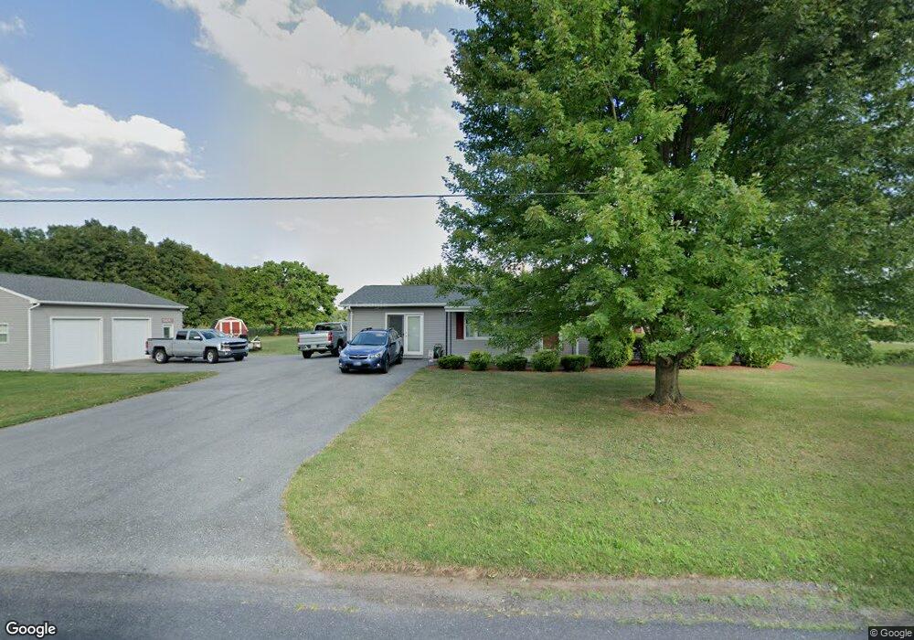
25 Storms Store Rd Unit 2 Littlestown, PA 17340
Estimated Value: $315,674 - $400,000
2
Beds
1
Bath
1,488
Sq Ft
$241/Sq Ft
Est. Value
About This Home
This home is located at 25 Storms Store Rd Unit 2, Littlestown, PA 17340 and is currently estimated at $358,669, approximately $241 per square foot. 25 Storms Store Rd Unit 2 is a home located in Adams County with nearby schools including Rolling Acres El School, Maple Avenue Middle School, and Littlestown Senior High School.
Ownership History
Date
Name
Owned For
Owner Type
Purchase Details
Closed on
May 20, 2008
Sold by
Rucker Steven R
Bought by
Rucker Steven R and Rucker Kimberly D
Current Estimated Value
Create a Home Valuation Report for This Property
The Home Valuation Report is an in-depth analysis detailing your home's value as well as a comparison with similar homes in the area
Home Values in the Area
Average Home Value in this Area
Purchase History
| Date | Buyer | Sale Price | Title Company |
|---|---|---|---|
| Rucker Steven R | -- | -- |
Source: Public Records
Tax History Compared to Growth
Tax History
| Year | Tax Paid | Tax Assessment Tax Assessment Total Assessment is a certain percentage of the fair market value that is determined by local assessors to be the total taxable value of land and additions on the property. | Land | Improvement |
|---|---|---|---|---|
| 2025 | $4,780 | $246,600 | $91,300 | $155,300 |
| 2024 | $4,574 | $246,600 | $91,300 | $155,300 |
| 2023 | $4,486 | $246,600 | $91,300 | $155,300 |
| 2022 | $4,454 | $246,600 | $91,300 | $155,300 |
| 2021 | $4,299 | $246,600 | $91,300 | $155,300 |
| 2020 | $4,239 | $246,600 | $91,300 | $155,300 |
| 2019 | $4,151 | $246,600 | $91,300 | $155,300 |
| 2018 | $4,062 | $246,600 | $91,300 | $155,300 |
| 2017 | $3,939 | $246,600 | $91,300 | $155,300 |
| 2016 | -- | $246,600 | $91,300 | $155,300 |
| 2015 | -- | $246,600 | $91,300 | $155,300 |
| 2014 | -- | $246,600 | $91,300 | $155,300 |
Source: Public Records
Map
Nearby Homes
- 67 Cedarfield Dr
- 138 Cedarfield Dr Unit 71
- 1 Hickory Ave
- 89 Maple St Unit 68
- 27 Maple St
- 48 Cannon Ln Unit 105
- 8 Maple St
- 464 Locust Ln
- 820 Storms Store Rd
- 34 W Hanover St
- 25 Harvest Dr
- 230 W Crest View Ln
- 0 Littlestown Rd
- 4900 Hanover Rd
- 202 Plunkert Rd Unit 2
- 1442 Honda Rd
- 345 Smoketown Rd
- 3801 Baltimore Pike
- 2779 Centennial Rd
- 20 Locust Dr
- 396 White Hall Rd
- 369 White Hall Rd
- 450 White Hall Rd Unit 1
- 45 Storms Store Rd
- 466 White Hall Rd
- 75 Storms Store Rd
- 565 Saint Lukes Rd
- 525 White Hall Rd
- 551 Saint Lukes Rd Unit 4
- 537 Saint Lukes Rd Unit 3
- 220 White Hall Rd Unit 1
- 485 Saint Lukes Rd Unit 2
- 506 Saint Lukes Rd
- 263 White Hall Rd Unit 2
- 460 Saint Lukes Rd
- 185 White Hall Rd
- 151 White Hall Rd
- 420 Saint Lukes Rd Unit 1
- 370 Saint Lukes Rd
- 165 White Hall Rd Unit 4