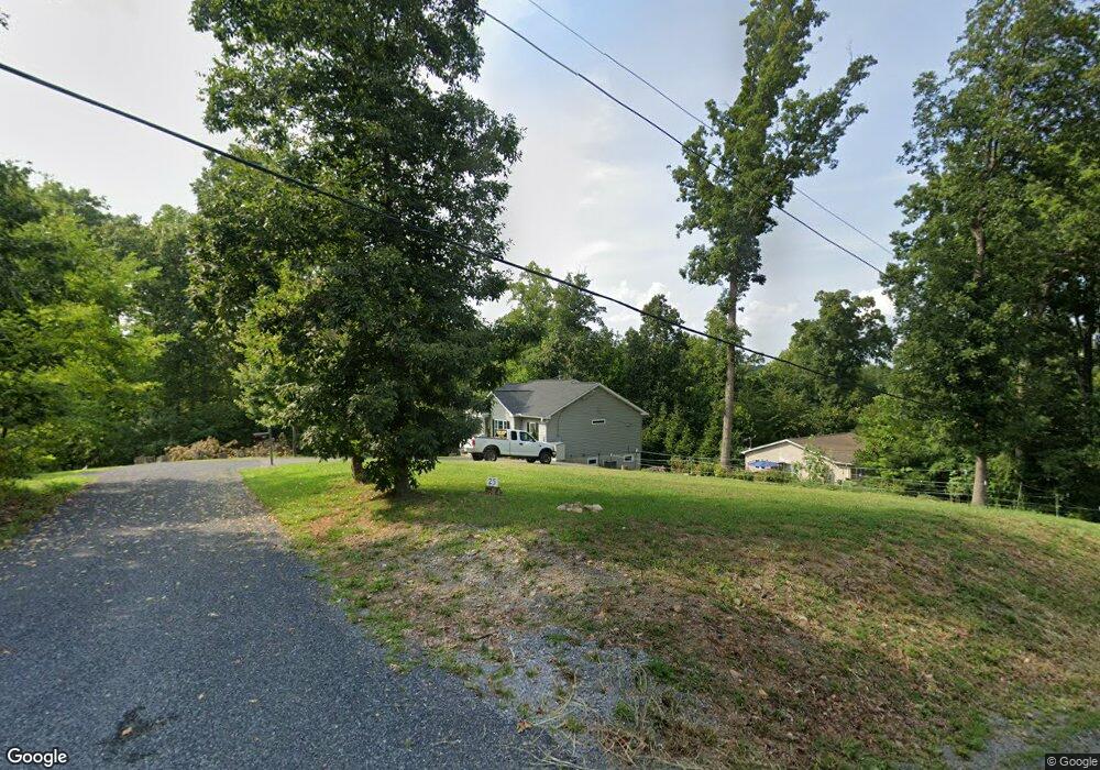
25 Summit Ridge Rd Front Royal, VA 22630
Estimated Value: $391,000 - $427,000
3
Beds
3
Baths
1,260
Sq Ft
$326/Sq Ft
Est. Value
About This Home
This home is located at 25 Summit Ridge Rd, Front Royal, VA 22630 and is currently estimated at $410,526, approximately $325 per square foot. 25 Summit Ridge Rd is a home located in Warren County with nearby schools including Leslie Fox Keyser Elementary School, Warren County High School, and Seton Home Study School.
Ownership History
Date
Name
Owned For
Owner Type
Purchase Details
Closed on
Dec 8, 2016
Sold by
Petrine Land Llc
Bought by
Thorp John and Thorp Janet
Current Estimated Value
Home Financials for this Owner
Home Financials are based on the most recent Mortgage that was taken out on this home.
Original Mortgage
$268,561
Outstanding Balance
$214,211
Interest Rate
3.47%
Mortgage Type
New Conventional
Estimated Equity
$196,315
Purchase Details
Closed on
Aug 2, 2013
Sold by
Cantrell Kenneth and Cantrell Monica
Bought by
Petrine Land Llc
Create a Home Valuation Report for This Property
The Home Valuation Report is an in-depth analysis detailing your home's value as well as a comparison with similar homes in the area
Home Values in the Area
Average Home Value in this Area
Purchase History
| Date | Buyer | Sale Price | Title Company |
|---|---|---|---|
| Thorp John | $295,123 | Stewart Title Guaranty Compa | |
| Petrine Land Llc | $15,000 | None Available |
Source: Public Records
Mortgage History
| Date | Status | Borrower | Loan Amount |
|---|---|---|---|
| Open | Thorp John | $268,561 |
Source: Public Records
Tax History
| Year | Tax Paid | Tax Assessment Tax Assessment Total Assessment is a certain percentage of the fair market value that is determined by local assessors to be the total taxable value of land and additions on the property. | Land | Improvement |
|---|---|---|---|---|
| 2025 | $2,082 | $434,600 | $47,900 | $386,700 |
| 2024 | $2,320 | $437,700 | $46,000 | $391,700 |
| 2023 | $2,145 | $437,700 | $46,000 | $391,700 |
| 2022 | $2,008 | $306,500 | $40,000 | $266,500 |
| 2021 | $2,661 | $306,500 | $40,000 | $266,500 |
| 2020 | $2,008 | $306,500 | $40,000 | $266,500 |
| 2019 | $2,008 | $306,500 | $40,000 | $266,500 |
| 2018 | $99 | $15,000 | $15,000 | $0 |
| 2017 | $98 | $15,000 | $15,000 | $0 |
| 2016 | $208 | $15,000 | $15,000 | $0 |
| 2015 | -- | $15,000 | $15,000 | $0 |
Source: Public Records
Map
Nearby Homes
- 0 Summit Ridge Rd Unit VAWR2013262
- 272 Juniper Dr
- 0 Juniper Dr Unit VAWR2013920
- 54 Magnolia Dr
- 0 Riverview Shores Dr Unit VAWR2013108
- 0 Riverview Shores Dr Unit VAWR2013786
- 242 Howellsville Rd
- 236 Howellsville Rd
- 241 Howellsville Rd
- 235 Howellsville Rd
- 288 Locust Grove Rd
- 40 Cherrywood Rd
- 0 Pin Oak Rd Unit VAWR2006146
- 241 Wildcat Dr
- 664 Brandy Rd
- 39 Bowling View Rd
- 133 Pineview Dr
- 714 Bennys Beach Rd
- 223 Brandy Rd
- 2723 Fairground Rd
- 775 Rollason Dr
- 284 Wilson Ln
- 53 Summit Ridge Rd
- 785 Rollason Dr
- 716 Rollason Dr
- 30 Hank Ct
- 319 Wilson Ln
- 178 Mitchell Dr
- 686 Rollason Dr
- 99 Summit Ridge Rd
- 89 Billy Mitchell Dr
- 285 Wilson Ln
- 671 Rollason Dr
- 166 Wilson Ln
- 114 Billy Mitchell Dr
- 56 Cedarside Ct
- 56 Cedarside Ct
- 652 Rollason Dr
- 0 Wilson Ln Unit VAWR2009114
- 0 Wilson Ln Unit VAWR2006342
Your Personal Tour Guide
Ask me questions while you tour the home.