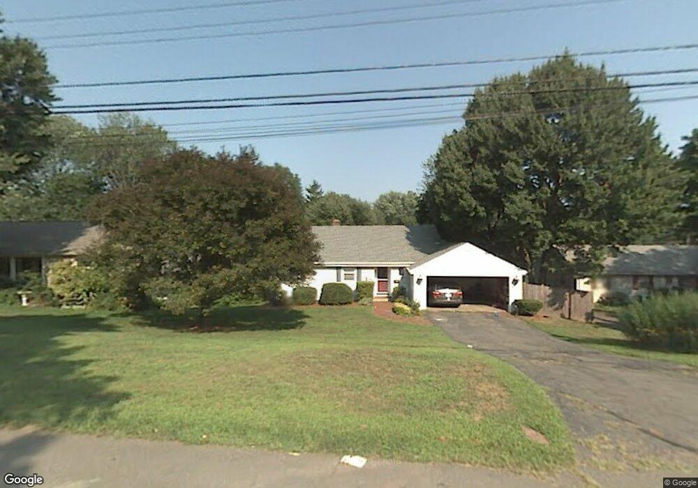
25 Terrace Rd West Hartford, CT 06107
Estimated Value: $494,000 - $565,000
3
Beds
3
Baths
1,463
Sq Ft
$357/Sq Ft
Est. Value
About This Home
This home is located at 25 Terrace Rd, West Hartford, CT 06107 and is currently estimated at $522,650, approximately $357 per square foot. 25 Terrace Rd is a home located in Hartford County with nearby schools including Wolcott School, Sedgwick Middle School, and Conard High School.
Ownership History
Date
Name
Owned For
Owner Type
Purchase Details
Closed on
Apr 18, 2016
Sold by
Neville 3Rd Charles D
Bought by
Neville Suzanne S
Current Estimated Value
Purchase Details
Closed on
May 4, 2005
Sold by
Wolszczak Jeffrey L and Wolszczak Julie K
Bought by
Neville 3Rd Charles D and Neville Suzanne S
Home Financials for this Owner
Home Financials are based on the most recent Mortgage that was taken out on this home.
Original Mortgage
$248,000
Interest Rate
6.01%
Purchase Details
Closed on
Jul 1, 2002
Sold by
Fncl Cendant Mobility
Bought by
Wolszczak Julie K and Wolszczak Jeffrey L
Purchase Details
Closed on
Dec 3, 1997
Sold by
Wittstein Jeffrey A and Wittstein Jennifer L
Bought by
Albright Thomas B and Albright Lecia A
Purchase Details
Closed on
Mar 29, 1993
Sold by
Leopoldino Eileen
Bought by
Wittstein Jeffrey and Wittstein Jennifer
Create a Home Valuation Report for This Property
The Home Valuation Report is an in-depth analysis detailing your home's value as well as a comparison with similar homes in the area
Home Values in the Area
Average Home Value in this Area
Purchase History
| Date | Buyer | Sale Price | Title Company |
|---|---|---|---|
| Neville Suzanne S | -- | -- | |
| Neville 3Rd Charles D | $310,000 | -- | |
| Wolszczak Julie K | $235,000 | -- | |
| Albright Thomas B | $156,500 | -- | |
| Wittstein Jeffrey | $166,000 | -- |
Source: Public Records
Mortgage History
| Date | Status | Borrower | Loan Amount |
|---|---|---|---|
| Previous Owner | Wittstein Jeffrey | $234,492 | |
| Previous Owner | Wittstein Jeffrey | $18,500 | |
| Previous Owner | Wittstein Jeffrey | $248,000 |
Source: Public Records
Tax History Compared to Growth
Tax History
| Year | Tax Paid | Tax Assessment Tax Assessment Total Assessment is a certain percentage of the fair market value that is determined by local assessors to be the total taxable value of land and additions on the property. | Land | Improvement |
|---|---|---|---|---|
| 2025 | $9,535 | $212,940 | $85,890 | $127,050 |
| 2024 | $9,018 | $212,940 | $85,890 | $127,050 |
| 2023 | $8,714 | $212,940 | $85,890 | $127,050 |
| 2022 | $8,662 | $212,940 | $85,890 | $127,050 |
| 2021 | $8,210 | $193,550 | $85,890 | $107,660 |
| 2020 | $7,789 | $186,340 | $80,150 | $106,190 |
| 2019 | $7,789 | $186,340 | $80,150 | $106,190 |
| 2018 | $7,640 | $186,340 | $80,150 | $106,190 |
| 2017 | $7,561 | $184,240 | $80,150 | $104,090 |
| 2016 | $7,091 | $179,480 | $61,320 | $118,160 |
| 2015 | $6,876 | $179,480 | $61,320 | $118,160 |
| 2014 | $6,707 | $179,480 | $61,320 | $118,160 |
Source: Public Records
Map
Nearby Homes
- 73 Emily Way
- 76 Jillian Cir
- 60 Cassandra Blvd
- 11 Fairwood Farms Dr
- 61 Waterside Ln
- 29 Fairwood Farms Dr
- 236 Ridgewood Rd
- 50 Tunxis Rd
- 43 Spring Ln
- 34 Sandhurst Dr
- 371 Middle Rd
- 00 Old Farm Dr
- 32 Miles Standish Dr
- 57 Wardwell Rd
- 39 Pheasant Hill Dr
- 51 Lemay St
- 9 Talcott Glen Unit K
- 5 Yorkshire Ct Unit 5
- 120 Yorkshire Ct Unit 120
- 269 Mountain Rd