25 Thompson Rd Conway, MA 01341
Conway AreaEstimated Value: $512,723 - $676,000
About This Home
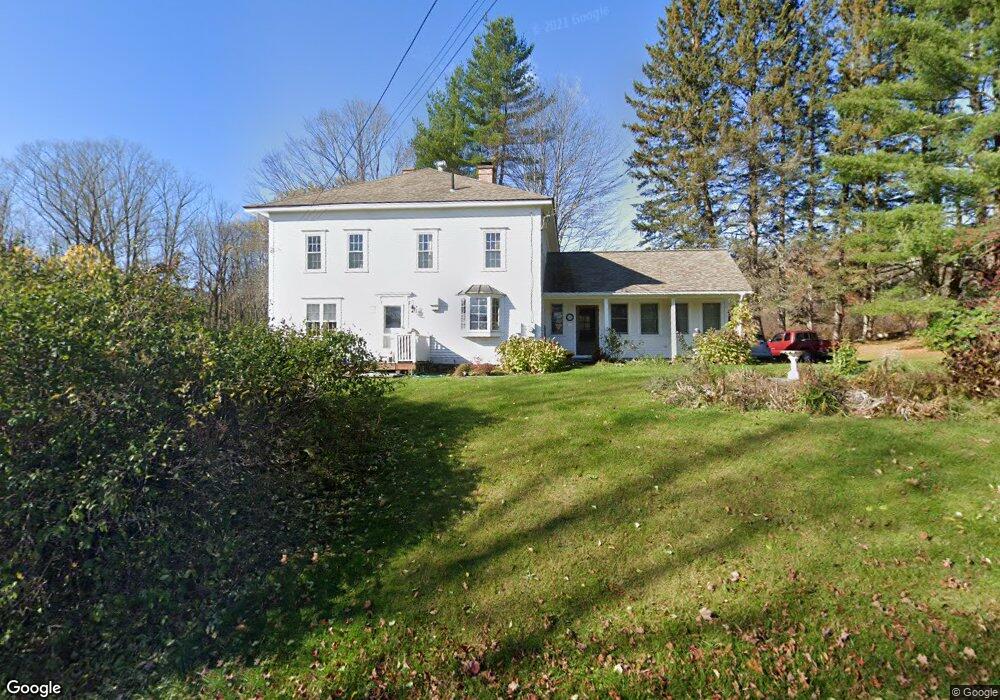
This home is located at 25 Thompson Rd, Conway, MA 01341 and is currently estimated at $588,681, approximately $232 per square foot. 25 Thompson Rd is a home located in Franklin County with nearby schools including Frontier Regional School.
Ownership History
We collect this data history from publicly available records. To have your information removed, we recommend requesting removal directly through your county’s website.
Purchase Details
Purchase Details
Home Values in the Area
Average Home Value in this Area
Purchase History
We collect this data history from publicly available records. To have your information removed, we recommend requesting removal directly through your county’s website.
| Date | Buyer | Sale Price | Title Company |
|---|---|---|---|
| -- | -- | ||
| $66,000 | -- |
Mortgage History
We collect this data history from publicly available records. To have your information removed, we recommend requesting removal directly through your county’s website.
| Date | Status | Borrower | Loan Amount |
|---|---|---|---|
| Open | $50,000 | ||
| Previous Owner | $95,550 |
Tax History
We collect this data history from publicly available records. To have your information removed, we recommend requesting removal directly through your county’s website.
| Year | Tax Paid | Tax Assessment Tax Assessment Total Assessment is a certain percentage of the fair market value that is determined by local assessors to be the total taxable value of land and additions on the property. | Land | Improvement |
|---|---|---|---|---|
| 2025 | $6,180 | $428,000 | $84,600 | $343,400 |
| 2024 | $5,720 | $348,800 | $76,800 | $272,000 |
| 2023 | $5,982 | $348,800 | $76,800 | $272,000 |
| 2022 | $5,805 | $323,400 | $71,600 | $251,800 |
| 2021 | $5,709 | $304,800 | $68,100 | $236,700 |
| 2020 | $5,604 | $298,700 | $67,900 | $230,800 |
| 2019 | $5,571 | $298,700 | $67,900 | $230,800 |
| 2018 | $5,526 | $298,700 | $67,900 | $230,800 |
| 2017 | $7,086 | $399,200 | $162,100 | $237,100 |
| 2016 | $5,279 | $316,500 | $89,900 | $226,600 |
| 2015 | $5,118 | $316,500 | $89,900 | $226,600 |
Map
- 2930 Shelburne Falls Rd
- 0 N Bear River Rd Unit 73485981
- 120 Bray Rd
- 87 Ashfield Rd
- 55 Ashfield Rd
- 0 Boyden Rd
- 0 Maple St
- 11 Bray Rd
- 19 S Maple St
- 2 Franklin St
- 15 School St
- 10 Deerfield Ave Unit 9
- 14 Main St
- 34 Sears St
- 965 Conway Rd
- 14 South St
- 105 State St
- 1230 Main Poland Rd
- 197 Buckland Rd
- 3 Hog Hollow Rd
- 0 Hart Rd
- O Thompson Rd
- 0 Thompson Rd
- Parcel C Thompson Rd
- Lot C Thompson Rd
- 161 Thompson Rd
- 161 Thompson Rd
- 2142 Shelburne Falls Rd
- 96 Hart Rd
- 2121 Shelburne Falls Rd
- 221 Thompson Rd
- 212 Thompson Rd
- 000 Thompson Rd
- 00 Thompson Rd
- 2441 Shelburne Falls Rd
- 214 Thompson Rd
- 2478 Shelburne Falls Rd
- 292 Thompson Rd
- 259 Thompson Rd
- 550 S Shirkshire Rd
Ask me questions while you tour the home.