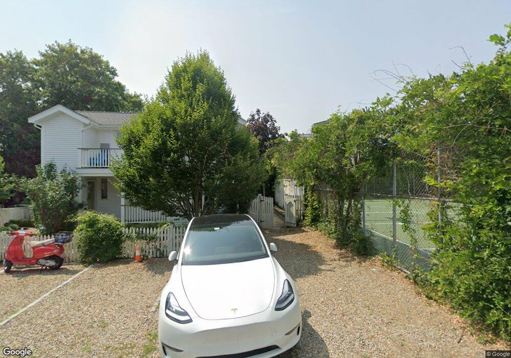
25 Tremont St Unit E1 Provincetown, MA 02657
Estimated Value: $1,368,000 - $1,653,000
2
Beds
2
Baths
915
Sq Ft
$1,658/Sq Ft
Est. Value
About This Home
This home is located at 25 Tremont St Unit E1, Provincetown, MA 02657 and is currently estimated at $1,517,066, approximately $1,657 per square foot. 25 Tremont St Unit E1 is a home located in Barnstable County with nearby schools including Provincetown Schools.
Ownership History
Date
Name
Owned For
Owner Type
Purchase Details
Closed on
May 19, 2003
Sold by
Mcgrath Thomas R
Bought by
Carey Paul J
Current Estimated Value
Home Financials for this Owner
Home Financials are based on the most recent Mortgage that was taken out on this home.
Original Mortgage
$320,000
Outstanding Balance
$139,585
Interest Rate
5.84%
Mortgage Type
Purchase Money Mortgage
Estimated Equity
$1,377,481
Purchase Details
Closed on
Jun 7, 1996
Sold by
Vignali Michael P and Buonafede Paul D
Bought by
Mcgrath Thomas R
Create a Home Valuation Report for This Property
The Home Valuation Report is an in-depth analysis detailing your home's value as well as a comparison with similar homes in the area
Home Values in the Area
Average Home Value in this Area
Purchase History
| Date | Buyer | Sale Price | Title Company |
|---|---|---|---|
| Carey Paul J | $456,000 | -- | |
| Carey Paul J | $456,000 | -- | |
| Mcgrath Thomas R | $152,500 | -- | |
| Mcgrath Thomas R | $152,500 | -- |
Source: Public Records
Mortgage History
| Date | Status | Borrower | Loan Amount |
|---|---|---|---|
| Open | Mcgrath Thomas R | $320,000 | |
| Closed | Mcgrath Thomas R | $320,000 | |
| Previous Owner | Mcgrath Thomas R | $275,000 |
Source: Public Records
Tax History Compared to Growth
Tax History
| Year | Tax Paid | Tax Assessment Tax Assessment Total Assessment is a certain percentage of the fair market value that is determined by local assessors to be the total taxable value of land and additions on the property. | Land | Improvement |
|---|---|---|---|---|
| 2025 | $7,940 | $1,417,800 | $0 | $1,417,800 |
| 2024 | $7,466 | $1,338,000 | $0 | $1,338,000 |
| 2023 | $6,601 | $1,103,800 | $0 | $1,103,800 |
| 2022 | $5,942 | $892,200 | $0 | $892,200 |
| 2021 | $5,915 | $835,500 | $0 | $835,500 |
| 2020 | $5,369 | $811,100 | $0 | $811,100 |
| 2019 | $5,405 | $765,600 | $0 | $765,600 |
| 2018 | $5,260 | $706,000 | $0 | $706,000 |
| 2017 | $5,236 | $679,100 | $0 | $679,100 |
| 2016 | $4,906 | $629,000 | $0 | $629,000 |
| 2015 | $3,816 | $517,100 | $0 | $517,100 |
Source: Public Records
Map
Nearby Homes
- 70 W Vine St
- 147 Bradford Street Extension Unit 1
- 74 Commercial St
- 10 Bradford St Unit 2
- 10 Bradford St Unit 3
- 10 Bradford St Unit 4
- 54 Commercial St Unit 3,4,5,6
- 27 Mechanic St
- 118 Commercial St Unit U118
- 44 Commercial St
- 44 Franklin St
- 3 Meadow Rd Unit 2
- 28 Commercial St Unit 2
- 29 Point St
- 15 Montello St Unit 3
- 25 Tremont St Unit G2
- 25 Tremont St Unit G1
- 25 Tremont St Unit F2
- 25 Tremont St Unit F1
- 25 Tremont St Unit E2
- 25 Tremont St Unit D2
- 25 Tremont St Unit D1
- 25 Tremont St Unit C2
- 25 Tremont St Unit C1
- 25 Tremont St Unit B1
- 25 Tremont St Unit A2
- 25 Tremont St Unit A1
- 25 Tremont St Unit 1A
- 25 Tremont St Unit UA2
- 1 Tremont St
- 17 W Vine St
- 17 W Vine St Unit 1-2
- 17 W Vine St Unit 1
- 17 W Vine St Unit 2
- 175 Bradford st Extension Unit 302