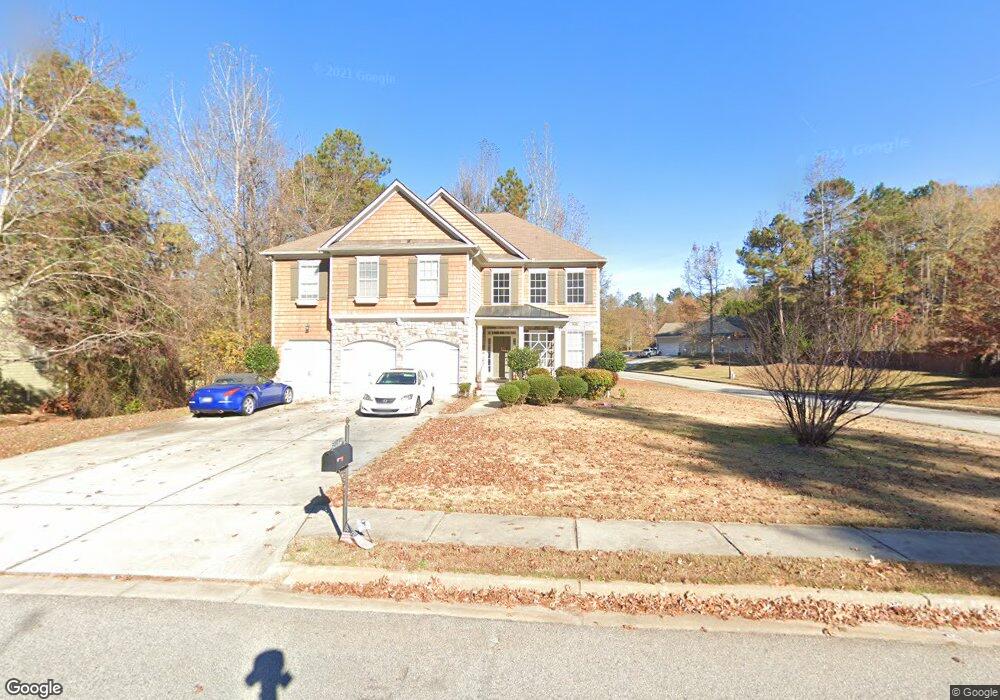
25 Tudor Way Senoia, GA 30276
Estimated Value: $545,000 - $595,000
4
Beds
4
Baths
4,219
Sq Ft
$134/Sq Ft
Est. Value
About This Home
This home is located at 25 Tudor Way, Senoia, GA 30276 and is currently estimated at $564,504, approximately $133 per square foot. 25 Tudor Way is a home located in Coweta County with nearby schools including Willis Road Elementary School, East Coweta Middle School, and East Coweta High School.
Ownership History
Date
Name
Owned For
Owner Type
Purchase Details
Closed on
Dec 28, 2006
Sold by
D R Horton Inc
Bought by
Ngo Nghia
Current Estimated Value
Home Financials for this Owner
Home Financials are based on the most recent Mortgage that was taken out on this home.
Original Mortgage
$273,656
Outstanding Balance
$160,864
Interest Rate
6.1%
Mortgage Type
New Conventional
Estimated Equity
$403,640
Purchase Details
Closed on
Mar 8, 2005
Sold by
Scarbrough & Rolander Development
Bought by
D R Horton Inc
Create a Home Valuation Report for This Property
The Home Valuation Report is an in-depth analysis detailing your home's value as well as a comparison with similar homes in the area
Home Values in the Area
Average Home Value in this Area
Purchase History
| Date | Buyer | Sale Price | Title Company |
|---|---|---|---|
| Ngo Nghia | $356,500 | -- | |
| D R Horton Inc | $7,640,000 | -- |
Source: Public Records
Mortgage History
| Date | Status | Borrower | Loan Amount |
|---|---|---|---|
| Open | Ngo Nghia | $273,656 |
Source: Public Records
Tax History Compared to Growth
Tax History
| Year | Tax Paid | Tax Assessment Tax Assessment Total Assessment is a certain percentage of the fair market value that is determined by local assessors to be the total taxable value of land and additions on the property. | Land | Improvement |
|---|---|---|---|---|
| 2025 | $6,314 | $233,218 | $30,000 | $203,218 |
| 2024 | $5,989 | $219,266 | $30,000 | $189,266 |
| 2023 | $5,989 | $196,270 | $30,000 | $166,270 |
| 2022 | $4,744 | $166,314 | $24,000 | $142,314 |
| 2021 | $5,255 | $169,888 | $24,000 | $145,888 |
| 2020 | $5,351 | $169,888 | $24,000 | $145,888 |
| 2019 | $4,987 | $143,767 | $26,000 | $117,767 |
| 2018 | $5,013 | $143,767 | $26,000 | $117,767 |
| 2017 | $4,851 | $138,556 | $26,000 | $112,556 |
| 2016 | $4,545 | $130,219 | $26,000 | $104,219 |
| 2015 | $4,537 | $131,852 | $12,000 | $119,852 |
| 2014 | $3,423 | $117,261 | $12,000 | $105,261 |
Source: Public Records
Map
Nearby Homes
- 20 Palladian Dr
- 45 Mulberry Dr
- 135 Mulberry Dr
- 185 Renwick Dr
- 300 Calebee Ave
- 290 Calebee Ave
- 170 Savannah Dr
- 183 Brittany Ln
- Hampshire Plan at Heritage Pointe
- 285 Staffin Dr
- Edison Plan at Heritage Pointe
- Jean Lee Plan at Heritage Pointe
- 300 Staffin Dr
- 270 Staffin Dr
- 305 Staffin Dr
- Marlene Plan at Heritage Pointe
- SAVANNAH Plan at Heritage Pointe
- 220 Calebee Ave
- 186 Brittany Ln
- 345 Darien Dr