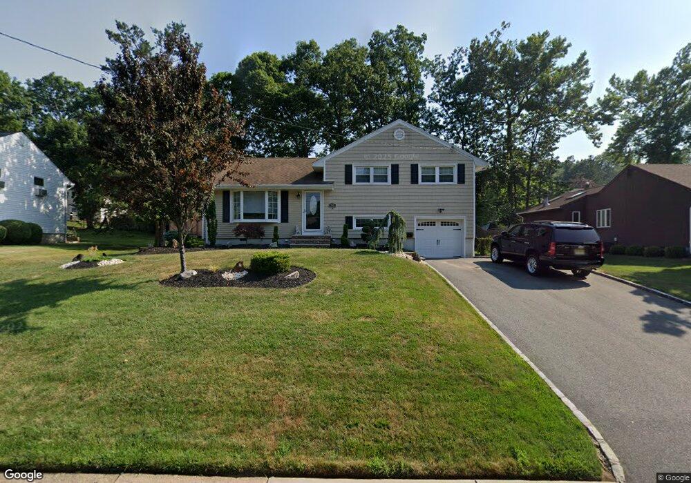
25 Vanderberg Place Cedar Grove, NJ 07009
Estimated Value: $690,991 - $741,000
--
Bed
--
Bath
1,606
Sq Ft
$443/Sq Ft
Est. Value
About This Home
This home is located at 25 Vanderberg Place, Cedar Grove, NJ 07009 and is currently estimated at $711,998, approximately $443 per square foot. 25 Vanderberg Place is a home located in Essex County with nearby schools including Cedar Grove High School, Monarch Montessori School, and Banyan Upper School.
Ownership History
Date
Name
Owned For
Owner Type
Purchase Details
Closed on
Jul 22, 2013
Bought by
Cristello Steven and Cristello Suzanne
Current Estimated Value
Purchase Details
Closed on
Jun 17, 2013
Sold by
Locascio Michael and Locascio Taryn
Bought by
Locascio Michael and Locascio Taryn
Purchase Details
Closed on
Dec 17, 2009
Sold by
Hung Hing Kai and Ho Tin Kam
Bought by
Locasio Michael and Locasio Taryn
Home Financials for this Owner
Home Financials are based on the most recent Mortgage that was taken out on this home.
Original Mortgage
$402,599
Interest Rate
4.79%
Mortgage Type
FHA
Purchase Details
Closed on
Jun 28, 1995
Sold by
Depasquale Maria De
Bought by
Hung Hing and Hung Tin
Home Financials for this Owner
Home Financials are based on the most recent Mortgage that was taken out on this home.
Original Mortgage
$187,000
Interest Rate
7.7%
Purchase Details
Closed on
Jul 29, 1988
Sold by
Hein Anthony Alfred
Bought by
Depasquale Maria C
Create a Home Valuation Report for This Property
The Home Valuation Report is an in-depth analysis detailing your home's value as well as a comparison with similar homes in the area
Home Values in the Area
Average Home Value in this Area
Purchase History
| Date | Buyer | Sale Price | Title Company |
|---|---|---|---|
| Cristello Steven | $475,000 | -- | |
| Locascio Michael | -- | -- | |
| Locasio Michael | $416,500 | Stewart Title Guaranty Co | |
| Hung Hing | $208,000 | -- | |
| Depasquale Maria C | $216,500 | -- |
Source: Public Records
Mortgage History
| Date | Status | Borrower | Loan Amount |
|---|---|---|---|
| Previous Owner | Locasio Michael | $402,599 | |
| Previous Owner | Hung Hing | $187,000 |
Source: Public Records
Tax History Compared to Growth
Tax History
| Year | Tax Paid | Tax Assessment Tax Assessment Total Assessment is a certain percentage of the fair market value that is determined by local assessors to be the total taxable value of land and additions on the property. | Land | Improvement |
|---|---|---|---|---|
| 2025 | $10,714 | $410,500 | $241,400 | $169,100 |
| 2024 | $10,714 | $410,500 | $241,400 | $169,100 |
| 2022 | $10,525 | $410,500 | $241,400 | $169,100 |
| 2021 | $10,398 | $410,500 | $241,400 | $169,100 |
| 2020 | $10,550 | $410,500 | $241,400 | $169,100 |
| 2019 | $10,308 | $410,500 | $241,400 | $169,100 |
| 2018 | $9,836 | $410,500 | $241,400 | $169,100 |
| 2017 | $9,729 | $410,500 | $241,400 | $169,100 |
| 2016 | $9,429 | $410,500 | $241,400 | $169,100 |
| 2015 | $9,212 | $410,500 | $241,400 | $169,100 |
| 2014 | $9,023 | $410,500 | $241,400 | $169,100 |
Source: Public Records
Map
Nearby Homes
- 303 Abbe Rd
- 6 Meadow Dr
- 7 Mountain Ridge Dr Unit 4B
- 4 Mountain Ridge Dr Unit 25
- 4 Mountain Ridge Dr
- 96 Montclair Ave
- 84 Center Ave
- 12 Bergen Dr
- 163 Donato Dr
- 157 1st Ave
- 207 Eileen Dr
- 215 Eileen Dr
- 120 Anderson Pkwy
- 47 1st Ave
- 58 Harvest Way
- 10 Harvest Way
- 26 Chestnut Ct
- 1 Chestnut Ct
- 18 Fairview Dr
- 86 Harvest Way