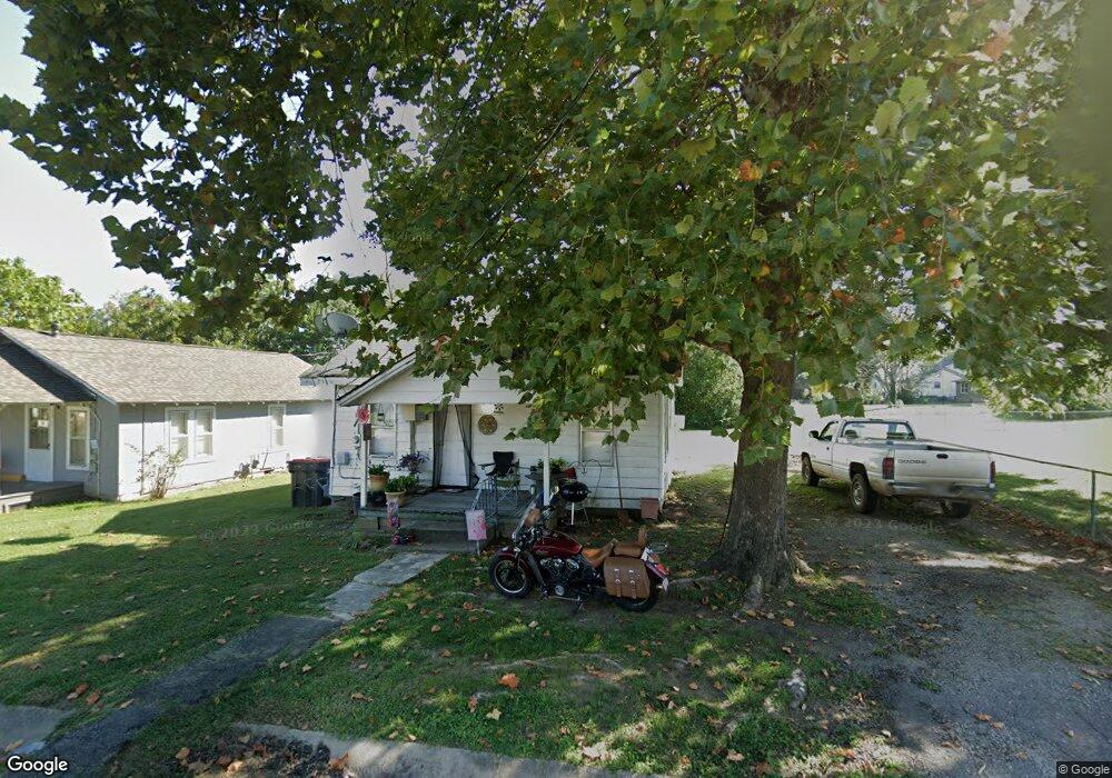
25 W 5th St Mulberry, AR 72947
Estimated Value: $64,000 - $120,000
--
Bed
--
Bath
1,000
Sq Ft
$84/Sq Ft
Est. Value
About This Home
This home is located at 25 W 5th St, Mulberry, AR 72947 and is currently estimated at $84,292, approximately $84 per square foot. 25 W 5th St is a home with nearby schools including Marvin Primary School, Pleasant View Junior High School, and Mulberry High School.
Ownership History
Date
Name
Owned For
Owner Type
Purchase Details
Closed on
Jun 6, 2023
Sold by
Jeff And Mary Marvin Revocable Trust and Marvin Jeff
Bought by
Marvin Trevor
Current Estimated Value
Home Financials for this Owner
Home Financials are based on the most recent Mortgage that was taken out on this home.
Original Mortgage
$41,374
Outstanding Balance
$24,166
Interest Rate
8.25%
Mortgage Type
Credit Line Revolving
Estimated Equity
$60,126
Purchase Details
Closed on
Feb 27, 2023
Sold by
Summers 4Th St Apartments Llc
Bought by
Donald And Lorraine Gettinger Family Trust
Purchase Details
Closed on
Aug 1, 2017
Sold by
Crain Kevin
Bought by
Marvin Jeff and Marvin Mary
Purchase Details
Closed on
Apr 22, 2008
Sold by
Berna Billy Gene and Berna Mary Anita
Bought by
Crain Kevin
Home Financials for this Owner
Home Financials are based on the most recent Mortgage that was taken out on this home.
Original Mortgage
$27,000
Interest Rate
5.86%
Mortgage Type
New Conventional
Create a Home Valuation Report for This Property
The Home Valuation Report is an in-depth analysis detailing your home's value as well as a comparison with similar homes in the area
Home Values in the Area
Average Home Value in this Area
Purchase History
| Date | Buyer | Sale Price | Title Company |
|---|---|---|---|
| Marvin Trevor | -- | None Listed On Document | |
| Donald And Lorraine Gettinger Family Trust | $900,000 | Waco Title | |
| Marvin Jeff | $14,000 | None Available | |
| Crain Kevin | $30,000 | None Available |
Source: Public Records
Mortgage History
| Date | Status | Borrower | Loan Amount |
|---|---|---|---|
| Open | Marvin Trevor | $41,374 | |
| Previous Owner | Crain Kevin | $27,000 |
Source: Public Records
Tax History Compared to Growth
Tax History
| Year | Tax Paid | Tax Assessment Tax Assessment Total Assessment is a certain percentage of the fair market value that is determined by local assessors to be the total taxable value of land and additions on the property. | Land | Improvement |
|---|---|---|---|---|
| 2025 | $407 | $7,800 | $2,250 | $5,550 |
| 2024 | $407 | $7,800 | $2,250 | $5,550 |
| 2023 | $309 | $7,800 | $2,250 | $5,550 |
| 2022 | $281 | $5,380 | $1,280 | $4,100 |
| 2021 | $262 | $5,380 | $1,280 | $4,100 |
| 2020 | $262 | $5,380 | $1,280 | $4,100 |
| 2019 | $262 | $5,380 | $1,280 | $4,100 |
| 2018 | $262 | $5,380 | $1,280 | $4,100 |
| 2017 | $252 | $5,380 | $1,280 | $4,100 |
| 2016 | $252 | $5,380 | $1,280 | $4,100 |
| 2015 | $252 | $5,380 | $1,280 | $4,100 |
| 2014 | $252 | $5,380 | $1,280 | $4,100 |
Source: Public Records
Map
Nearby Homes
- 519 Church Ave
- 101 Reynolds St
- 414 Carter Ave
- 210 W 2nd St
- 770 Church Ave
- 36 W 8th St
- 8 W 10th St
- TBD Duncan Rd
- 1321 Old Graphic St
- TBD (lot 29) Keystone Dr
- TBD (lot 30) Keystone Dr
- 5527 Wire Rd
- 2034 Mulberry Wire Rd
- 2150 Old Graphic St
- 206 & 216 W 5th St
- 3042 Mulberry Highway 64 W
- 9643 Wire Rd
- TBD Exsorbet Dr
- TBD Industrial Park Dr
- 3032 King Dr