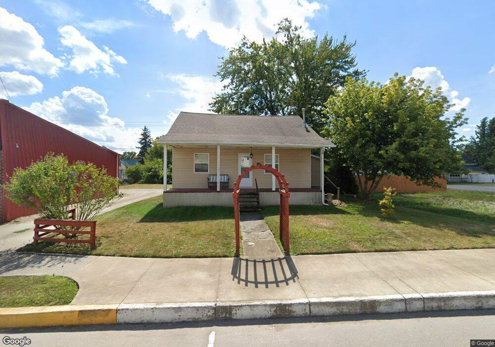
25 W Main St Wakeman, OH 44889
Estimated Value: $126,895 - $183,000
4
Beds
1
Bath
1,101
Sq Ft
$146/Sq Ft
Est. Value
About This Home
This home is located at 25 W Main St, Wakeman, OH 44889 and is currently estimated at $160,974, approximately $146 per square foot. 25 W Main St is a home located in Huron County with nearby schools including Western Reserve Elementary School, Western Reserve Middle School, and Western Reserve High School.
Ownership History
Date
Name
Owned For
Owner Type
Purchase Details
Closed on
Jul 3, 1997
Bought by
Tackett Christopher J and Tackett Marlene R
Current Estimated Value
Purchase Details
Closed on
Apr 21, 1995
Sold by
Freshwater William J
Bought by
Meilander Robert D and Meilander Kathryn
Home Financials for this Owner
Home Financials are based on the most recent Mortgage that was taken out on this home.
Original Mortgage
$34,500
Interest Rate
8.64%
Mortgage Type
New Conventional
Create a Home Valuation Report for This Property
The Home Valuation Report is an in-depth analysis detailing your home's value as well as a comparison with similar homes in the area
Home Values in the Area
Average Home Value in this Area
Purchase History
| Date | Buyer | Sale Price | Title Company |
|---|---|---|---|
| Tackett Christopher J | $55,000 | -- | |
| Meilander Robert D | $29,000 | -- | |
| Meilander Robert D | $29,000 | -- |
Source: Public Records
Mortgage History
| Date | Status | Borrower | Loan Amount |
|---|---|---|---|
| Previous Owner | Meilander Robert D | $34,500 |
Source: Public Records
Tax History Compared to Growth
Tax History
| Year | Tax Paid | Tax Assessment Tax Assessment Total Assessment is a certain percentage of the fair market value that is determined by local assessors to be the total taxable value of land and additions on the property. | Land | Improvement |
|---|---|---|---|---|
| 2024 | $1,363 | $35,810 | $3,660 | $32,150 |
| 2023 | $1,363 | $28,160 | $2,590 | $25,570 |
| 2022 | $1,074 | $28,160 | $2,590 | $25,570 |
| 2021 | $1,106 | $28,160 | $2,590 | $25,570 |
| 2020 | $958 | $23,200 | $2,590 | $20,610 |
| 2019 | $955 | $23,200 | $2,590 | $20,610 |
| 2018 | $946 | $23,200 | $2,590 | $20,610 |
| 2017 | $853 | $21,290 | $2,590 | $18,700 |
| 2016 | $838 | $21,120 | $2,590 | $18,530 |
| 2015 | $830 | $21,120 | $2,590 | $18,530 |
| 2014 | $800 | $20,440 | $2,590 | $17,850 |
| 2013 | $774 | $20,440 | $2,590 | $17,850 |
Source: Public Records
Map
Nearby Homes
- 22 E Main St
- 27 Deer Run Dr
- 6175 U S 20
- 5 Foxwood Cir
- 22 Foxwood Cir
- 42 Stony Brook Ln
- 34 Cherdon Cir
- 5810 U S 20 Unit 47
- 5810 U S 20 Unit 3
- 5810 U S 20 Unit 72
- 5810 U S 20 Unit 98
- 5810 U S 20 Unit 111
- 5810 U S 20 Unit 76
- 5951 Ohio 303
- 2860 Derussey Rd
- 13701 Andress Rd
- 3876 Townsend Angling Rd
- 1910 Wenz Rd
- 52273 Betts Rd
- 52025 Betts Rd