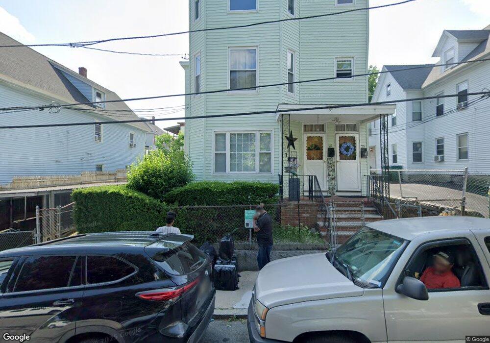
25 Ware St Lowell, MA 01851
Lower Highlands NeighborhoodEstimated Value: $755,000 - $792,000
9
Beds
4
Baths
3,952
Sq Ft
$194/Sq Ft
Est. Value
About This Home
This home is located at 25 Ware St, Lowell, MA 01851 and is currently estimated at $768,333, approximately $194 per square foot. 25 Ware St is a home located in Middlesex County with nearby schools including Abraham Lincoln Elementary School, Charles W. Morey Elementary School, and Charlotte M. Murkland Elementary School.
Ownership History
Date
Name
Owned For
Owner Type
Purchase Details
Closed on
May 29, 2025
Sold by
Colon Concepcion C and Cruz Maria E
Bought by
Oladele Mutiu A and Oladele Abisola S
Current Estimated Value
Home Financials for this Owner
Home Financials are based on the most recent Mortgage that was taken out on this home.
Original Mortgage
$712,500
Outstanding Balance
$708,836
Interest Rate
5.88%
Mortgage Type
Purchase Money Mortgage
Estimated Equity
$59,497
Purchase Details
Closed on
Sep 26, 2011
Sold by
Fnma
Bought by
En Sameth
Create a Home Valuation Report for This Property
The Home Valuation Report is an in-depth analysis detailing your home's value as well as a comparison with similar homes in the area
Home Values in the Area
Average Home Value in this Area
Purchase History
| Date | Buyer | Sale Price | Title Company |
|---|---|---|---|
| Oladele Mutiu A | $750,000 | None Available | |
| En Sameth | $66,500 | -- | |
| En Sameth | $66,500 | -- | |
| En Sameth | $66,500 | -- |
Source: Public Records
Mortgage History
| Date | Status | Borrower | Loan Amount |
|---|---|---|---|
| Open | Oladele Mutiu A | $712,500 |
Source: Public Records
Tax History Compared to Growth
Tax History
| Year | Tax Paid | Tax Assessment Tax Assessment Total Assessment is a certain percentage of the fair market value that is determined by local assessors to be the total taxable value of land and additions on the property. | Land | Improvement |
|---|---|---|---|---|
| 2025 | $7,042 | $613,400 | $112,400 | $501,000 |
| 2024 | $6,718 | $564,100 | $105,000 | $459,100 |
| 2023 | $6,588 | $530,400 | $91,300 | $439,100 |
| 2022 | $5,981 | $471,300 | $72,200 | $399,100 |
| 2021 | $5,170 | $384,100 | $62,800 | $321,300 |
| 2020 | $4,745 | $355,200 | $62,800 | $292,400 |
| 2019 | $4,632 | $329,900 | $59,700 | $270,200 |
| 2018 | $4,226 | $293,700 | $56,900 | $236,800 |
| 2017 | $4,057 | $271,900 | $55,100 | $216,800 |
| 2016 | $3,760 | $248,000 | $51,200 | $196,800 |
| 2015 | $3,529 | $228,000 | $51,200 | $176,800 |
| 2013 | $3,122 | $208,000 | $61,400 | $146,600 |
Source: Public Records
Map
Nearby Homes
- 27 Royal St
- 45 Marshall St
- 173 Westford St
- 28 Grand St
- 42 Branch St
- 21 Kimball Ave
- 201 Thorndike St Unit 2-05
- 201 Thorndike St Unit 501
- 201 Thorndike St Unit 2-312
- 195 Thorndike St Unit 4
- 84 Cambridge St
- 490 School St Unit 2
- 100 Lane St
- 95 S Highland St
- 491 Dutton St Unit 320
- 491 Dutton St Unit 403
- 491 Dutton St Unit 415
- 491 Dutton St Unit 502
- 491 Dutton St Unit 504
- 710 School St
- 25 Ware St Unit 3
- 25 Ware St Unit 2
- 31 Ware St
- 31 Ware St Unit 2nd Floor
- 33 Ware St Unit 1,1
- 21 Ware St
- 49 Royal St
- 15 Ware St
- 47 Royal St
- 17 Ware St Unit 2
- 45 Royal St
- 57 Royal St
- 28 Ware St Unit 5
- 28 Ware St Unit 4
- 28 Ware St Unit 3
- 28 Ware St Unit 2
- 28 Ware St Unit 1
- 41 Royal St
- 11 Ware St
- 41 Ware St