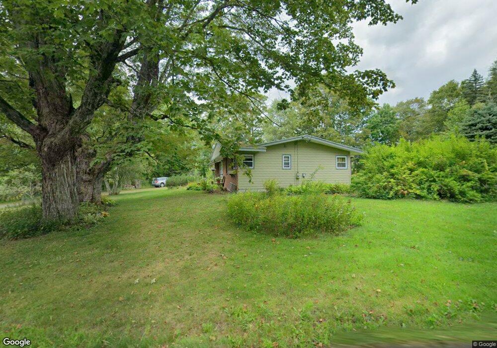
25 Watson Spruce Corner Rd Ashfield, MA 01330
Ashfield NeighborhoodEstimated Value: $341,000 - $398,275
3
Beds
2
Baths
1,646
Sq Ft
$221/Sq Ft
Est. Value
About This Home
This home is located at 25 Watson Spruce Corner Rd, Ashfield, MA 01330 and is currently estimated at $363,569, approximately $220 per square foot. 25 Watson Spruce Corner Rd is a home located in Franklin County with nearby schools including Mohawk Trail Regional High School.
Ownership History
Date
Name
Owned For
Owner Type
Purchase Details
Closed on
Jul 12, 2002
Sold by
Mckittrick Jeffrey D and Mckittrick Andrea D
Bought by
Stravino Laura A and Boesel Lael J
Current Estimated Value
Home Financials for this Owner
Home Financials are based on the most recent Mortgage that was taken out on this home.
Original Mortgage
$131,750
Interest Rate
6.79%
Mortgage Type
Purchase Money Mortgage
Purchase Details
Closed on
Nov 22, 1996
Sold by
Florence Sb
Bought by
Mckittrick Jeffrey D and Mckittrick Andrea D
Create a Home Valuation Report for This Property
The Home Valuation Report is an in-depth analysis detailing your home's value as well as a comparison with similar homes in the area
Home Values in the Area
Average Home Value in this Area
Purchase History
| Date | Buyer | Sale Price | Title Company |
|---|---|---|---|
| Stravino Laura A | $155,000 | -- | |
| Mckittrick Jeffrey D | $85,000 | -- |
Source: Public Records
Mortgage History
| Date | Status | Borrower | Loan Amount |
|---|---|---|---|
| Open | Mckittrick Jeffrey D | $121,500 | |
| Closed | Mckittrick Jeffrey D | $132,700 | |
| Closed | Mckittrick Jeffrey D | $131,750 | |
| Previous Owner | Mckittrick Jeffrey D | $106,000 |
Source: Public Records
Tax History
| Year | Tax Paid | Tax Assessment Tax Assessment Total Assessment is a certain percentage of the fair market value that is determined by local assessors to be the total taxable value of land and additions on the property. | Land | Improvement |
|---|---|---|---|---|
| 2025 | $4,006 | $297,600 | $78,900 | $218,700 |
| 2024 | $4,069 | $278,500 | $78,900 | $199,600 |
| 2023 | $3,925 | $222,900 | $63,100 | $159,800 |
| 2022 | $3,631 | $208,900 | $59,900 | $149,000 |
| 2021 | $2,893 | $207,500 | $59,900 | $147,600 |
| 2020 | $3,457 | $207,500 | $59,900 | $147,600 |
| 2019 | $3,406 | $198,500 | $56,000 | $142,500 |
| 2018 | $682 | $198,500 | $56,000 | $142,500 |
| 2017 | $2,412 | $202,200 | $55,200 | $147,000 |
| 2016 | $3,163 | $192,400 | $55,200 | $137,200 |
| 2015 | $3,073 | $192,400 | $55,200 | $137,200 |
| 2014 | $3,318 | $205,300 | $52,100 | $153,200 |
Source: Public Records
Map
Nearby Homes
- 333 Ranney Corner Rd
- 311 Cummington Rd
- 54 E Main St
- 0 Sears Rd Unit 73373850
- 78 Shaw Rd
- 278 E Main St
- 141 Stage Rd
- 609 Berkshire Trail
- 10 Maple St
- 240 Beldingville Rd
- 44 Aberdeen Rd
- 39 Hawley St
- 0 N Bear River Rd Unit 73485981
- 0 Fuller Rd
- 11 S Chesterfield Rd
- 00 Capen Clark Rd
- 55 Cummington Rd
- 0 Pynchon Rd Unit 73512590
- 3 Hog Hollow Rd
- 0, Lot 7 East Rd
- 77 Watson Spruce Corner Rd
- 1, 2A &2B Spruce Corner Rd
- 17 Watson Spruce Corner Rd
- 0 Watson Spruce Corner Rd
- 1179 Spruce Corner Rd
- 1207 Spruce Corner Rd
- 1237 Spruce Corner Rd
- 1280 Spruce Corner Rd
- 1280 Spruce Corner Rd
- 0 Plainfield Rd
- 1451 lot00 Spruce Corner
- 1281 Spruce Corner Rd
- 142 Watson Spruce Corner Rd
- 1097 Spruce Corner Rd
- 68 Plainfield Rd
- 1330 Spruce Corner Rd
- 1029 Spruce Corner Rd
- 1379 Spruce Corner Rd
- 118 Plainfield Rd
- 243 Watson Spruce Corner Rd
Your Personal Tour Guide
Ask me questions while you tour the home.