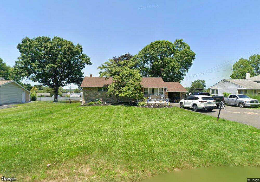
250 Acorn Dr Warminster, PA 18974
Estimated Value: $366,126 - $478,000
--
Bed
1
Bath
1,464
Sq Ft
$302/Sq Ft
Est. Value
About This Home
This home is located at 250 Acorn Dr, Warminster, PA 18974 and is currently estimated at $442,282, approximately $302 per square foot. 250 Acorn Dr is a home located in Bucks County with nearby schools including Willow Dale El School, Log College Middle School, and William Tennent High School.
Ownership History
Date
Name
Owned For
Owner Type
Purchase Details
Closed on
Jul 26, 2003
Sold by
Colagreco Maureen and Goldstein Maureen
Bought by
Colagreco Dave and Colagreco Maureen
Current Estimated Value
Home Financials for this Owner
Home Financials are based on the most recent Mortgage that was taken out on this home.
Original Mortgage
$60,000
Interest Rate
4.83%
Mortgage Type
New Conventional
Purchase Details
Closed on
Jul 6, 1999
Sold by
Goldstein Harris and Goldstein Maureen
Bought by
Goldstein Maureen
Purchase Details
Closed on
Aug 29, 1996
Sold by
Mcgeary G Patricia
Bought by
Goldstein Harris and Goldstein Maureen
Home Financials for this Owner
Home Financials are based on the most recent Mortgage that was taken out on this home.
Original Mortgage
$139,700
Outstanding Balance
$11,975
Interest Rate
8.18%
Estimated Equity
$430,307
Create a Home Valuation Report for This Property
The Home Valuation Report is an in-depth analysis detailing your home's value as well as a comparison with similar homes in the area
Home Values in the Area
Average Home Value in this Area
Purchase History
| Date | Buyer | Sale Price | Title Company |
|---|---|---|---|
| Colagreco Dave | -- | -- | |
| Goldstein Maureen | -- | -- | |
| Goldstein Harris | $140,000 | -- |
Source: Public Records
Mortgage History
| Date | Status | Borrower | Loan Amount |
|---|---|---|---|
| Closed | Colagreco Dave | $60,000 | |
| Open | Goldstein Harris | $139,700 |
Source: Public Records
Tax History Compared to Growth
Tax History
| Year | Tax Paid | Tax Assessment Tax Assessment Total Assessment is a certain percentage of the fair market value that is determined by local assessors to be the total taxable value of land and additions on the property. | Land | Improvement |
|---|---|---|---|---|
| 2025 | $4,221 | $20,000 | $5,840 | $14,160 |
| 2024 | $4,221 | $20,000 | $5,840 | $14,160 |
| 2023 | $4,091 | $20,000 | $5,840 | $14,160 |
| 2022 | $4,004 | $20,000 | $5,840 | $14,160 |
| 2021 | $3,911 | $20,000 | $5,840 | $14,160 |
| 2020 | $3,856 | $20,000 | $5,840 | $14,160 |
| 2019 | $3,651 | $20,000 | $5,840 | $14,160 |
| 2018 | $3,564 | $20,000 | $5,840 | $14,160 |
| 2017 | $3,459 | $20,000 | $5,840 | $14,160 |
| 2016 | -- | $20,000 | $5,840 | $14,160 |
| 2015 | $3,434 | $20,000 | $5,840 | $14,160 |
| 2014 | $3,434 | $20,000 | $5,840 | $14,160 |
Source: Public Records
Map
Nearby Homes
- 442 Acorn Dr
- 254 Sassafras Ct Unit 254
- 192 Hackberry Ct
- 223 Sassafras Ct Unit 223
- 244 Sassafras Ct Unit 244
- 1334 Mallard Cir
- 13 Eagle Ct
- 64 Villa Dr Unit 206
- 1575 W Street Rd Unit 626
- 1575 W Street Rd Unit 812
- 1575 W Street Rd Unit 721
- 1277 Beverly Rd
- 100 Villa Dr Unit 224
- 1309 Clyde Rd
- 1274 Beverly Rd
- Faraday Plan at Liberty Ridge
- Westmont Plan at Liberty Ridge
- Northbrook Plan at Liberty Ridge
- 605 Liberty Ridge Rd
- 607 Liberty Ridge Rd