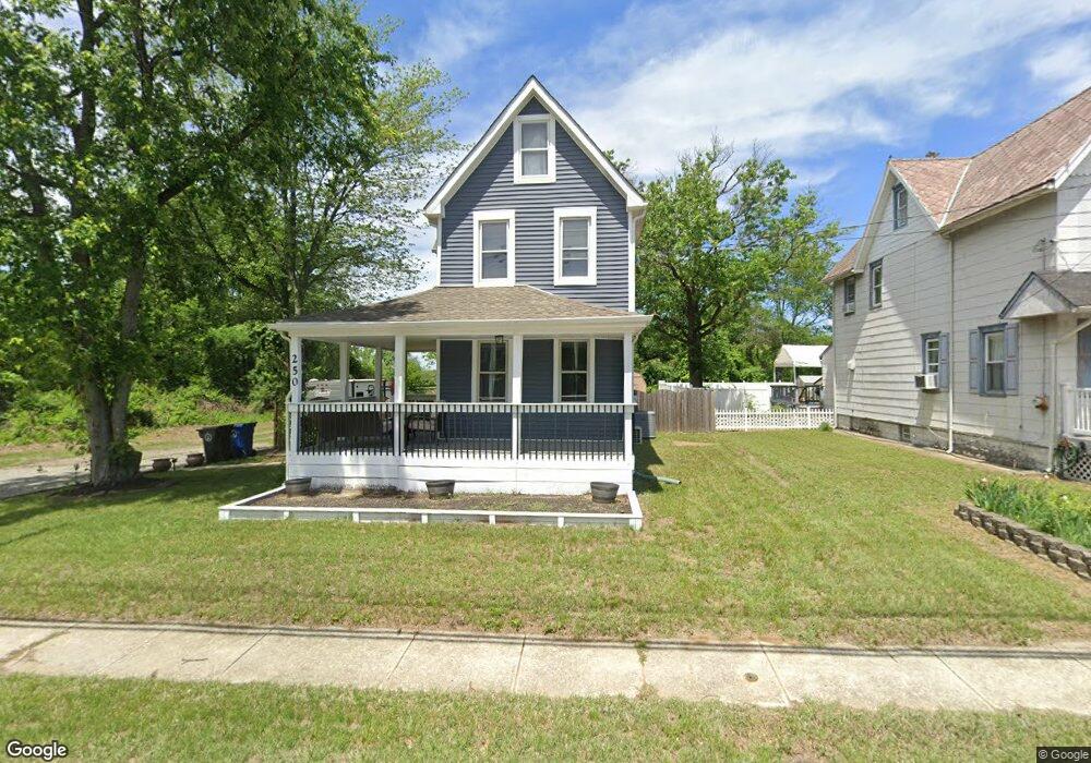
250 Crown Point Rd West Deptford, NJ 08086
West Deptford Township NeighborhoodEstimated Value: $227,179 - $294,000
--
Bed
--
Bath
1,102
Sq Ft
$237/Sq Ft
Est. Value
About This Home
This home is located at 250 Crown Point Rd, West Deptford, NJ 08086 and is currently estimated at $261,045, approximately $236 per square foot. 250 Crown Point Rd is a home located in Gloucester County with nearby schools including Red Bank Elementary School, Green-Fields Elementary School, and Oakview Elementary School.
Ownership History
Date
Name
Owned For
Owner Type
Purchase Details
Closed on
Oct 21, 2013
Sold by
Killeen Ronald J
Bought by
Killeen Stephanie L and Killeen Ronald B
Current Estimated Value
Home Financials for this Owner
Home Financials are based on the most recent Mortgage that was taken out on this home.
Original Mortgage
$116,758
Outstanding Balance
$87,677
Interest Rate
4.56%
Mortgage Type
New Conventional
Estimated Equity
$173,368
Purchase Details
Closed on
Oct 17, 2013
Sold by
Killeen Ronald J
Bought by
Killeen Ronald B and Killeen Stephanie L
Home Financials for this Owner
Home Financials are based on the most recent Mortgage that was taken out on this home.
Original Mortgage
$116,758
Outstanding Balance
$87,677
Interest Rate
4.56%
Mortgage Type
New Conventional
Estimated Equity
$173,368
Create a Home Valuation Report for This Property
The Home Valuation Report is an in-depth analysis detailing your home's value as well as a comparison with similar homes in the area
Home Values in the Area
Average Home Value in this Area
Purchase History
| Date | Buyer | Sale Price | Title Company |
|---|---|---|---|
| Killeen Stephanie L | $135,000 | -- | |
| Killeen Ronald B | $135,000 | -- |
Source: Public Records
Mortgage History
| Date | Status | Borrower | Loan Amount |
|---|---|---|---|
| Open | Killeen Stephanie L | $116,758 |
Source: Public Records
Tax History Compared to Growth
Tax History
| Year | Tax Paid | Tax Assessment Tax Assessment Total Assessment is a certain percentage of the fair market value that is determined by local assessors to be the total taxable value of land and additions on the property. | Land | Improvement |
|---|---|---|---|---|
| 2025 | $5,189 | $148,600 | $38,600 | $110,000 |
| 2024 | $5,122 | $148,600 | $38,600 | $110,000 |
| 2023 | $5,122 | $148,600 | $38,600 | $110,000 |
| 2022 | $3,977 | $115,900 | $38,600 | $77,300 |
| 2021 | $3,843 | $115,900 | $38,600 | $77,300 |
| 2020 | $3,953 | $115,900 | $38,600 | $77,300 |
| 2019 | $3,843 | $115,900 | $38,600 | $77,300 |
| 2018 | $3,739 | $115,900 | $38,600 | $77,300 |
| 2017 | $3,652 | $115,900 | $38,600 | $77,300 |
| 2016 | $3,550 | $115,900 | $38,600 | $77,300 |
| 2015 | $3,382 | $115,900 | $38,600 | $77,300 |
| 2014 | $3,214 | $115,900 | $38,600 | $77,300 |
Source: Public Records
Map
Nearby Homes
- 247 Crown Point Rd
- 232 Snowy Egret Ln
- 253 Snowy Egret Ln
- 433 Crown Point Rd
- 439 Crown Point Rd
- 47 Pelican Place Unit 47
- 67 Pelican Place
- 64 Tilden Rd
- 10 Kennedy Ct
- 124 Brent Ct
- 113 Brent Ct
- 121 Cape May Ave
- 740 Carter Hill Dr
- 400 Audubon Ave
- 107 Audubon Ave
- 640 Worcester Dr
- 1810 Fernwood Dr
- 863 Doncaster Dr
- 157 Robin Dr
- 266 Passaic Ave
- 252 Crown Point Rd
- 254 Crown Point Rd
- 256 Crown Point Rd
- 255 Crown Point Rd
- 257 Crown Point Rd
- 251 Crown Point Rd
- 253 Crown Point Rd
- 260 Crown Point Rd
- 249 Crown Point Rd
- 259 Crown Point Rd
- 245 Crown Point Rd
- 262 Crown Point Rd
- 262 Crown Point Rd Unit A
- 262 Crown Point Rd Unit 2
- 243 Crown Point Rd
- 263 Crown Point Rd
- 261 Crown Point Rd
- 265 Crown Point Rd
- 267 Crown Point Rd
- 0 Church St Unit 1002524116