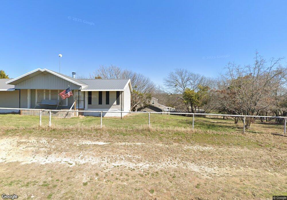
250 Dillingham Ln Weatherford, TX 76085
Estimated Value: $464,394 - $703,000
--
Bed
--
Bath
2,503
Sq Ft
$226/Sq Ft
Est. Value
About This Home
This home is located at 250 Dillingham Ln, Weatherford, TX 76085 and is currently estimated at $565,099, approximately $225 per square foot. 250 Dillingham Ln is a home located in Parker County with nearby schools including Crockett Elementary School, Tison Middle School, and Weatherford High School.
Ownership History
Date
Name
Owned For
Owner Type
Purchase Details
Closed on
Apr 9, 2024
Sold by
Green Don and Green M
Bought by
Green Family Trust and Green
Current Estimated Value
Purchase Details
Closed on
Feb 15, 1996
Bought by
Green Donald E and Green Maureen A
Purchase Details
Closed on
Jan 1, 1901
Bought by
Green Donald E and Green Maureen A
Create a Home Valuation Report for This Property
The Home Valuation Report is an in-depth analysis detailing your home's value as well as a comparison with similar homes in the area
Home Values in the Area
Average Home Value in this Area
Purchase History
| Date | Buyer | Sale Price | Title Company |
|---|---|---|---|
| Green Family Trust | -- | None Listed On Document | |
| Green Donald E | -- | -- | |
| Green Donald E | -- | -- |
Source: Public Records
Tax History Compared to Growth
Tax History
| Year | Tax Paid | Tax Assessment Tax Assessment Total Assessment is a certain percentage of the fair market value that is determined by local assessors to be the total taxable value of land and additions on the property. | Land | Improvement |
|---|---|---|---|---|
| 2025 | $1,974 | $493,390 | $146,870 | $346,520 |
| 2024 | $1,974 | $370,216 | -- | -- |
| 2023 | $1,974 | $336,560 | $0 | $0 |
| 2022 | $5,697 | $305,970 | $88,850 | $217,120 |
| 2021 | $5,622 | $305,970 | $88,850 | $217,120 |
| 2020 | $5,136 | $273,510 | $79,910 | $193,600 |
| 2019 | $4,981 | $273,510 | $79,910 | $193,600 |
| 2018 | $4,552 | $209,840 | $46,500 | $163,340 |
| 2017 | $4,222 | $209,840 | $46,500 | $163,340 |
| 2016 | $3,839 | $172,940 | $46,500 | $126,440 |
| 2015 | $3,417 | $172,880 | $46,440 | $126,440 |
| 2014 | $3,337 | $175,150 | $46,440 | $128,710 |
Source: Public Records
Map
Nearby Homes
- 1860 Trailwood Dr
- Haven Plan at Wossum Ranch
- 1300 Green Ridge Rd
- Vista Plan at Wossum Ranch
- 1305 Green Ridge Rd
- 1337 Eagle Dr
- 1301 Eagle Dr
- 777 Trailwood Dr
- 707 Gail Dr
- 719 Gail Dr
- 116 Sandstone Ln
- 408 Sandridge Dr
- 1201 Azle Hwy
- 107 W Stagecoach Trail
- 150 Ellis Spring Dr
- 5885-F Upper Denton Rd
- 5885-H Upper Denton Rd
- E 67 Acres TBD Upper Denton Rd
- 5885-G Upper Denton Rd
- 104 W Stagecoach Trail
- 212 Dillingham Ln
- 280 Dillingham Ln
- 320 Dillingham Ln
- 310 Dillingham Ln
- 202 Dillingham Ln
- 315 Dillingham Ln
- 1104 N Oak Trail
- 317 Dillingham Ln
- 2405 Upper Denton Rd Unit 2
- 2421 Upper Denton Rd
- 425 Dillingham Ln
- 351 Rebecca Ln
- 00 Rebecca
- 367 Dillingham Ln
- 2445 Upper Denton Rd
- 475 Dillingham Ln
- 476 Dillingham Ln
- 2350 Upper Denton Rd
- 2595 Upper Denton Rd
- 2338 Upper Denton Rd