250 E Main St John Day, OR 97845
Estimated payment $2,910/month
About This Lot
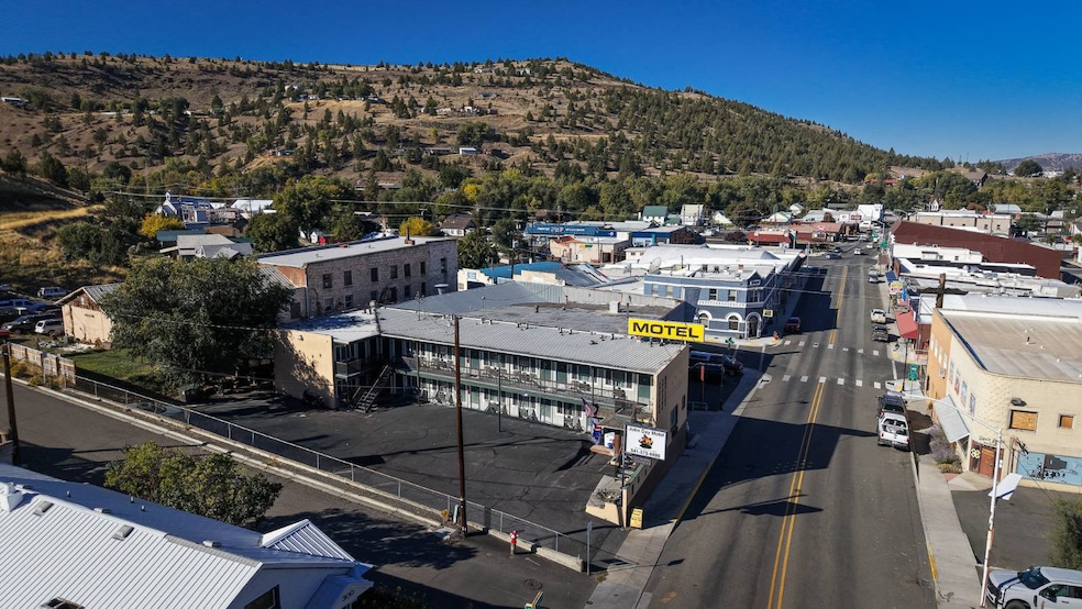
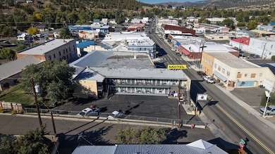
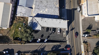
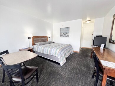
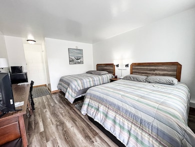
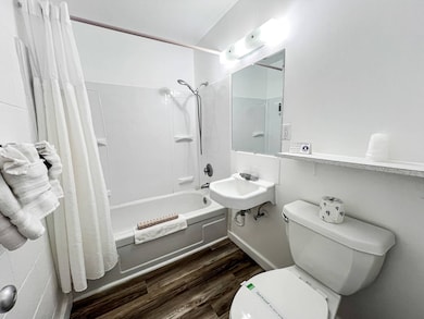
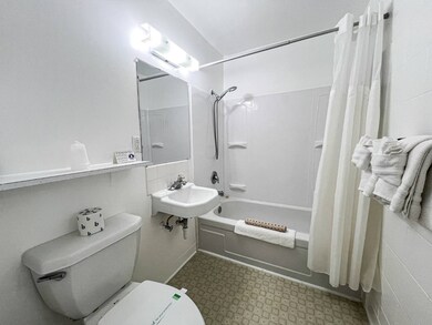
Discover a 14-unit, non-franchised motel that is both profitable and ready for immediate operation. This business can be managed by either an owner or a manager due to its manageable size. The property includes six single queen bed units, eight double queen bed units, and a manager suite. It is highly rated on Bookings and Google. Recent upgrades include new signage, heating and air conditioning units, refrigerators and microwaves, 32" flat-screen TVs, new beds and flooring, and updated shower surrounds, bedding, and towels. The amenities feature an outdoor seating area, a guest firepit and BBQ, and a small garage/storage space. John Day offers a wealth of public land and recreational activities, such as fossil beds, gold panning, hiking, 4-wheeling, snowmobiling, high mountain lakes, hunting, and more. The current owners are absentee, and there's a manager on-site who is willing to stay or help you start your new life in Grant County while learning to operate the motel. Showings by appointment only. Seller is motivated. Year built 1963, 5,363 sq ft, .42 acres, 2024 taxes $4,025.12.
Property Details
Property Type
- Land
Est. Annual Taxes
- $4,025
Lot Details
- 0.42 Acre Lot
Map
Tax History
| Year | Tax Paid | Tax Assessment Tax Assessment Total Assessment is a certain percentage of the fair market value that is determined by local assessors to be the total taxable value of land and additions on the property. | Land | Improvement |
|---|---|---|---|---|
| 2025 | $4,141 | $274,369 | $42,852 | $231,517 |
| 2024 | $4,025 | $266,378 | $41,600 | $224,778 |
| 2023 | $3,911 | $258,620 | $40,391 | $218,229 |
| 2022 | $3,794 | $251,088 | $39,221 | $211,867 |
| 2021 | $3,681 | $243,775 | $38,070 | $205,705 |
| 2020 | $3,873 | $236,675 | $36,961 | $199,714 |
| 2019 | $3,771 | $229,782 | $37,977 | $191,805 |
| 2018 | $3,589 | $223,090 | $36,870 | $186,220 |
| 2017 | $3,571 | $219,975 | $36,356 | $183,619 |
| 2016 | $3,504 | $213,568 | $35,295 | $178,273 |
| 2015 | $3,328 | $201,309 | $33,269 | $168,040 |
| 2014 | $3,328 | $201,309 | $33,269 | $168,040 |
| 2013 | $3,115 | $195,446 | $43,280 | $152,166 |
Property History
| Date | Event | Price | List to Sale | Price per Sq Ft |
|---|---|---|---|---|
| 01/18/2026 01/18/26 | Pending | -- | -- | -- |
| 12/04/2025 12/04/25 | Price Changed | $499,900 | -9.1% | -- |
| 09/30/2025 09/30/25 | For Sale | $550,000 | -- | -- |
Purchase History
| Date | Type | Sale Price | Title Company |
|---|---|---|---|
| Quit Claim Deed | -- | Stewart Title Guaranty Compa | |
| Warranty Deed | -- | None Available | |
| Warranty Deed | $249,000 | None Available |
Source: My State MLS
MLS Number: 11586057
APN: 13S3126BA11200
- 304 SE Hillcrest Dr
- 100 SE Hillcrest Rd
- 173 N Canyon Blvd
- 250 NE Dayton St
- 128 SW Canton St
- 312 N Canyon Blvd
- 212 NW Bridge St
- 518 SE 2nd Ave
- 410 NW Bridge St
- 213 NW 4th Ave
- 314 NW 3rd Ave
- 311 NE 7th Ave
- 633 SE Hillcrest Rd
- 212 NW 5th Ave
- 0 NE 7th St
- 311 NE 7th St
- 0 SW 4th Ave Unit 24562517
- 755 S Canyon Blvd
- 843 NW Bridge St
- 748 E Main St

Ask me questions while you tour the home.