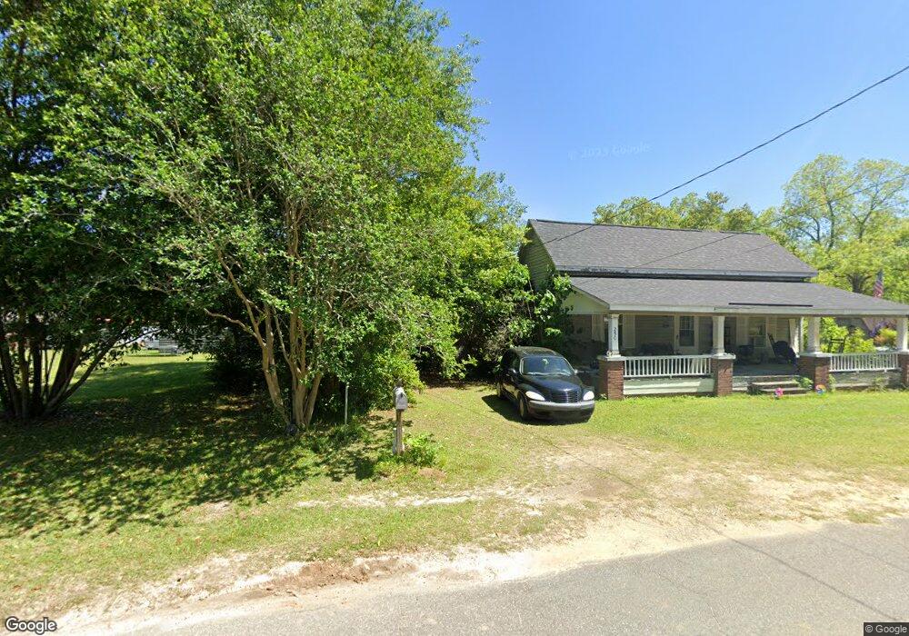
250 Elm St NW Poulan, GA 31781
Estimated Value: $75,596 - $160,000
3
Beds
2
Baths
1,368
Sq Ft
$96/Sq Ft
Est. Value
About This Home
This home is located at 250 Elm St NW, Poulan, GA 31781 and is currently estimated at $131,399, approximately $96 per square foot. 250 Elm St NW is a home located in Worth County with nearby schools including Worth County Primary School, Worth County Elementary School, and Worth County Middle School.
Ownership History
Date
Name
Owned For
Owner Type
Purchase Details
Closed on
Oct 18, 2016
Sold by
Wyman Clark
Bought by
Hayes Flippo Duane Clark and Hayes Flippo Mildred
Current Estimated Value
Purchase Details
Closed on
Jun 29, 2010
Sold by
Flippo Duana Clark
Bought by
Flippo Wymon Clark
Purchase Details
Closed on
Dec 12, 2007
Sold by
Mccullough Sandra Gray
Bought by
Flippo Duane Clark
Purchase Details
Closed on
Jan 1, 2007
Sold by
Reynolds Roy W
Bought by
Reynolds Tina Renae
Purchase Details
Closed on
Jul 1, 2006
Sold by
Gray Joel Daniel
Bought by
Reynolds Roy W
Purchase Details
Closed on
Jun 1, 2006
Sold by
Reynolds Roy W
Bought by
Linley Cynthia
Create a Home Valuation Report for This Property
The Home Valuation Report is an in-depth analysis detailing your home's value as well as a comparison with similar homes in the area
Home Values in the Area
Average Home Value in this Area
Purchase History
| Date | Buyer | Sale Price | Title Company |
|---|---|---|---|
| Hayes Flippo Duane Clark | $28,036 | -- | |
| Flippo Wymon Clark | -- | -- | |
| Flippo Duane Clark | $30,000 | -- | |
| Reynolds Tina Renae | -- | -- | |
| Reynolds Roy W | -- | -- | |
| Linley Cynthia | -- | -- |
Source: Public Records
Tax History Compared to Growth
Tax History
| Year | Tax Paid | Tax Assessment Tax Assessment Total Assessment is a certain percentage of the fair market value that is determined by local assessors to be the total taxable value of land and additions on the property. | Land | Improvement |
|---|---|---|---|---|
| 2024 | $343 | $11,706 | $3,712 | $7,994 |
| 2023 | $343 | $11,215 | $3,712 | $7,503 |
| 2022 | $326 | $11,215 | $3,712 | $7,503 |
| 2021 | $326 | $11,215 | $3,712 | $7,503 |
| 2020 | $327 | $11,215 | $3,712 | $7,503 |
| 2019 | $327 | $11,215 | $3,712 | $7,503 |
| 2018 | $383 | $11,215 | $3,712 | $7,503 |
| 2017 | $383 | $11,215 | $3,712 | $7,503 |
| 2016 | $383 | $11,215 | $3,712 | $7,503 |
| 2015 | $383 | $11,215 | $3,712 | $7,503 |
| 2014 | $383 | $11,214 | $3,712 | $7,503 |
| 2013 | -- | $11,214 | $3,712 | $7,503 |
| 2012 | -- | $11,214 | $3,711 | $7,502 |
Source: Public Records
Map
Nearby Homes
- 565 Sands Dr Unit 8
- 565 Sands Dr
- 0 Sands Dr
- 0 P T Salter Rd Unit 138997
- 376 West Rd
- 196 Griffin Houston Rd
- 107 Dunbar Cir
- 103 Dunbar Cir
- 0 Multiple Lots Unit 138826
- 314 E Hobson St
- 302 Sadler St
- 307 E Hobson St
- 202A E Welch St
- 106 Rosewood Dr
- 101 Pecan St
- 000 Georgia 256
- 104 Lynn Cir
- 112 Courtney Cir
- 102 Courtney Cir
- 117 Donna Dr
- 253 Elm St NW
- 238 Elm St NW
- 219 Ousley St NW
- 245 Elm St NW
- 211 Ousley St NW
- 304 Elm St NW
- 239 Hunton St NW
- 303 Elm St NW
- 319 Ousley St NW
- 222 Elm St NW
- 231 Hunton St NW
- 212 NW Ousley St
- 217 Elm St NW
- 217 Elm St NW
- 219 Hunton St NW
- 218 Elm St NW
- 331 Ousley St NW
- 338 Ousley St NW
- 216 Elm St NW
- 230 Hunton St NW