Estimated Value: $80,000 - $109,253
3
Beds
1
Bath
1,300
Sq Ft
$70/Sq Ft
Est. Value
About This Home
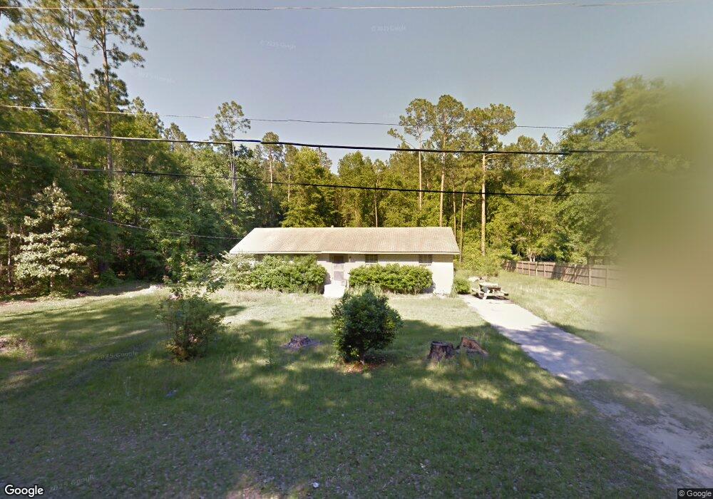
This home is located at 250 Fern St, Jesup, GA 31546 and is currently estimated at $91,313, approximately $70 per square foot. 250 Fern St is a home located in Wayne County with nearby schools including Jesup Elementary School, Arthur Williams Middle School, and Wayne County High School.
Ownership History
Date
Name
Owned For
Owner Type
Purchase Details
Closed on
Nov 30, 2018
Sold by
Eason Julia Frances
Bought by
Cutcliffe Christine
Current Estimated Value
Home Financials for this Owner
Home Financials are based on the most recent Mortgage that was taken out on this home.
Original Mortgage
$10,000,000
Outstanding Balance
$6,004,779
Interest Rate
4.8%
Mortgage Type
Commercial
Estimated Equity
-$5,913,466
Purchase Details
Closed on
Mar 1, 1992
Bought by
Sessoms Julia Frances
Purchase Details
Closed on
Jun 1, 1976
Create a Home Valuation Report for This Property
The Home Valuation Report is an in-depth analysis detailing your home's value as well as a comparison with similar homes in the area
Home Values in the Area
Average Home Value in this Area
Purchase History
| Date | Buyer | Sale Price | Title Company |
|---|---|---|---|
| Cutcliffe Christine | $55,000 | -- | |
| Sessoms Julia Frances | -- | -- | |
| Eason John H | -- | -- | |
| -- | -- | -- |
Source: Public Records
Mortgage History
| Date | Status | Borrower | Loan Amount |
|---|---|---|---|
| Open | Cutcliffe Christine | $10,000,000 |
Source: Public Records
Tax History Compared to Growth
Tax History
| Year | Tax Paid | Tax Assessment Tax Assessment Total Assessment is a certain percentage of the fair market value that is determined by local assessors to be the total taxable value of land and additions on the property. | Land | Improvement |
|---|---|---|---|---|
| 2024 | $1,025 | $33,523 | $2,620 | $30,903 |
| 2023 | $893 | $25,248 | $2,650 | $22,598 |
| 2022 | $795 | $25,248 | $2,650 | $22,598 |
| 2021 | $851 | $25,248 | $2,650 | $22,598 |
| 2020 | $881 | $25,248 | $2,650 | $22,598 |
| 2019 | $907 | $25,248 | $2,650 | $22,598 |
| 2018 | $334 | $23,634 | $1,970 | $21,664 |
| 2017 | $781 | $23,634 | $1,970 | $21,664 |
| 2016 | $222 | $23,634 | $1,970 | $21,664 |
| 2014 | $559 | $23,634 | $1,970 | $21,664 |
| 2013 | -- | $23,633 | $1,969 | $21,664 |
Source: Public Records
Map
Nearby Homes
- 548 N Cypress St
- 455 N Mahogany St
- 0 E Oak St
- Apt E Oak St
- 447 NE Broad St
- 385 N Hickory St
- 498 NE Broad St
- 436-441 Brunswick St
- 217 E Pine St
- 217 Pine Ridge Rd
- 249 Pine Ridge Rd
- 207 E Pine St
- 197 NW Broad St
- 658 E Walnut St
- 111 N Mahogany St
- 301 U S 301
- 15 Bethlehem Rd
- 0 Bethlehem Rd Unit 10523941
- 0 Bethlehem Rd Unit 1654015
- 0 Bethlehem Rd Unit 23561377
- 210 Fern St
- 0 Greenbrae St
- 285 Fern St
- 192 Sumac Dr
- 195 Fern St
- 190 Fern St
- 117 Sumac Dr
- 205 Hemlock St
- 255 Hemlock St
- 704 Hemlock St
- 0 Sumac Dr
- 0 Tract 3 - Hemlock St Unit 10156078
- 0 Tract 3 - Hemlock St
- 199 Greenbrae St
- 695 Hemlock St
- 792 Hemlock St
- 703 Hemlock St
- 197 Greenbrae St
- 625 Fir St
- 635 Fir St