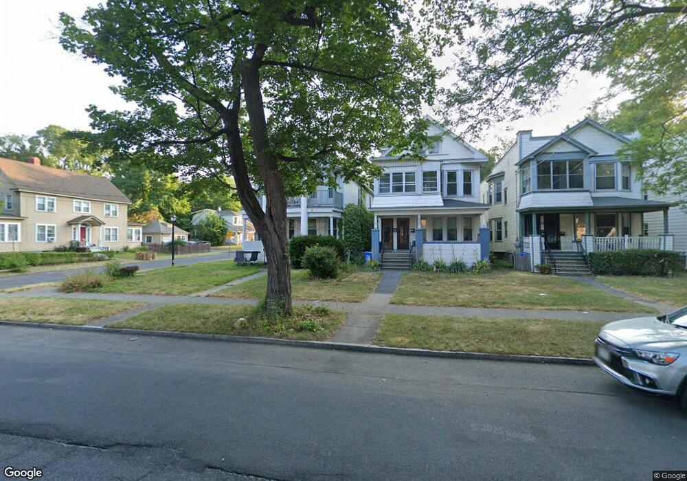
250 Manning Blvd Albany, NY 12206
Lower Washington Avenue NeighborhoodEstimated Value: $269,159 - $327,000
6
Beds
2
Baths
2,192
Sq Ft
$136/Sq Ft
Est. Value
About This Home
This home is located at 250 Manning Blvd, Albany, NY 12206 and is currently estimated at $298,790, approximately $136 per square foot. 250 Manning Blvd is a home located in Albany County with nearby schools including Pine Hills Elementary School, Stephen And Harriet Myers Middle School, and Albany High School.
Ownership History
Date
Name
Owned For
Owner Type
Purchase Details
Closed on
Aug 26, 2008
Sold by
Johnson Thomas
Bought by
Watchorn Michael
Current Estimated Value
Home Financials for this Owner
Home Financials are based on the most recent Mortgage that was taken out on this home.
Original Mortgage
$177,750
Outstanding Balance
$119,186
Interest Rate
6.69%
Estimated Equity
$179,604
Purchase Details
Closed on
Jul 23, 2004
Sold by
Spandaro Carl
Bought by
Johnson Thomas
Purchase Details
Closed on
Jan 31, 2003
Sold by
O'Hara Angela
Bought by
Spadaro Carl
Create a Home Valuation Report for This Property
The Home Valuation Report is an in-depth analysis detailing your home's value as well as a comparison with similar homes in the area
Home Values in the Area
Average Home Value in this Area
Purchase History
| Date | Buyer | Sale Price | Title Company |
|---|---|---|---|
| Watchorn Michael | $197,500 | -- | |
| Watchorn Michael S | $197,500 | None Available | |
| Johnson Thomas | $167,000 | Christopher L Lindsay | |
| Spadaro Carl | -- | -- |
Source: Public Records
Mortgage History
| Date | Status | Borrower | Loan Amount |
|---|---|---|---|
| Open | Watchorn Michael S | $177,750 |
Source: Public Records
Tax History Compared to Growth
Tax History
| Year | Tax Paid | Tax Assessment Tax Assessment Total Assessment is a certain percentage of the fair market value that is determined by local assessors to be the total taxable value of land and additions on the property. | Land | Improvement |
|---|---|---|---|---|
| 2024 | $5,744 | $236,000 | $47,200 | $188,800 |
| 2023 | $5,607 | $151,000 | $30,200 | $120,800 |
| 2022 | $5,409 | $151,000 | $30,200 | $120,800 |
| 2021 | $5,372 | $151,000 | $30,200 | $120,800 |
| 2020 | $5,091 | $151,000 | $30,200 | $120,800 |
| 2019 | $5,945 | $151,000 | $30,200 | $120,800 |
| 2018 | $5,093 | $151,000 | $30,200 | $120,800 |
| 2016 | $4,945 | $151,000 | $30,200 | $120,800 |
Source: Public Records
Map
Nearby Homes
- 278 Manning Blvd
- 15 Buchanan St
- 137 N Pine Ave
- 160 Manning Blvd
- 34 Buchanan St
- 866 Washington Ave
- 129 N Pine Ave
- 118 N Allen St
- 112 N Allen St
- 21 Lincoln Ave
- 195 Kent St
- 147 Homestead Ave
- 349 Manning Blvd
- 131 Homestead Ave
- 455 Bradford St
- 3 Van Buren St
- 357 Manning Blvd
- 1009 Washington Ave
- 1014 Washington Ave
- 847 Jay St
- 252 Manning Blvd
- 254 Manning Blvd
- 256 Manning Blvd
- 248 Manning Blvd
- 12 Cleveland St
- 258 Manning Blvd
- 246 Manning Blvd
- 16 Cleveland St
- 260 Manning Blvd
- 262 Manning Blvd
- 13 Cleveland St
- 262 Manning Blvd
- 9 Cleveland St
- 244 Manning Blvd
- 11 Mckinley St
- 15 Cleveland St
- 13 Mckinley St
- 253 Manning Blvd
- 11 Mc Kinley St
- 264 Manning Blvd