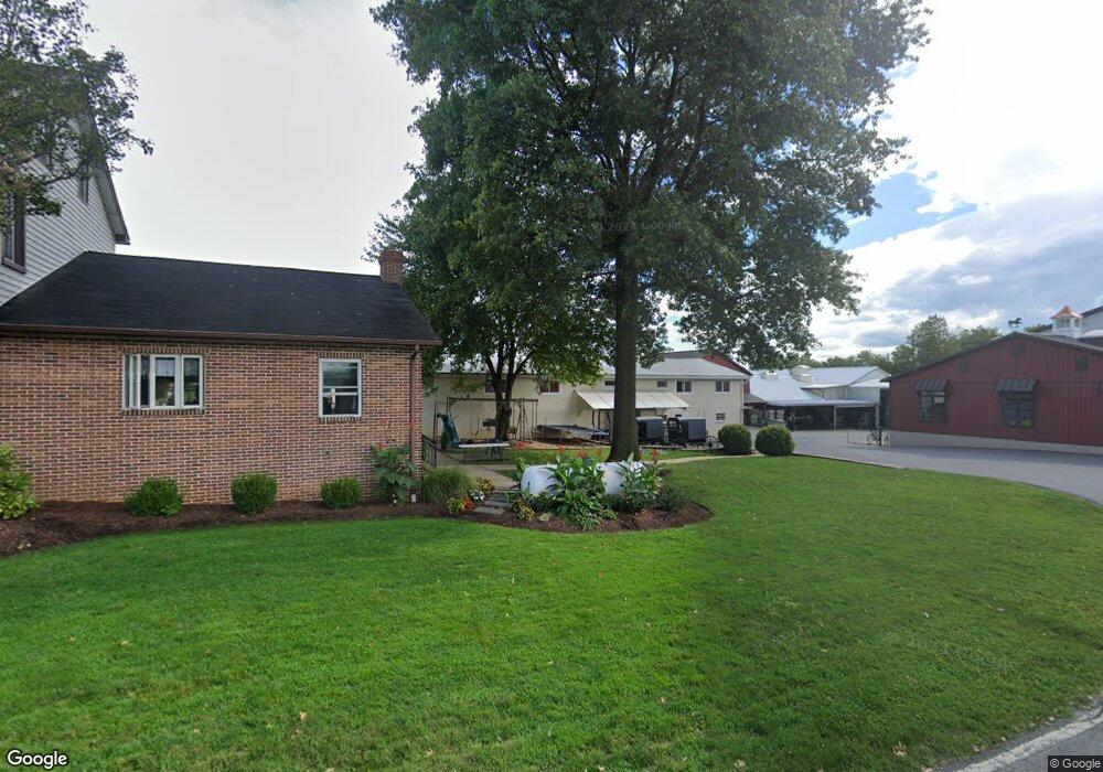
250 Maple Ave Bird In Hand, PA 17505
Estimated Value: $580,000 - $823,000
5
Beds
2
Baths
19,431
Sq Ft
$37/Sq Ft
Est. Value
About This Home
This home is located at 250 Maple Ave, Bird In Hand, PA 17505 and is currently estimated at $710,506, approximately $36 per square foot. 250 Maple Ave is a home located in Lancaster County with nearby schools including Smoketown Elementary School, Gerald G. Huesken Middle School, and Conestoga Valley High School.
Ownership History
Date
Name
Owned For
Owner Type
Purchase Details
Closed on
Oct 3, 2024
Sold by
Stoltzfus Christian A and Stoltzfus Barbara Ann
Bought by
Stoltzfus Ephraim J and Stoltzfus Mary Ann
Current Estimated Value
Home Financials for this Owner
Home Financials are based on the most recent Mortgage that was taken out on this home.
Original Mortgage
$1,400,000
Outstanding Balance
$1,385,586
Interest Rate
6.46%
Mortgage Type
Seller Take Back
Estimated Equity
-$675,080
Create a Home Valuation Report for This Property
The Home Valuation Report is an in-depth analysis detailing your home's value as well as a comparison with similar homes in the area
Home Values in the Area
Average Home Value in this Area
Purchase History
| Date | Buyer | Sale Price | Title Company |
|---|---|---|---|
| Stoltzfus Ephraim J | -- | None Listed On Document |
Source: Public Records
Mortgage History
| Date | Status | Borrower | Loan Amount |
|---|---|---|---|
| Open | Stoltzfus Ephraim J | $1,400,000 |
Source: Public Records
Tax History Compared to Growth
Tax History
| Year | Tax Paid | Tax Assessment Tax Assessment Total Assessment is a certain percentage of the fair market value that is determined by local assessors to be the total taxable value of land and additions on the property. | Land | Improvement |
|---|---|---|---|---|
| 2025 | $9,025 | $445,800 | $113,600 | $332,200 |
| 2024 | $9,025 | $445,800 | $113,600 | $332,200 |
| 2023 | $8,817 | $445,800 | $113,600 | $332,200 |
| 2022 | $8,597 | $445,800 | $113,600 | $332,200 |
| 2021 | $8,294 | $445,800 | $113,600 | $332,200 |
| 2020 | $6,994 | $375,900 | $113,600 | $262,300 |
| 2019 | $6,843 | $375,900 | $113,600 | $262,300 |
| 2018 | $10,070 | $375,900 | $113,600 | $262,300 |
| 2017 | $8,599 | $397,200 | $89,600 | $307,600 |
| 2016 | $8,496 | $397,200 | $89,600 | $307,600 |
| 2015 | $2,171 | $397,200 | $89,600 | $307,600 |
| 2014 | $5,892 | $397,200 | $89,600 | $307,600 |
Source: Public Records
Map
Nearby Homes
- 323 Enterprise Dr
- 339 Enterprise Dr
- 2596 Old Philadelphia Pike
- 2498 Old Philadelphia Park
- 425 Mill Creek Rd
- 2453 Lincoln Hwy E
- 7 Pleasant Dr
- 103 Fairhill Dr
- 2472 Leaman Rd
- 26 Ruth Dr
- 31 Jere Rd
- 0 - Lot #2 Paradise Ln
- 439 Coreopsis Dr
- 15 S Singer Ave
- 3088 Lincoln Hwy E
- 305 Greenland Dr Unit 385
- 347 Greenland Dr
- 33 Black Oak Dr
- 68 Horseshoe Rd
- 37 Black Oak Dr
- 248 Maple Ave
- 255 Maple Ave
- 251 Maple Ave
- 249 Maple Ave
- 242 Maple Ave
- 247 Maple Ave
- 243 Maple Ave
- 264 Maple Ave
- 236 Maple Ave
- 239 Maple Ave
- 224 Maple Ave
- 2688 Old Philadelphia Pike
- 2686 Old Philadelphia Pike
- 238 Railroad Ave
- 2684 Old Philadelphia Pike
- 2689 Old Philadelphia Pike
- 240 Railroad Ave
- 2678 Old Philadelphia Pike
- 2680 Old Philadelphia Pike
- 2683 Old Philadelphia Pike