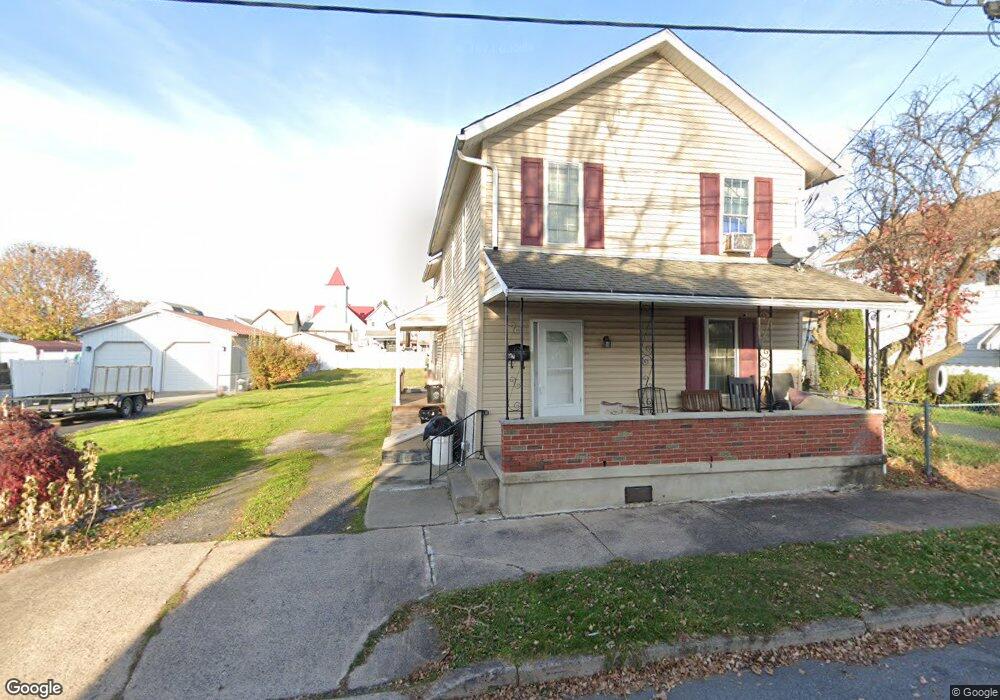
250 Matson Ave Wilkes Barre, PA 18705
Estimated Value: $206,000 - $234,000
4
Beds
3
Baths
2,200
Sq Ft
$98/Sq Ft
Est. Value
About This Home
This home is located at 250 Matson Ave, Wilkes Barre, PA 18705 and is currently estimated at $215,290, approximately $97 per square foot. 250 Matson Ave is a home located in Luzerne County with nearby schools including Leo E. Solomon-Plains Elementary School, Cradock Middle School, and Solomon/Plains Junior High School.
Ownership History
Date
Name
Owned For
Owner Type
Purchase Details
Closed on
Jan 27, 2008
Sold by
Foose John C
Bought by
Meshanski Joseph A
Current Estimated Value
Home Financials for this Owner
Home Financials are based on the most recent Mortgage that was taken out on this home.
Original Mortgage
$74,100
Interest Rate
4.94%
Mortgage Type
Purchase Money Mortgage
Create a Home Valuation Report for This Property
The Home Valuation Report is an in-depth analysis detailing your home's value as well as a comparison with similar homes in the area
Home Values in the Area
Average Home Value in this Area
Purchase History
| Date | Buyer | Sale Price | Title Company |
|---|---|---|---|
| Meshanski Joseph A | $78,000 | Investors Title Insurance Co |
Source: Public Records
Mortgage History
| Date | Status | Borrower | Loan Amount |
|---|---|---|---|
| Previous Owner | Meshanski Joseph A | $74,100 |
Source: Public Records
Tax History Compared to Growth
Tax History
| Year | Tax Paid | Tax Assessment Tax Assessment Total Assessment is a certain percentage of the fair market value that is determined by local assessors to be the total taxable value of land and additions on the property. | Land | Improvement |
|---|---|---|---|---|
| 2025 | $11,163 | $67,200 | $20,500 | $46,700 |
| 2024 | $11,163 | $67,200 | $20,500 | $46,700 |
| 2023 | $11,163 | $67,200 | $20,500 | $46,700 |
| 2022 | $11,151 | $67,200 | $20,500 | $46,700 |
| 2021 | $11,151 | $67,200 | $20,500 | $46,700 |
| 2020 | $11,151 | $67,200 | $20,500 | $46,700 |
| 2019 | $11,111 | $67,200 | $20,500 | $46,700 |
| 2018 | $11,071 | $67,200 | $20,500 | $46,700 |
| 2017 | $11,031 | $67,200 | $20,500 | $46,700 |
| 2016 | -- | $67,200 | $20,500 | $46,700 |
| 2015 | -- | $67,200 | $20,500 | $46,700 |
| 2014 | -- | $67,200 | $20,500 | $46,700 |
Source: Public Records
Map
Nearby Homes
- 245 Matson Ave
- 239 Matson Ave
- 133 Govier St
- 180 Gardner Ave
- 178 Gardner Ave
- 19 Virginia Dr
- 52 Mill St
- 35 Kado St
- 31 Harriet St
- 76 Brader Dr
- 18 Samantha Dr
- 14 Knight St
- 1326 N Washington St Unit PORTFOLIO 3 BUILDING
- 221 E Thomas St
- 330 E Thomas St
- 12 Mayock St
- 11 Mayock St
- 9 Mayock St
- 13 Mayock St
- 10 Mayock St
- 254 Matson Ave
- 240 Matson Ave
- 256 Matson Ave
- 236 Matson Ave
- 233 Austin Ave
- 230 Matson Ave
- 241 Austin Ave
- 93 Trethaway St
- 237 Austin Ave
- 229 Austin Ave
- 227 Austin Ave
- 225 Austin Ave
- 251 Matson Ave
- 223 Austin Ave
- 105 Trethaway St
- 237 Matson Ave
- 1102 Scott St
- 235 Matson Ave
- 229 Matson Ave
- 1068 Scott St