Estimated Value: $313,756 - $382,000
Studio
--
Bath
--
Sq Ft
47,045
Sq Ft Lot
About This Home
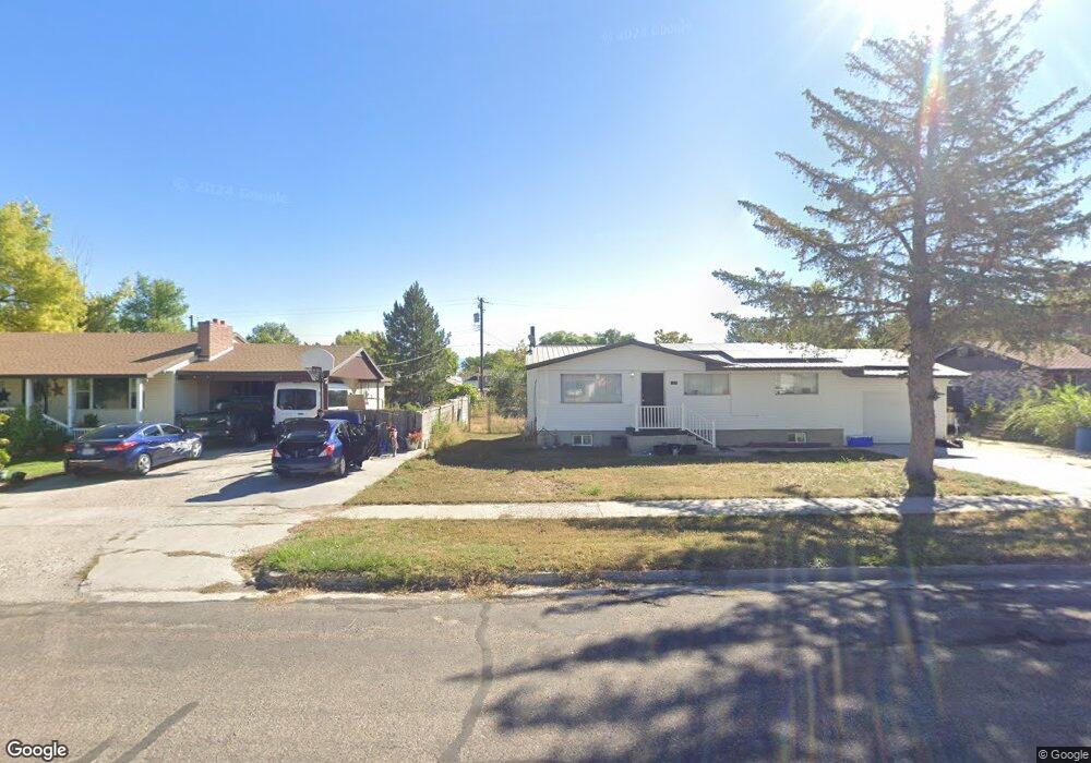
This home is located at 250 N 100 E, Delta, UT 84624 and is currently estimated at $355,585. 250 N 100 E is a home.
Ownership History
Date
Name
Owned For
Owner Type
Purchase Details
Closed on
Dec 20, 2021
Sold by
Dale Kelsch
Bought by
Kelsch Susie and Kelsch Dale
Current Estimated Value
Home Financials for this Owner
Home Financials are based on the most recent Mortgage that was taken out on this home.
Original Mortgage
$55,000
Outstanding Balance
$35,826
Interest Rate
2.98%
Mortgage Type
New Conventional
Estimated Equity
$319,759
Purchase Details
Closed on
Jan 13, 2017
Sold by
Williams David L and Williams Janice R
Bought by
Kelsch Dale and Kelsch Susan
Home Financials for this Owner
Home Financials are based on the most recent Mortgage that was taken out on this home.
Original Mortgage
$96,000
Interest Rate
4.08%
Mortgage Type
New Conventional
Create a Home Valuation Report for This Property
The Home Valuation Report is an in-depth analysis detailing your home's value as well as a comparison with similar homes in the area
Purchase History
| Date | Buyer | Sale Price | Title Company |
|---|---|---|---|
| Kelsch Susie | $73,150 | New Title Company Name | |
| Kelsch Susie | $73,150 | New Title Company Name | |
| Kelsch Dale | -- | First American Equity Loan S |
Source: Public Records
Mortgage History
| Date | Status | Borrower | Loan Amount |
|---|---|---|---|
| Open | Kelsch Susie | $55,000 | |
| Closed | Kelsch Susie | $55,000 | |
| Previous Owner | Kelsch Dale | $96,000 |
Source: Public Records
Tax History
| Year | Tax Paid | Tax Assessment Tax Assessment Total Assessment is a certain percentage of the fair market value that is determined by local assessors to be the total taxable value of land and additions on the property. | Land | Improvement |
|---|---|---|---|---|
| 2025 | $1,272 | $166,563 | $39,300 | $127,263 |
| 2024 | $1,272 | $178,061 | $34,317 | $143,744 |
| 2023 | $1,630 | $178,061 | $34,317 | $143,744 |
| 2022 | $1,134 | $106,568 | $27,453 | $79,115 |
| 2021 | $1,088 | $98,595 | $23,872 | $74,723 |
| 2020 | $949 | $86,847 | $21,702 | $65,145 |
| 2019 | $858 | $78,960 | $19,910 | $59,050 |
| 2018 | $819 | $77,150 | $18,100 | $59,050 |
| 2017 | $856 | $77,150 | $18,100 | $59,050 |
| 2016 | $688 | $64,698 | $13,575 | $51,123 |
| 2015 | $688 | $64,698 | $13,575 | $51,123 |
| 2014 | -- | $64,698 | $13,575 | $51,123 |
| 2013 | -- | $64,698 | $13,575 | $51,123 |
Source: Public Records
Map
Nearby Homes
- 135 E 200 N
- 115 W 200 S
- 58 E 300 South St
- 0 County Road 4616
- Parcel # 8816
- 50 N 100 Rd E
- 479 E 100 N
- 145 N 200 E
- 80 W 470 N
- 1565 W Sunflower Ln Unit 3
- 1615 W Sunflower Ln
- 1615 W Sunflower Ln Unit 4
- 1565 W Sunflower Ln
- 2000 N West Frontage I-15
- 0 Tbd Black Rock Rd Unit LotWP001
- 1100 S 725 Rd W
- 310 S 500 West Rd
- 465 S 100 W
- 760 E 700 St S
- 155 E 500 St S
Your Personal Tour Guide
Ask me questions while you tour the home.