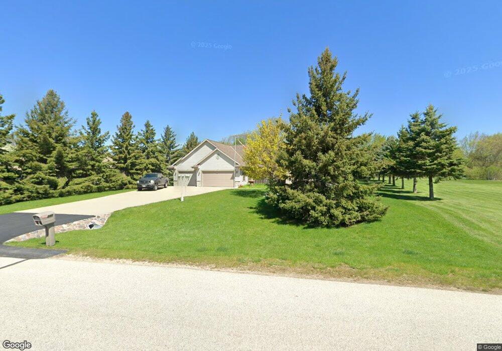
250 Pheasant Ln West Bend, WI 53090
Estimated Value: $370,000 - $513,000
3
Beds
2
Baths
1,474
Sq Ft
$292/Sq Ft
Est. Value
About This Home
This home is located at 250 Pheasant Ln, West Bend, WI 53090 and is currently estimated at $430,114, approximately $291 per square foot. 250 Pheasant Ln is a home located in Washington County with nearby schools including Decorah Elementary School, Badger Middle School, and East High School.
Ownership History
Date
Name
Owned For
Owner Type
Purchase Details
Closed on
Mar 1, 2018
Sold by
Mayer Andrew J and Mayer Sandra
Bought by
Scholten Anthony A and Schroeder Jean M
Current Estimated Value
Purchase Details
Closed on
Nov 11, 2005
Sold by
Mayer Joseph D and Mayer Michelle M
Bought by
Mayer Andrew J and Mayer Sandra
Home Financials for this Owner
Home Financials are based on the most recent Mortgage that was taken out on this home.
Original Mortgage
$123,000
Interest Rate
6.13%
Mortgage Type
New Conventional
Create a Home Valuation Report for This Property
The Home Valuation Report is an in-depth analysis detailing your home's value as well as a comparison with similar homes in the area
Home Values in the Area
Average Home Value in this Area
Purchase History
| Date | Buyer | Sale Price | Title Company |
|---|---|---|---|
| Scholten Anthony A | $295,000 | None Available | |
| Mayer Andrew J | $275,000 | None Available |
Source: Public Records
Mortgage History
| Date | Status | Borrower | Loan Amount |
|---|---|---|---|
| Previous Owner | Mayer Andrew J | $123,000 |
Source: Public Records
Tax History Compared to Growth
Tax History
| Year | Tax Paid | Tax Assessment Tax Assessment Total Assessment is a certain percentage of the fair market value that is determined by local assessors to be the total taxable value of land and additions on the property. | Land | Improvement |
|---|---|---|---|---|
| 2024 | $4,212 | $320,200 | $71,600 | $248,600 |
| 2023 | $3,810 | $320,200 | $71,600 | $248,600 |
| 2022 | $3,987 | $231,400 | $62,300 | $169,100 |
| 2021 | $4,136 | $231,400 | $62,300 | $169,100 |
| 2020 | $4,068 | $231,400 | $62,300 | $169,100 |
| 2019 | $3,997 | $231,400 | $62,300 | $169,100 |
| 2018 | $3,913 | $231,400 | $62,300 | $169,100 |
| 2017 | $3,779 | $231,400 | $62,300 | $169,100 |
| 2016 | $3,795 | $231,400 | $62,300 | $169,100 |
| 2015 | $3,822 | $231,400 | $62,300 | $169,100 |
| 2014 | $3,822 | $231,400 | $62,300 | $169,100 |
| 2013 | $3,843 | $231,400 | $62,300 | $169,100 |
Source: Public Records
Map
Nearby Homes
- 6814 Diane Dr Unit 16
- 6813 Diane Dr
- 7033 County Highway M
- 933 Spring Ct
- Lt2 Spring Ct
- Lt1 County Highway Y
- Lt2 County Highway Y
- 6273 Pleasant Hill Dr
- 3147 Wisconsin 33
- 1102 Harbor Ct
- 1072 Harbor Ct
- 1110 Harbor Ct
- 1118 Harbor Ct
- 3661 Blue Goose Rd
- Lt1 Blue Goose Rd
- Lt3 Blue Goose Rd
- Lt2 Blue Goose Rd
- Lt1 Wisconsin 33
- Lt0 County Rd M
- Lt1 Decorah Rd
- 260 Pheasant Ln
- Lt13 Pheasant Ln
- lot 13 Pheasant Ln
- 234 Pheasant Ln
- 6942 Shady Lane Rd
- 270 Pheasant Ln
- 6950 Shady Lane Rd
- 241 Dove Cir
- 261 Dove Cir
- 226 Pheasant Ln
- 271 Terry Jak Dr
- 225 Quail Cir
- 269 Pheasant Ln
- 6964 Shady Lane Rd
- 245 Dove Cir
- 249 Terry Jak Dr
- 218 Pheasant Ln
- 257 Dove Cir
- 223 Quail Cir
- 253 Dove Cir