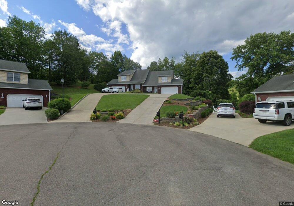
250 Saint Andrews Dr Bristol, VA 24202
Estimated Value: $384,000 - $400,000
3
Beds
3
Baths
2,154
Sq Ft
$183/Sq Ft
Est. Value
About This Home
This home is located at 250 Saint Andrews Dr, Bristol, VA 24202 and is currently estimated at $393,741, approximately $182 per square foot. 250 Saint Andrews Dr is a home located in Bristol City with nearby schools including Virginia High School.
Ownership History
Date
Name
Owned For
Owner Type
Purchase Details
Closed on
Sep 2, 2021
Sold by
Walls Karen H
Bought by
Epes Robert G and Epes Linda
Current Estimated Value
Home Financials for this Owner
Home Financials are based on the most recent Mortgage that was taken out on this home.
Original Mortgage
$200,000
Outstanding Balance
$181,713
Interest Rate
2.7%
Mortgage Type
Purchase Money Mortgage
Estimated Equity
$212,028
Purchase Details
Closed on
May 11, 2006
Sold by
Bill Roberts Construction Llc
Bought by
Walls Karen H
Home Financials for this Owner
Home Financials are based on the most recent Mortgage that was taken out on this home.
Original Mortgage
$82,983
Interest Rate
6.4%
Mortgage Type
New Conventional
Create a Home Valuation Report for This Property
The Home Valuation Report is an in-depth analysis detailing your home's value as well as a comparison with similar homes in the area
Home Values in the Area
Average Home Value in this Area
Purchase History
| Date | Buyer | Sale Price | Title Company |
|---|---|---|---|
| Epes Robert G | $281,100 | Attorney | |
| Walls Karen H | $217,983 | -- |
Source: Public Records
Mortgage History
| Date | Status | Borrower | Loan Amount |
|---|---|---|---|
| Open | Epes Robert G | $200,000 | |
| Previous Owner | Walls Karen H | $82,983 |
Source: Public Records
Tax History Compared to Growth
Tax History
| Year | Tax Paid | Tax Assessment Tax Assessment Total Assessment is a certain percentage of the fair market value that is determined by local assessors to be the total taxable value of land and additions on the property. | Land | Improvement |
|---|---|---|---|---|
| 2025 | -- | $303,800 | $44,000 | $259,800 |
| 2024 | $2,344 | $209,300 | $27,500 | $181,800 |
| 2023 | $2,449 | $209,300 | $27,500 | $181,800 |
| 2022 | $2,344 | $209,300 | $27,500 | $181,800 |
| 2021 | $2,344 | $209,300 | $27,500 | $181,800 |
| 2020 | $2,363 | $202,000 | $25,000 | $177,000 |
| 2019 | $2,363 | $202,000 | $25,000 | $177,000 |
| 2018 | $1,182 | $202,000 | $25,000 | $177,000 |
| 2016 | -- | $178,200 | $0 | $0 |
| 2015 | -- | $0 | $0 | $0 |
| 2014 | -- | $0 | $0 | $0 |
Source: Public Records
Map
Nearby Homes
- 152 Acorn Ln
- Tbd Harleywood Rd
- TBD Acorn Ln Unit Lot 18
- TBD Acorn Ln Unit Lot 17
- TBD Acorn Ln
- 12338 Reedy Creek Rd
- Tr.26/27 Peaceful Valley Rd
- Tbd Wallace Pike
- 8 Acres Campground Rd
- 11423 Reedy Creek Rd
- TBD Walton Ridge Rd
- 15216 Bordwine Rd
- 12075 Goose Creek Rd
- 14448 Rainbow Rd Unit 69
- 15346 Woodstone Cir
- 18272 Fortunes Way
- 15046 Corona St Unit 45
- Tbd Northwoods Trail
- 18339 Fortunes Way
- 18346 Fortunes Way
- 250 Saint Andrews Dr
- 251 Saint Andrews Dr
- 246 Saint Andrews Dr
- 127 Saint Andrews Dr Unit na
- 127 Saint Andrews Dr
- 244 Saint Andrews Dr
- 245 Saint Andrews Dr
- 232 Saint Andrews Dr
- 233 Saint Andrews Dr
- 121 Saint Andrews Dr Unit 121
- 230 Saint Andrews Dr
- 121 St Andrews Unit 6A
- 231 Saint Andrews Dr
- 210 Saint Andrews Dr
- 211 Saint Andrews Dr
- 208 Saint Andrews Dr
- 209 Saint Andrews Dr
- 188 Saint Andrews Dr
- 189 Saint Andrews Dr
- 114 Saint Andrews Dr