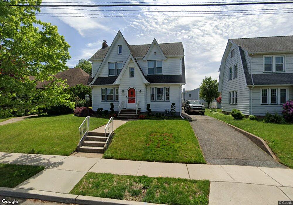
250 Stanley Ave Hasbrouck Heights, NJ 07604
Estimated Value: $599,000 - $640,000
--
Bed
--
Bath
1,608
Sq Ft
$383/Sq Ft
Est. Value
About This Home
This home is located at 250 Stanley Ave, Hasbrouck Heights, NJ 07604 and is currently estimated at $616,106, approximately $383 per square foot. 250 Stanley Ave is a home located in Bergen County with nearby schools including Hasbrouck Heights High School and Corpus Christi School.
Ownership History
Date
Name
Owned For
Owner Type
Purchase Details
Closed on
Aug 31, 2011
Sold by
Der Boghosian Jonathan
Bought by
Colaneri John and Tascarella Mikelle
Current Estimated Value
Home Financials for this Owner
Home Financials are based on the most recent Mortgage that was taken out on this home.
Original Mortgage
$284,000
Outstanding Balance
$197,429
Interest Rate
4.58%
Mortgage Type
Purchase Money Mortgage
Estimated Equity
$418,677
Purchase Details
Closed on
Feb 10, 2003
Sold by
Estate Of Arax Der Boghosian
Bought by
Boghosian Jonathan Der
Create a Home Valuation Report for This Property
The Home Valuation Report is an in-depth analysis detailing your home's value as well as a comparison with similar homes in the area
Home Values in the Area
Average Home Value in this Area
Purchase History
| Date | Buyer | Sale Price | Title Company |
|---|---|---|---|
| Colaneri John | $355,000 | -- | |
| Boghosian Jonathan Der | -- | -- |
Source: Public Records
Mortgage History
| Date | Status | Borrower | Loan Amount |
|---|---|---|---|
| Open | Colaneri John | $284,000 |
Source: Public Records
Tax History Compared to Growth
Tax History
| Year | Tax Paid | Tax Assessment Tax Assessment Total Assessment is a certain percentage of the fair market value that is determined by local assessors to be the total taxable value of land and additions on the property. | Land | Improvement |
|---|---|---|---|---|
| 2025 | $10,491 | $410,600 | $208,700 | $201,900 |
| 2024 | $10,120 | $410,600 | $208,700 | $201,900 |
| 2023 | $10,030 | $392,700 | $198,700 | $194,000 |
| 2022 | $10,030 | $372,600 | $188,700 | $183,900 |
| 2021 | $9,794 | $346,800 | $178,700 | $168,100 |
| 2020 | $9,810 | $341,100 | $172,200 | $168,900 |
| 2019 | $9,548 | $335,600 | $170,200 | $165,400 |
| 2018 | $9,414 | $330,100 | $168,200 | $161,900 |
| 2017 | $9,231 | $323,200 | $166,200 | $157,000 |
| 2016 | $9,260 | $305,100 | $156,200 | $148,900 |
| 2015 | $9,110 | $305,100 | $156,200 | $148,900 |
| 2014 | $8,860 | $305,100 | $156,200 | $148,900 |
Source: Public Records
Map
Nearby Homes
- 460 Boulevard
- 513 Boulevard
- 485 Hasbrouck Ave
- 229 Baldwin Ave
- 140 Prospect St
- 233 Lasalle Ave
- 12 Macarthur Ave
- 14 James Ct
- 80 Macarthur Ave
- 252 Paterson Ave
- 268 Church St
- 238 Bell Ave
- 8800 Boulevard Unit 5F
- 8800 Boulevard Unit 7K
- 8800 Boulevard Unit 4B
- 212 Paterson Ave
- 48 Hasbrouck Ave
- 100 Charlton Ave
- 32 Pasadena Ave
- 18 Hasbrouck Ave
- 246 Stanley Ave
- 254 Stanley Ave
- 258 Stanley Ave
- 450 Collins Ave
- 454 Collins Ave
- 251 Williams Ave
- 446 Collins Ave
- 247 Williams Ave
- 255 Williams Ave
- 262 Stanley Ave
- 259 Williams Ave
- 243 Williams Ave
- 251 Stanley Ave
- 245 Stanley Ave
- 456 Collins Ave
- 259 Stanley Ave
- 440 Collins Ave
- 265 Williams Ave
- 460 Collins Ave
- 447 Burton Ave