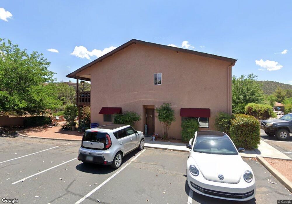
250 Sunset #10 Dr Unit 10 Sedona, AZ 86336
1
Bed
--
Bath
632
Sq Ft
--
Built
About This Home
This home is located at 250 Sunset #10 Dr Unit 10, Sedona, AZ 86336. 250 Sunset #10 Dr Unit 10 is a home located in Yavapai County with nearby schools including West Sedona Elementary School, Sedona Red Rock Junior/Senior High School, and Sedona Charter School.
Ownership History
Date
Name
Owned For
Owner Type
Purchase Details
Closed on
Jan 12, 2011
Sold by
Charles Vincent John
Bought by
S G Reader & Associates Inc 401 K Plan
Purchase Details
Closed on
Nov 2, 2006
Sold by
Charles Vincent John
Bought by
Charles Vincent John
Purchase Details
Closed on
Jan 19, 2005
Sold by
Persiani Gabriel and Persiani Karen
Bought by
Charles Vincent John
Home Financials for this Owner
Home Financials are based on the most recent Mortgage that was taken out on this home.
Original Mortgage
$127,200
Interest Rate
7.2%
Mortgage Type
New Conventional
Purchase Details
Closed on
Jan 29, 2002
Sold by
Qh Development Llc
Bought by
Persiani Gabriel and Persiani Karen
Create a Home Valuation Report for This Property
The Home Valuation Report is an in-depth analysis detailing your home's value as well as a comparison with similar homes in the area
Home Values in the Area
Average Home Value in this Area
Purchase History
| Date | Buyer | Sale Price | Title Company |
|---|---|---|---|
| S G Reader & Associates Inc 401 K Plan | $95,000 | First American Title Prescot | |
| Charles Vincent John | -- | None Available | |
| Charles Vincent John | $159,000 | Transnation Title | |
| Persiani Gabriel | $84,000 | Chicago Title Insurance Co |
Source: Public Records
Mortgage History
| Date | Status | Borrower | Loan Amount |
|---|---|---|---|
| Previous Owner | Charles Vincent John | $127,200 | |
| Closed | Charles Vincent John | $31,800 |
Source: Public Records
Tax History Compared to Growth
Tax History
| Year | Tax Paid | Tax Assessment Tax Assessment Total Assessment is a certain percentage of the fair market value that is determined by local assessors to be the total taxable value of land and additions on the property. | Land | Improvement |
|---|---|---|---|---|
| 2026 | $1,073 | -- | -- | -- |
| 2024 | $1,045 | -- | -- | -- |
| 2023 | $1,045 | $14,707 | $3,565 | $11,142 |
| 2022 | $1,026 | $12,853 | $3,371 | $9,482 |
| 2021 | $1,042 | $11,778 | $3,121 | $8,657 |
| 2020 | $1,042 | $0 | $0 | $0 |
| 2019 | $1,032 | $0 | $0 | $0 |
| 2018 | $1,061 | $0 | $0 | $0 |
| 2017 | $1,065 | $0 | $0 | $0 |
| 2016 | $1,138 | $0 | $0 | $0 |
| 2015 | -- | $0 | $0 | $0 |
| 2014 | -- | $0 | $0 | $0 |
Source: Public Records
Map
Nearby Homes
- 99 Morning Sun Dr Unit 50
- 89 Morning Sun Dr Unit 55
- 250 Sunset Dr Unit 28
- 104 Jasmine Ct
- 205 Sunset Dr Unit 159
- 205 Sunset Dr Unit 108
- 205 Sunset Dr Unit 26
- 205 Sunset Dr Unit 78
- 205 Sunset Dr Unit 187
- 46 Morning Sun Dr Unit 8
- 40 Morning Sun Dr
- 25 Bird Ln
- 12 Tanager Ln
- 15 Bonita Ln
- 90 Hilltop Rd Unit 29
- 186 Columbine Ct
- 2155 W State Route 89a Unit 109
- 2155 W State Route 89a Unit 103
- 2155 W State Route 89a Unit 108
- 2035 Whippet Way
- 250 Sunset 9 Dr Unit 9
- 250 Dr Unit 8
- 250 Sunset #8 Dr Unit 8
- 250 Sunset 10 Dr Unit 10
- 250 Sunset #6 Dr Unit 6
- 250 Sunset - #13 Dr
- 250 Sunset #13 Dr Unit 13
- 250 Sunset 4 Dr Unit 4
- 250 Sunset #4 Dr Unit 4
- 250 Sunset 5 Dr Unit 5
- 250 Sunset #5 Dr Unit 5
- 250 Sunset #14 Dr Unit 14
- 250 Sunset 14 Dr Unit 14
- 250 Sunset Dr Unit 8