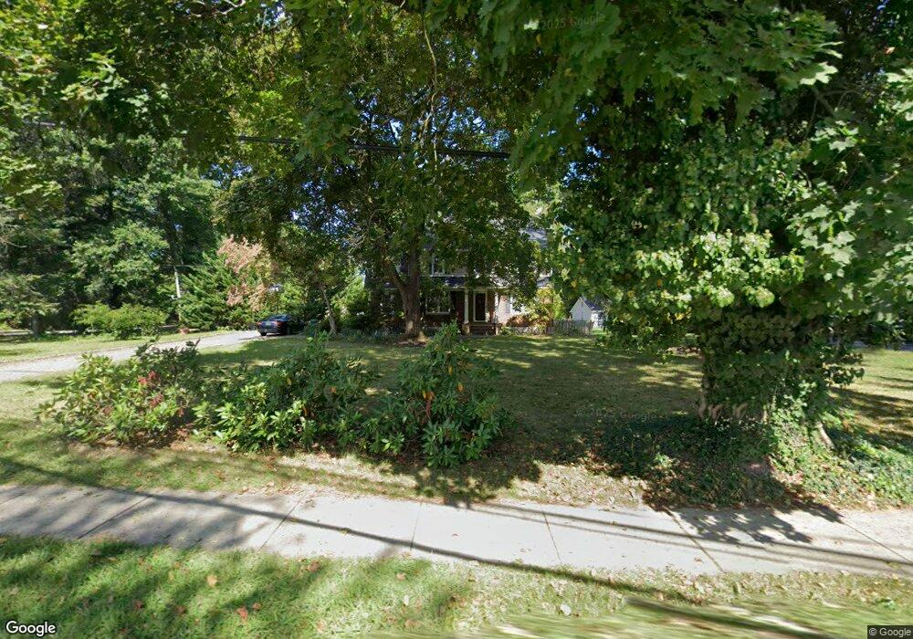
250 Vail Rd Parsippany, NJ 07054
Estimated Value: $638,319 - $854,000
--
Bed
--
Bath
2,194
Sq Ft
$340/Sq Ft
Est. Value
About This Home
This home is located at 250 Vail Rd, Parsippany, NJ 07054 and is currently estimated at $745,830, approximately $339 per square foot. 250 Vail Rd is a home located in Morris County with nearby schools including Northvail Elementary School, Central Middle School, and Parsippany High School.
Ownership History
Date
Name
Owned For
Owner Type
Purchase Details
Closed on
Sep 12, 2001
Sold by
Dice James
Bought by
Martocci James and Josevski Lora
Current Estimated Value
Home Financials for this Owner
Home Financials are based on the most recent Mortgage that was taken out on this home.
Original Mortgage
$255,500
Outstanding Balance
$99,558
Interest Rate
6.98%
Estimated Equity
$646,272
Purchase Details
Closed on
Oct 29, 1998
Sold by
Ahlers Thomas H and Ahlers Barbara
Bought by
Diee James E and Diee Carole A
Home Financials for this Owner
Home Financials are based on the most recent Mortgage that was taken out on this home.
Original Mortgage
$157,500
Interest Rate
6.64%
Purchase Details
Closed on
Jun 10, 1998
Sold by
Ahlers Barbara
Bought by
Ahlers Thomas H and Ahlers Barbara
Create a Home Valuation Report for This Property
The Home Valuation Report is an in-depth analysis detailing your home's value as well as a comparison with similar homes in the area
Home Values in the Area
Average Home Value in this Area
Purchase History
| Date | Buyer | Sale Price | Title Company |
|---|---|---|---|
| Martocci James | $269,000 | -- | |
| Diee James E | $210,000 | -- | |
| Ahlers Thomas H | -- | -- |
Source: Public Records
Mortgage History
| Date | Status | Borrower | Loan Amount |
|---|---|---|---|
| Open | Martocci James | $255,500 | |
| Previous Owner | Diee James E | $157,500 |
Source: Public Records
Tax History Compared to Growth
Tax History
| Year | Tax Paid | Tax Assessment Tax Assessment Total Assessment is a certain percentage of the fair market value that is determined by local assessors to be the total taxable value of land and additions on the property. | Land | Improvement |
|---|---|---|---|---|
| 2025 | $10,748 | $315,200 | $165,600 | $149,600 |
| 2024 | $10,550 | $315,200 | $165,600 | $149,600 |
| 2023 | $10,550 | $315,200 | $165,600 | $149,600 |
| 2022 | $9,863 | $315,200 | $165,600 | $149,600 |
| 2021 | $9,863 | $315,200 | $165,600 | $149,600 |
| 2020 | $9,651 | $315,200 | $165,600 | $149,600 |
| 2019 | $9,390 | $315,200 | $165,600 | $149,600 |
| 2018 | $9,182 | $315,200 | $165,600 | $149,600 |
| 2017 | $8,971 | $315,200 | $165,600 | $149,600 |
| 2016 | $8,810 | $315,200 | $165,600 | $149,600 |
| 2015 | $8,586 | $315,200 | $165,600 | $149,600 |
| 2014 | $8,469 | $315,200 | $165,600 | $149,600 |
Source: Public Records
Map
Nearby Homes
- 20 Sandra Dr
- 20 Druid Hill Dr
- 18 Woodhaven Rd
- 12 Celtic Way
- 159 Ball Ave
- 255 Knoll Rd
- 8 New England Dr
- 4 New Hampshire Ct
- 209 Raymound Blvd
- 189 Littleton Rd Unit 41
- 24 Leah Way
- 123 Cardigan Ct Unit 123
- 263 Lake Shore Dr
- 5 Jefferson Ave
- 144 Jillian Blvd
- 17 Madison Ave
- 51 Willow Ln
- 44 Willow Ln
- 49 Willow Ln
- 30 Madison Ave