C
Seller's Agent in 2025
CHRISTINA PENNYPACKER
Real Broker, LLC
2 in this area
5 Total Sales
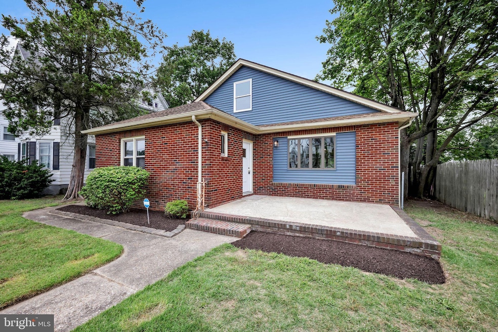
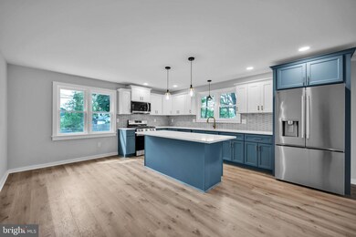
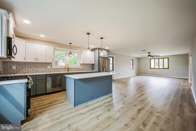
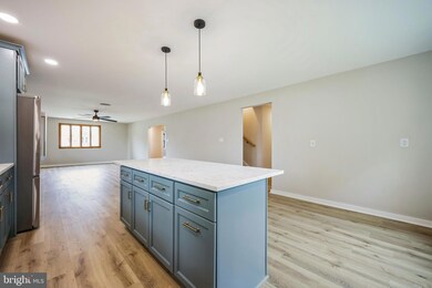
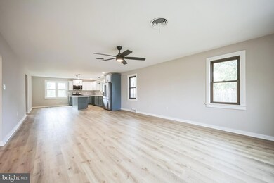
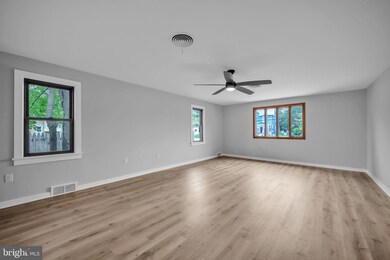
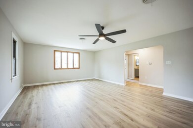
Welcome to 250 W Broad St, a fully renovated home where modern style meets everyday convenience! This spacious 3-bedroom, 2.5-bath property offers a 2-car garage and thoughtful updates throughout. Step inside to an impressive open-concept main level featuring a huge living and dining area that flows seamlessly into a stunning kitchen with brand-new cabinetry, sleek countertops, and a full stainless-steel appliance package. The main floor also includes two large bedrooms, a full bath, a half bath, and a laundry room with a new washer and dryer. Upstairs, enjoy a private master suite with a huge walk-in closet and its own full bathroom. A full basement provides excellent storage or potential for future finishing. Head outside through a convenient mudroom to a private, fenced-in backyard which has enough space for relaxing/entertaining and also features a storage shed and access to the 2-car garage with ample off street parking. Home features all new luxury plank flooring, new plumbing throughout, new furnace and updated mechanicals. Conveniently located near major highways, schools, and shopping, this home is truly move-in ready and designed for today’s lifestyle. Schedule your tour today!
Last Agent to Sell the Property
cstrouse07@gmail.com Real Broker, LLC License #2446263 Listed on: 08/07/2025

Last Buyer's Agent
(856) 874-6345 mcleanteamhomes@gmail.com Keller Williams Realty - Marlton License #1327381
| Date | Type | Sale Price | Title Company |
|---|---|---|---|
| Deed | $340,000 | First American Title Insurance | |
| Deed | $140,000 | Pittman Title & Escrow | |
| Deed | $140,000 | Pittman Title & Escrow |
| Date | Status | Loan Amount | Loan Type |
|---|---|---|---|
| Open | $351,220 | VA | |
| Previous Owner | $174,000 | Construction |
| Date | Event | Price | List to Sale | Price per Sq Ft |
|---|---|---|---|---|
| 09/30/2025 09/30/25 | Sold | $340,000 | -2.8% | $155 / Sq Ft |
| 09/10/2025 09/10/25 | Pending | -- | -- | -- |
| 08/13/2025 08/13/25 | Price Changed | $349,900 | -7.9% | $159 / Sq Ft |
| 08/07/2025 08/07/25 | For Sale | $379,900 | -- | $173 / Sq Ft |
| Year | Tax Paid | Tax Assessment Tax Assessment Total Assessment is a certain percentage of the fair market value that is determined by local assessors to be the total taxable value of land and additions on the property. | Land | Improvement |
|---|---|---|---|---|
| 2025 | $5,355 | $121,700 | $14,700 | $107,000 |
| 2024 | $5,350 | $121,700 | $14,700 | $107,000 |
| 2023 | $5,350 | $121,700 | $14,700 | $107,000 |
| 2022 | $5,253 | $121,700 | $14,700 | $107,000 |
| 2021 | $3,890 | $121,700 | $14,700 | $107,000 |
| 2020 | $5,119 | $121,700 | $14,700 | $107,000 |
| 2019 | $4,958 | $121,700 | $14,700 | $107,000 |
| 2018 | $4,675 | $121,700 | $14,700 | $107,000 |
| 2017 | $4,655 | $121,700 | $14,700 | $107,000 |
| 2016 | $4,435 | $121,700 | $14,700 | $107,000 |
| 2015 | $4,409 | $121,700 | $14,700 | $107,000 |
| 2014 | $4,351 | $129,200 | $17,100 | $112,100 |
C
Seller's Agent in 2025
CHRISTINA PENNYPACKER
Real Broker, LLC
2 in this area
5 Total Sales
Seller Co-Listing Agent in 2025
Timothy Kerr
Real Broker, LLC
(609) 870-4369
7 in this area
448 Total Sales
Buyer's Agent in 2025
Lisa McLean
Keller Williams Realty - Marlton
(856) 874-6345
1 in this area
94 Total Sales
Source: Bright MLS
MLS Number: NJGL2060982
APN: 14-00099-0000-00004
Disclaimer: Certain information contained herein is derived from information provided by parties other than Homes.com. All information provided is deemed reliable, but is not guaranteed to be accurate and should be independently verified.
![]() The data relating to real estate for sale on this website appears in part through the BRIGHT Internet Data Exchange program, a voluntary cooperative exchange of property listing data between licensed real estate brokerage firms, and is provided by BRIGHT through a licensing agreement.
The data relating to real estate for sale on this website appears in part through the BRIGHT Internet Data Exchange program, a voluntary cooperative exchange of property listing data between licensed real estate brokerage firms, and is provided by BRIGHT through a licensing agreement.
Listing information is from various brokers who participate in the Bright MLS IDX program and not all listings may be visible on the site.
The property information being provided on or through the website is for the personal, non-commercial use of consumers and such information may not be used for any purpose other than to identify prospective properties consumers may be interested in purchasing.
Some properties which appear for sale on the website may no longer be available because they are for instance, under contract, sold or are no longer being offered for sale.
Property information displayed is deemed reliable but is not guaranteed.
Copyright 2025 Bright MLS, Inc.