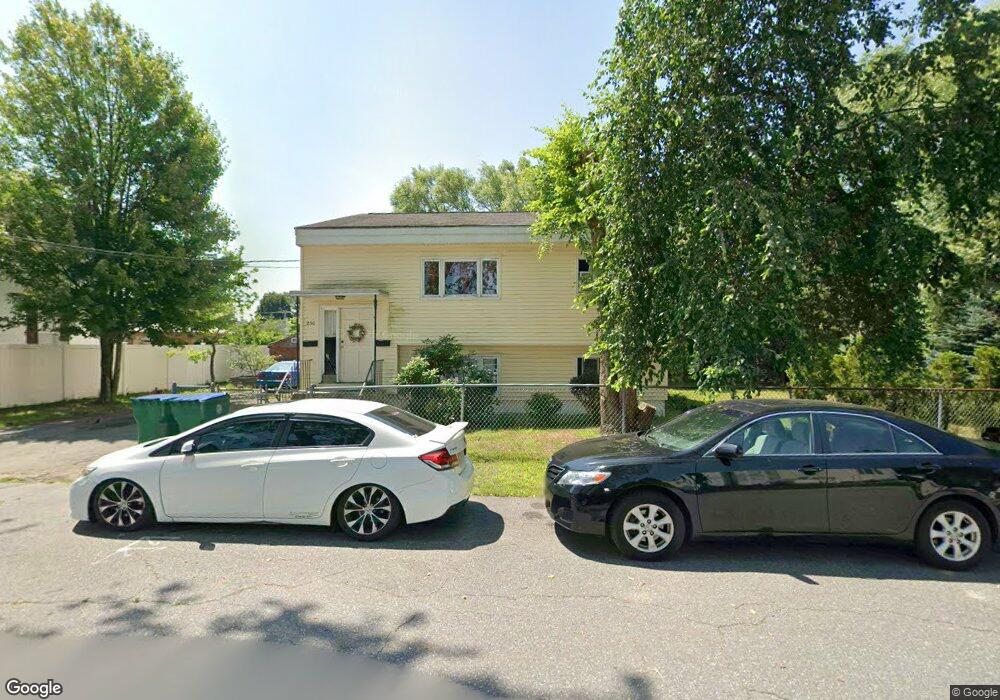
250 W Manchester St Lowell, MA 01852
Sacred Heart NeighborhoodEstimated Value: $418,000 - $686,000
4
Beds
3
Baths
2,182
Sq Ft
$258/Sq Ft
Est. Value
About This Home
This home is located at 250 W Manchester St, Lowell, MA 01852 and is currently estimated at $562,200, approximately $257 per square foot. 250 W Manchester St is a home located in Middlesex County with nearby schools including Abraham Lincoln Elementary School, Moody Elementary School, and Greenhalge Elementary School.
Ownership History
Date
Name
Owned For
Owner Type
Purchase Details
Closed on
Oct 14, 2004
Sold by
Rosas Hope M
Bought by
Rosas Fernando and Rosas Hope M
Current Estimated Value
Purchase Details
Closed on
Jul 1, 1994
Sold by
Draper Roland J and Oliveri Deborah
Bought by
Teng Steve and Ma Hope
Home Financials for this Owner
Home Financials are based on the most recent Mortgage that was taken out on this home.
Original Mortgage
$91,309
Interest Rate
8.55%
Mortgage Type
Purchase Money Mortgage
Create a Home Valuation Report for This Property
The Home Valuation Report is an in-depth analysis detailing your home's value as well as a comparison with similar homes in the area
Home Values in the Area
Average Home Value in this Area
Purchase History
| Date | Buyer | Sale Price | Title Company |
|---|---|---|---|
| Rosas Fernando | -- | -- | |
| Rosas Fernando | -- | -- | |
| Teng Steve | $94,000 | -- | |
| Teng Steve | $94,000 | -- |
Source: Public Records
Mortgage History
| Date | Status | Borrower | Loan Amount |
|---|---|---|---|
| Previous Owner | Teng Steve | $20,000 | |
| Previous Owner | Teng Steve | $10,000 | |
| Previous Owner | Teng Steve | $91,309 |
Source: Public Records
Tax History Compared to Growth
Tax History
| Year | Tax Paid | Tax Assessment Tax Assessment Total Assessment is a certain percentage of the fair market value that is determined by local assessors to be the total taxable value of land and additions on the property. | Land | Improvement |
|---|---|---|---|---|
| 2025 | $6,080 | $529,600 | $163,900 | $365,700 |
| 2024 | $5,836 | $490,000 | $153,200 | $336,800 |
| 2023 | $5,418 | $436,200 | $133,200 | $303,000 |
| 2022 | $5,016 | $395,300 | $121,100 | $274,200 |
| 2021 | $4,654 | $345,800 | $105,400 | $240,400 |
| 2020 | $4,302 | $322,000 | $100,200 | $221,800 |
| 2019 | $3,612 | $257,300 | $92,800 | $164,500 |
| 2018 | $3,559 | $236,000 | $88,400 | $147,600 |
| 2017 | $3,212 | $215,300 | $80,400 | $134,900 |
| 2016 | $3,109 | $205,100 | $70,200 | $134,900 |
| 2015 | $2,855 | $184,400 | $70,200 | $114,200 |
| 2013 | $2,654 | $176,800 | $78,400 | $98,400 |
Source: Public Records
Map
Nearby Homes
- 255 Plain St
- 131 London St
- 59 Boston Rd
- 29 Marriner St
- 433 Lincoln St
- 31 Waite St
- 15 Carter Ave
- 60 Liberty St Unit 3
- 59 Livingston St
- 15 Barclay St
- 58 Fay St Unit 2
- 122 Swan St Unit 102
- 35 Prospect St
- 52 Bigelow St
- 106 Lundberg St Unit 6
- 1000 Central St
- 17 Cedar Ct
- 8 Cedar Ct
- 20 Woodland Dr Unit 304
- 20 Woodland Dr Unit 316
- 244 W Manchester St
- 101 Montreal St
- 240 W Manchester St
- 247 W Manchester St
- 125 Montreal St
- 255 W Manchester St
- 99 Montreal St
- 238 W Manchester St
- 241 W Manchester St
- 259 W Manchester St
- 233 W Manchester St
- 91 Montreal St
- 131 Montreal St
- 232 W Manchester St
- 52 Eaton St
- 20 Montreal St
- 82 Waldo St Unit F
- 82 Waldo St Unit D
- 82 Waldo St Unit C
- 82 Waldo St Unit B