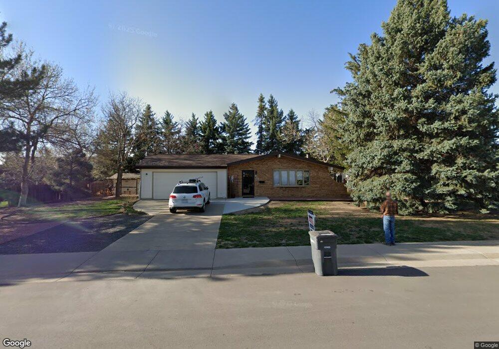
250 W Spaulding St Lafayette, CO 80026
Estimated Value: $562,299 - $685,000
3
Beds
1
Bath
1,036
Sq Ft
$630/Sq Ft
Est. Value
About This Home
This home is located at 250 W Spaulding St, Lafayette, CO 80026 and is currently estimated at $652,825, approximately $630 per square foot. 250 W Spaulding St is a home located in Boulder County with nearby schools including Lafayette Elementary School, Angevine Middle School, and Centaurus High School.
Ownership History
Date
Name
Owned For
Owner Type
Purchase Details
Closed on
Feb 26, 1990
Bought by
Quandt Steven W
Current Estimated Value
Purchase Details
Closed on
Jul 20, 1989
Bought by
Quandt Steven W
Purchase Details
Closed on
Jun 2, 1987
Bought by
Quandt Steven W
Purchase Details
Closed on
Aug 5, 1986
Bought by
Quandt Steven W
Purchase Details
Closed on
Jan 19, 1978
Bought by
Quandt Steven W
Create a Home Valuation Report for This Property
The Home Valuation Report is an in-depth analysis detailing your home's value as well as a comparison with similar homes in the area
Home Values in the Area
Average Home Value in this Area
Purchase History
| Date | Buyer | Sale Price | Title Company |
|---|---|---|---|
| Quandt Steven W | $58,500 | -- | |
| Quandt Steven W | -- | -- | |
| Quandt Steven W | $74,200 | -- | |
| Quandt Steven W | -- | -- | |
| Quandt Steven W | $32,000 | -- |
Source: Public Records
Tax History Compared to Growth
Tax History
| Year | Tax Paid | Tax Assessment Tax Assessment Total Assessment is a certain percentage of the fair market value that is determined by local assessors to be the total taxable value of land and additions on the property. | Land | Improvement |
|---|---|---|---|---|
| 2025 | $2,338 | $34,700 | $14,781 | $19,919 |
| 2024 | $2,338 | $34,700 | $14,781 | $19,919 |
| 2023 | $2,299 | $26,391 | $18,941 | $11,136 |
| 2022 | $2,312 | $24,611 | $13,330 | $11,281 |
| 2021 | $2,287 | $25,320 | $13,714 | $11,606 |
| 2020 | $2,435 | $26,648 | $12,012 | $14,636 |
| 2019 | $2,402 | $26,648 | $12,012 | $14,636 |
| 2018 | $2,190 | $23,990 | $10,224 | $13,766 |
| 2017 | $2,132 | $26,523 | $11,303 | $15,220 |
| 2016 | $1,918 | $20,887 | $9,329 | $11,558 |
| 2015 | $1,797 | $16,056 | $5,254 | $10,802 |
| 2014 | $1,388 | $16,056 | $5,254 | $10,802 |
Source: Public Records
Map
Nearby Homes
- 511 S Roosevelt Ave
- 998 Milo Cir Unit A
- 924 Milo Cir Unit A
- 285 Skylark Cir
- 304 Skylark Cir
- 1068 Milo Cir Unit A
- 1198 Milo Cir Unit A
- 1091 Milo Cir Unit B
- 1045 Milo Cir Unit A
- 715 Bunting Dr
- 655 N Gooseberry Ct
- 712 Bunting Dr
- 911 Homer Cir
- 1191 Milo Cir Unit A
- 709 Cardinal Dr
- 403 W Cannon St
- 490 E Sutton Cir
- 372 S Carr Ave
- 713 Flamingo Dr
- 306 E Cannon St
- 200 W Spaulding St
- 300 W Spaulding St
- 714 S Carole Ave
- 717 S Longmont Ave
- 717 S Carole Ave
- 712 S Carole Ave
- 715 S Longmont Ave
- 150 W Spaulding St
- 350 W Spaulding St
- 713 S Carole Ave
- 716 S Miller Ave
- 225 Waneka Pkwy
- 710 S Carole Ave
- 716 S Longmont Ave
- 713 S Longmont Ave
- 711 S Carole Ave
- 714 S Miller Ave
- 530 W Spaulding St
- 708 S Carole Ave
- 711 S Longmont Ave