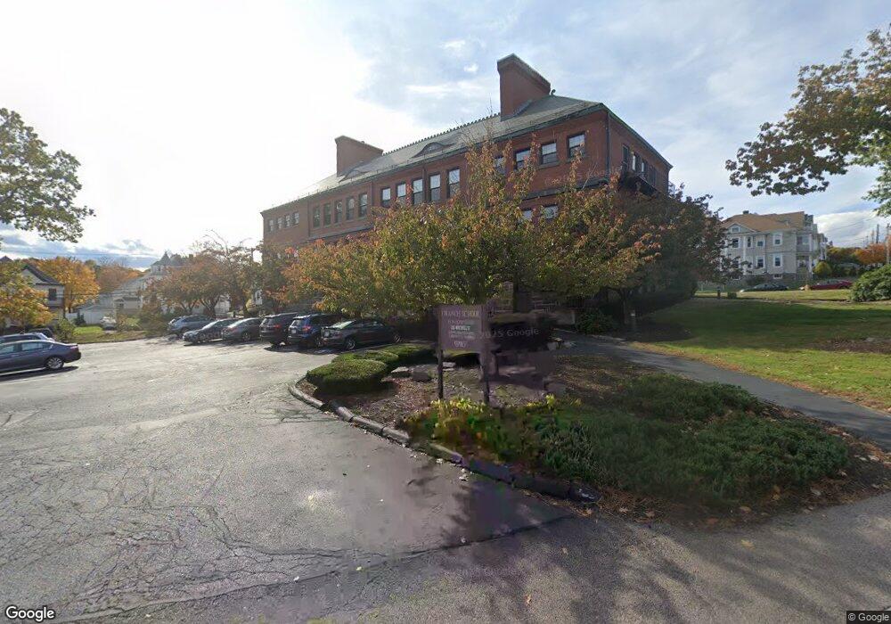
250 Whitwell St Unit 12 Quincy, MA 02169
Quincy Center NeighborhoodEstimated Value: $248,000 - $292,000
1
Bed
1
Bath
520
Sq Ft
$521/Sq Ft
Est. Value
About This Home
This home is located at 250 Whitwell St Unit 12, Quincy, MA 02169 and is currently estimated at $270,885, approximately $520 per square foot. 250 Whitwell St Unit 12 is a home located in Norfolk County with nearby schools including Charles A. Bernazzani Elementary School, Central Middle School, and Quincy High School.
Ownership History
Date
Name
Owned For
Owner Type
Purchase Details
Closed on
Feb 9, 2005
Sold by
Donohue Marie R
Bought by
Donohue John and Donohue Marie R
Current Estimated Value
Purchase Details
Closed on
Apr 2, 1997
Sold by
Kougias May
Bought by
Donohue Marie R
Home Financials for this Owner
Home Financials are based on the most recent Mortgage that was taken out on this home.
Original Mortgage
$42,000
Interest Rate
7.5%
Mortgage Type
Purchase Money Mortgage
Create a Home Valuation Report for This Property
The Home Valuation Report is an in-depth analysis detailing your home's value as well as a comparison with similar homes in the area
Home Values in the Area
Average Home Value in this Area
Purchase History
| Date | Buyer | Sale Price | Title Company |
|---|---|---|---|
| Donohue John | -- | -- | |
| Donohue John | -- | -- | |
| Donohue Marie R | $60,000 | -- |
Source: Public Records
Mortgage History
| Date | Status | Borrower | Loan Amount |
|---|---|---|---|
| Previous Owner | Donohue Marie R | $42,000 |
Source: Public Records
Tax History Compared to Growth
Tax History
| Year | Tax Paid | Tax Assessment Tax Assessment Total Assessment is a certain percentage of the fair market value that is determined by local assessors to be the total taxable value of land and additions on the property. | Land | Improvement |
|---|---|---|---|---|
| 2025 | $2,897 | $251,300 | $0 | $251,300 |
| 2024 | $2,716 | $241,000 | $0 | $241,000 |
| 2023 | $2,421 | $217,500 | $0 | $217,500 |
| 2022 | $2,894 | $241,600 | $0 | $241,600 |
| 2021 | $2,823 | $232,500 | $0 | $232,500 |
| 2020 | $2,919 | $234,800 | $0 | $234,800 |
| 2019 | $2,693 | $214,600 | $0 | $214,600 |
| 2018 | $2,659 | $199,300 | $0 | $199,300 |
| 2017 | $2,507 | $176,900 | $0 | $176,900 |
| 2016 | $2,626 | $182,900 | $0 | $182,900 |
| 2015 | $2,270 | $155,500 | $0 | $155,500 |
| 2014 | $1,948 | $131,100 | $0 | $131,100 |
Source: Public Records
Map
Nearby Homes
- 73 Cranch St Unit 73
- 293 Whitwell St
- 73 Scotch Pond Place
- 118 Dimmock St
- 195 Thomas Burgin Pkwy Unit 205
- 215 Thomas Burgin Pkwy Unit 35
- 165 Granite St
- 18 Cliveden St Unit 201W
- 33 Brook Rd
- 1 Adams St Unit 502
- 2 Cliveden St Unit 601E
- 20 Whitney Rd
- 20 Whitney Rd Unit 307
- 20 Whitney Rd Unit 101
- 77 Adams St Unit 610
- 64 Garfield St Unit B
- 312 Adams St
- 1 Cityview Ln Unit 204
- 1 Cityview Ln Unit 506
- 25 Carrolls Ln
- 250 Whitwell St Unit 9
- 250 Whitwell St Unit 7
- 250 Whitwell St Unit 6
- 250 Whitwell St Unit 4
- 250 Whitwell St Unit 3
- 250 Whitwell St Unit 2
- 250 Whitwell St Unit 17
- 250 Whitwell St Unit 16
- 250 Whitwell St Unit 15
- 250 Whitwell St Unit 14
- 250 Whitwell St Unit 13
- 250 Whitwell St Unit 11
- 250 Whitwell St Unit 10
- 250 Whitwell St Unit 1
- 250 Whitwell St
- 250 Whitwell St Unit 5,250
- 228 Whitwell St
- 59 Bedford St
- 59 Bedford St Unit 1
- 235 Whitwell St