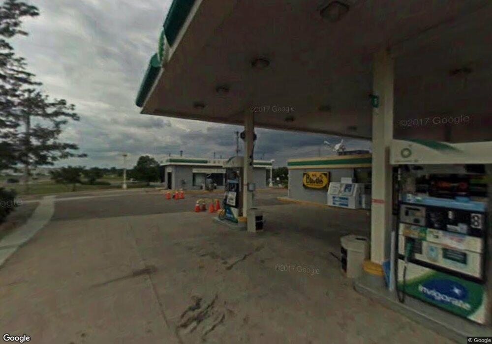
2500 Airport Rd Jackson, MI 49202
Estimated Value: $678,892
--
Bed
--
Bath
1,826
Sq Ft
$372/Sq Ft
Est. Value
About This Home
This home is located at 2500 Airport Rd, Jackson, MI 49202 and is currently estimated at $678,892, approximately $371 per square foot. 2500 Airport Rd is a home located in Jackson County with nearby schools including Western High School, Da Vinci Institute Primary School, and Da Vinci Institute High School.
Ownership History
Date
Name
Owned For
Owner Type
Purchase Details
Closed on
Jun 2, 2021
Sold by
Airport Road Express Stop Llc
Bought by
Gpm Southeast Llc
Current Estimated Value
Purchase Details
Closed on
Aug 1, 2016
Sold by
Xoom Inc
Bought by
Airport Road Express Stop Llc and Express Stop Real Estate Holdings Llc
Purchase Details
Closed on
Feb 24, 2011
Sold by
Neal Inc
Bought by
505 Nw Ave Llc
Create a Home Valuation Report for This Property
The Home Valuation Report is an in-depth analysis detailing your home's value as well as a comparison with similar homes in the area
Home Values in the Area
Average Home Value in this Area
Purchase History
| Date | Buyer | Sale Price | Title Company |
|---|---|---|---|
| Gpm Southeast Llc | -- | None Available | |
| Airport Road Express Stop Llc | $310,000 | Land Title Agency Llc | |
| Xoom Inc | -- | Land Title Agency Llc | |
| 505 Nw Ave Llc | $265,000 | Liberty Title |
Source: Public Records
Tax History Compared to Growth
Tax History
| Year | Tax Paid | Tax Assessment Tax Assessment Total Assessment is a certain percentage of the fair market value that is determined by local assessors to be the total taxable value of land and additions on the property. | Land | Improvement |
|---|---|---|---|---|
| 2025 | $6,805 | $148,950 | $0 | $0 |
| 2024 | $5,062 | $146,800 | $0 | $0 |
| 2023 | $4,821 | $119,200 | $0 | $0 |
| 2022 | $6,115 | $109,400 | $0 | $0 |
| 2021 | $4,953 | $87,800 | $0 | $0 |
| 2020 | $5,024 | $92,400 | $0 | $0 |
| 2019 | $4,901 | $90,000 | $0 | $0 |
| 2018 | $4,568 | $87,300 | $0 | $0 |
| 2017 | $4,369 | $83,500 | $0 | $0 |
| 2016 | $3,448 | $82,905 | $82,905 | $0 |
| 2015 | $4,330 | $81,745 | $81,745 | $0 |
| 2014 | $4,330 | $84,562 | $84,562 | $0 |
| 2013 | -- | $84,562 | $84,562 | $0 |
Source: Public Records
Map
Nearby Homes
- 1149 Maynard Ave
- 911 Evanston Dr
- 1050 Maynard Ave
- 0 VL Laurence Ave
- VL Laurence Ave
- 1225 Longfellow Ave
- 885 Bryant Ave
- 881 Bryant Ave
- 923 Wayne St
- 807 Winifred St
- 834 N Brown St
- 3840 Jarrow St
- 3842 Jarrow St
- 0 Evelyn St
- 0 Shirley Dr Unit 24064060
- 2410 Shirley Dr
- 951 W Monroe St St
- 3884 Shoreham St
- 821 N Wisner St
- 1513 Daniel Rd
- 2550 Airport Rd
- VL O'Neill Dr
- 3507 Wayland Dr
- 3519 Wayland Dr
- 2588 Airport Rd
- 4315 Wayland Dr
- 3514 Wayland Dr
- 3516 Wayland Dr
- 3518 Wayland Dr
- 2600 Airport Rd
- 3530 Wayland Dr
- 2705 Longview Dr
- 2701 Longview Dr
- 0 O'Neill Dr
- 1040 Brentwood Rd
- 2356 Spencer Dr
- 1039 Brentwood Rd
- 3027 W Argyle St
- 1021 Airport Rd
- 2357 Spencer Dr
