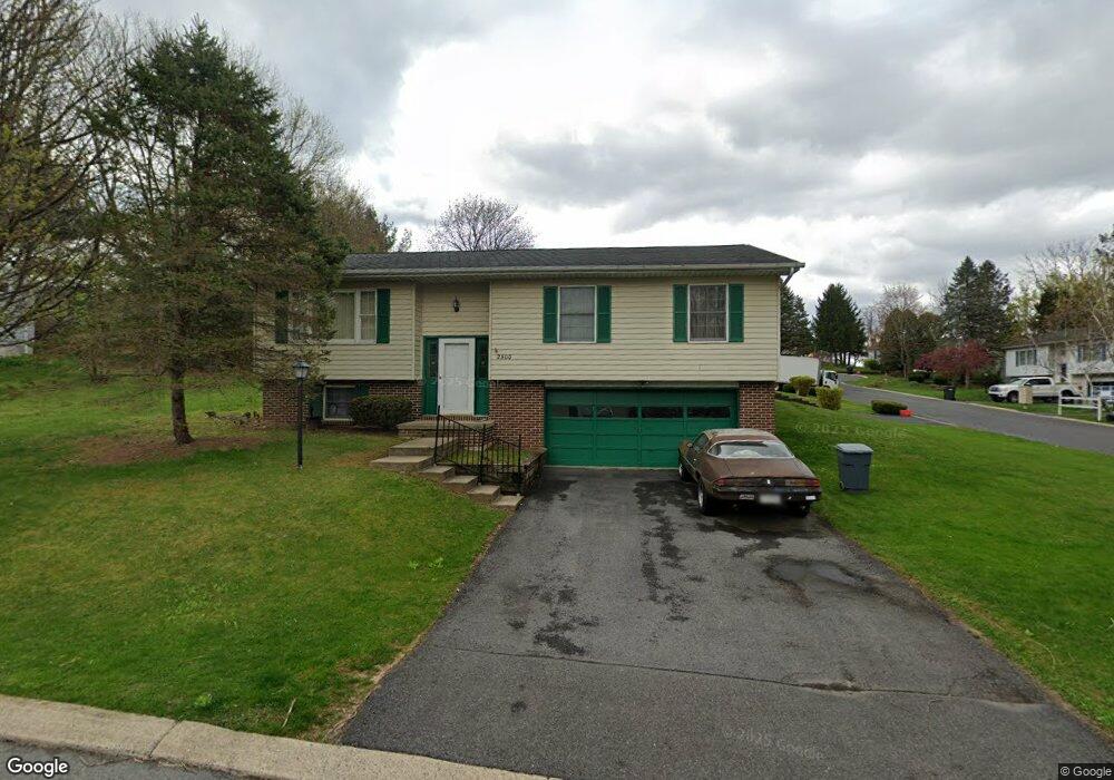
2500 Buchenhorst Rd State College, PA 16801
Estimated Value: $296,000 - $326,000
3
Beds
2
Baths
1,220
Sq Ft
$255/Sq Ft
Est. Value
About This Home
This home is located at 2500 Buchenhorst Rd, State College, PA 16801 and is currently estimated at $310,496, approximately $254 per square foot. 2500 Buchenhorst Rd is a home located in Centre County with nearby schools including Spring Creek Elementary, Mount Nittany Middle School, and State College Area High School.
Ownership History
Date
Name
Owned For
Owner Type
Purchase Details
Closed on
Mar 25, 2004
Sold by
Marshall Thomas D and Marshall Tracy M
Bought by
Durant Helen L
Current Estimated Value
Home Financials for this Owner
Home Financials are based on the most recent Mortgage that was taken out on this home.
Original Mortgage
$140,298
Outstanding Balance
$65,064
Interest Rate
5.56%
Mortgage Type
FHA
Estimated Equity
$245,432
Create a Home Valuation Report for This Property
The Home Valuation Report is an in-depth analysis detailing your home's value as well as a comparison with similar homes in the area
Home Values in the Area
Average Home Value in this Area
Purchase History
| Date | Buyer | Sale Price | Title Company |
|---|---|---|---|
| Durant Helen L | $142,500 | -- |
Source: Public Records
Mortgage History
| Date | Status | Borrower | Loan Amount |
|---|---|---|---|
| Open | Durant Helen L | $140,298 |
Source: Public Records
Tax History Compared to Growth
Tax History
| Year | Tax Paid | Tax Assessment Tax Assessment Total Assessment is a certain percentage of the fair market value that is determined by local assessors to be the total taxable value of land and additions on the property. | Land | Improvement |
|---|---|---|---|---|
| 2025 | $2,876 | $44,345 | $8,270 | $36,075 |
| 2024 | $2,731 | $44,345 | $8,270 | $36,075 |
| 2023 | $2,731 | $44,345 | $8,270 | $36,075 |
| 2022 | $2,662 | $44,345 | $8,270 | $36,075 |
| 2021 | $2,662 | $44,345 | $8,270 | $36,075 |
| 2020 | $2,649 | $44,345 | $8,270 | $36,075 |
| 2019 | $2,174 | $44,345 | $8,270 | $36,075 |
| 2018 | $2,545 | $44,345 | $8,270 | $36,075 |
| 2017 | $2,515 | $44,345 | $8,270 | $36,075 |
| 2016 | -- | $44,345 | $8,270 | $36,075 |
| 2015 | -- | $44,345 | $8,270 | $36,075 |
| 2014 | -- | $44,345 | $8,270 | $36,075 |
Source: Public Records
Map
Nearby Homes
- 211 Farmhill Dr
- 217 Farmhill Dr
- 151 Sunhaven Lane Lot Unit 61
- 423 Farmhill Dr
- 429 Farmhill Dr
- ON 1st Ave
- 140 Pepperberry Ln
- 246 1st Ave
- 250 1st Ave
- 135 Fernleaf Ct
- 330 Trout Rd
- 124 Broad Oak Ln
- 122 Broad Oak Ln
- 118 Broad Oak Ln
- 127 Broad Oak Ln
- 116 Broad Oak Ln
- 624 Struble Rd
- 418 Pike St
- 120 Creekside Dr
- 133 Creekside Dr
- 2505 Shawn Cir
- 2506 Buchenhorst Rd
- 2479 Buchenhorst Rd
- 250 Farmhill Dr
- 2500 Shawn Cir
- 2504 Shawn Cir
- 2508 Buchenhorst Rd
- 2488 Buchenhorst Rd
- 2483 Buchenhorst Rd
- 2475 Buchenhorst Rd
- 2508 Shawn Cir
- 2484 Buchenhorst Rd
- 2485 Buchenhorst Rd
- 2510 Buchenhorst Rd
- 2515 Shawn Cir
- 2473 Buchenhorst Rd
- 2514 Shawn Cir
- 2480 Buchenhorst Rd
- 241 Farmhill Dr
- 247 Farmhill Dr